
Arriola is an unincorporated community in Montezuma County, in the U.S. state of Colorado. [1]
History
A post office called Arriola was established in 1894, and remained in operation until 1933. [2] The name is said to honor one Spanish officer. [3]
References
- ^ U.S. Geological Survey Geographic Names Information System: Arriola, Colorado
- ^ "Post offices". Jim Forte Postal History. Archived from the original on March 6, 2016. Retrieved June 22, 2016.
- ^ Dawson, John Frank (1954). Place names in Colorado: why 700 communities were so named, 150 of Spanish or Indian origin. Denver, CO: The J. Frank Dawson Publishing Co. p. 7.
Municipalities and communities of
Montezuma County, Colorado, United States | ||
|---|---|---|
| City | 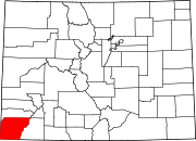 | |
| Towns | ||
| CDP | ||
|
Unincorporated communities | ||
|
Indian reservations | ||
| Footnotes | ‡This populated place also has portions in an adjacent county or counties | |
37°26′33″N 108°38′46″W / 37.44250°N 108.64611°W
|
| This Colorado state location article is a stub. You can help Wikipedia by expanding it. |