Aquia Harbour, Virginia | |
|---|---|
 Aerial view of
Garrisonville (foreground) and Aquia Harbour (center) with Aquia Creek and the Potomac River in the background | |
 Location in
Stafford County and the state of
Virginia. | |
| Coordinates: 38°27′31″N 77°23′3″W / 38.45861°N 77.38417°W | |
| Country | United States |
| State | Virginia |
| County | Stafford |
| Area | |
| • Total | 7.78 sq mi (20.2 km2) |
| • Land | 7.74 sq mi (20.0 km2) |
| • Water | 0.04 sq mi (0.1 km2) |
| Elevation | 10 ft (3 m) |
| Population (
2010) | |
| • Total | 6,727 |
| Time zone | UTC-5 ( Eastern (EST)) |
| • Summer ( DST) | UTC-4 (EDT) |
| FIPS code | 51-02112 [1] |
| GNIS feature ID | 1749073 [2] |
Aquia Harbour is a census-designated place (CDP) in Stafford County, Virginia, United States, 13 miles (21 km) north of Fredericksburg. The population was 6,727 at the 2010 census. Aquia Church, erected in 1757 and now a National Historic Landmark, is located west of the community.
Geography
Aquia Harbour is located at 38°27′31″N 77°23′3″W / 38.45861°N 77.38417°W. [3]
According to the United States Census Bureau, the CDP has a total area of 7.78 square miles (20.2 km2), of which 7.74 square miles (20.0 km2) is land and 0.04 square miles (0.1 km2) or 0.5% is water.
Demographics
As of the 2010 Census, [4] there were 6,727 people, 2,223 households, and 1,914 families residing in the CDP. The racial makeup of the CDP was 84.8% White, 7.7% Black or African American, 0.6% Native American, 2.2% Asian, 0.10% Pacific Islander, 1.3% from other races, and 3.3% from two or more races. Hispanic or Latino of any race were 7.3% of the population.
There were 2,223 households, out of which 38.1% had children under the age of 18 living with them, 75.6% were married couples living together, 7.2% had a female householder with no husband present, and 13.9% were non-families. The average household size was 3.03 and the average family size was 3.24.
In the CDP, 24.8% of the population was under the age of 18. The median age was 40 years. Women made up 50.4% of the population.
The CDP's median income for a household in 2010 was $125,216, and the median income for a family was $128,789. Males had a median income of $86,203 versus $59,698 for females. The per capita income for the CDP was $45,680. About 1.3% of families and 1.8% of the population were below the poverty line, including 2.6% of those under age 18 and 7.9% of those age 65 or over.
References
- ^ "U.S. Census website". United States Census Bureau. Retrieved January 31, 2008.
- ^ "US Board on Geographic Names". United States Geological Survey. October 25, 2007. Retrieved January 31, 2008.
- ^ "US Gazetteer files: 2010, 2000, and 1990". United States Census Bureau. February 12, 2011. Retrieved April 23, 2011.
- ^ United States Census Bureau (January 10, 2013). "Aquia Harbour CDP, Virginia". State and County QuickFacts. Archived from the original on June 3, 2013. Retrieved April 7, 2013.
External links
-
 Aquia Harbour travel guide from Wikivoyage
 - Aquia Harbour Property Owners Association
Municipalities and communities of
Stafford County, Virginia, United States | ||
|---|---|---|
| CDPs | 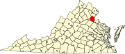 | |
|
Unincorporated communities |
| |
| Footnotes | ‡This populated place also has portions in an adjacent county or counties | |