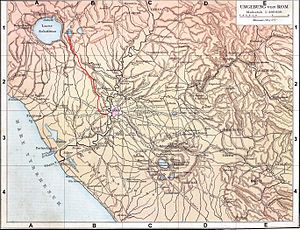
The Aqua Augusta, which was also called the Aqua Alsietina, [1] was an aqueduct supplying ancient Rome. Owing to severe drought, the Emperor Augustus built the Aqua Augusta in or around 33 BC[ citation needed] in order to supplement the Aqua Marcia, and then later the Aqua Claudia when required. However, the aqueduct was poorly designed and most of it collapsed in 27 BC.[ citation needed]
The aqueduct, perhaps via a branch, also fed the town of Feronia as mentioned in inscriptions found there. [2]
References
- ^ Frontinus, De aquaeductu 11
- ^ A. M. Sgubini Moretti - Enciclopedia dell' Arte Antica (1995), LUCUS FERONIAE Vol. IV, p. 725 and 1970, p. 442
External links
- University of Utrecht Archived 2007-03-11 at the Wayback Machine
- University of Chicago
41°53′12″N 12°28′10″E / 41.88667°N 12.46944°E
