Anganur
Anganoor | |
|---|---|
village | |
 | |
| Coordinates: 11°21′26.80″N 79°9′36.21″E / 11.3574444°N 79.1600583°E | |
| Country | |
| State | Tamil Nadu |
| District | Ariyalur |
| Population | |
| • Total | 1,000 (Nearly) |
| Languages | |
| • Official | Tamil |
| Time zone | UTC+5:30 ( IST) |
| PIN | 621709
[1] |
| Telephone code | 04329 |
| Vehicle registration | TN-61 |
| Nearest city | sendurai, Tittakudi |
| Lok Sabha constituency | chidambaram |
| Vidhan Sabha constituency | Kunnam |
| Avg. summer temperature | 38 °C (100 °F) |
| Avg. winter temperature | 30 °C (86 °F) |
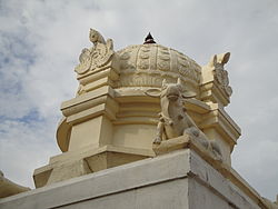
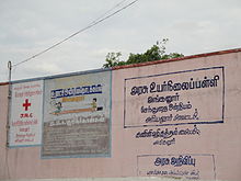
Anganur is a village in the Sannasinallur panchayat Sendurai taluk of Ariyalur district, Tamil Nadu, India, located 14 km from Sendurai and 8 km from Tittakudi. The river called as Chinna aaru (small river) crossing this village. Thol Thirumavalavan, the Dalit activist, was born here. [2]


References
Wikimedia Commons has media related to
Anganur.
- ^ "PinCode: Anganur, Ariyalur..." indiapincodes.net. Retrieved 17 February 2015.
- ^ "Over 100 VCK men held". The Hindu. 19 January 2009. Archived from the original on 30 January 2009. Retrieved 21 February 2011.

