Andul | |
|---|---|
Census Town | |
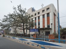
 Façade of the
Andul rajbari | |
 Andul Location in West Bengal, India  Andul Andul (India) | |
| Coordinates: 22°35′N 88°14′E / 22.58°N 88.24°E | |
| Country | |
| State | West Bengal |
| District | Howrah |
| Population (2011) | |
| • Total | 6,302 |
| Languages | |
| • Official | Bengali, English |
| Time zone | UTC+5:30 ( IST) |
| PIN | 711302 |
| Vehicle registration | WB |
| Lok Sabha constituency | Howrah |
| Vidhan Sabha constituency | Sankrail |
| Website |
howrah |

Andul is a census town in Sankrail CD Block of Howrah Sadar subdivision in Howrah district in the Indian state of West Bengal. It is a part of Kolkata Urban Agglomeration. [1]
Geography
Area of Andul is 17.98 km². [2] Andul is located at 22°35′N 88°14′E / 22.58°N 88.24°E. [3] It is situated between Mourigram and Argari.
Demographics
As per 2011 Census of India Andul had a total population of 6,302 of which 3,182 (50%) were males and 3,120 (50%) were females. Population below 6 years was 397. The total number of literates in Andul was 5,626 (95.28% of the population over 6 years). [4]
Andul was part of Kolkata Urban Agglomeration in 2011 census. [5]
As of 2001 [update] India census, [6] Andul had a population of 5677. Males constitute 51% of the population and females 49%. Andul has an average literacy rate of 87%, higher than the national average of 59.5%; with 53% of the males and 47% of females literate. 6% of the population is under 6 years of age.
Economy

"Kamal Nursery" [7] and "The Indian Nursery" [8] two of the most famous names in the Indian horticulture industry are situated at Mahiari, Andul. Howrah Flower Growers' Association organize flower exhibition at Kamal Nursery every year. [9] Manufacturing and fabrication of wooden furniture forms livelihood of a large number of population. This particular handcraft is popular throughout the district and the fame has reached outside the state also. Most of the population is associated with different service based industry like finance, education, Information Technology and Software. Modern days has seen rapid industrial growth in the outskirts of the village as it is closely associated with nearby Jangalpur and Dhulagori industrial estates.
Places to visit

- Andul Royal Palace (or, Andul Rajbari).
- Jhorehat Harisabha Griha.
- Annapurna Temple. [10]
- Dutta Chowdhury family Durga mandap [11] [12] [13]
- Kashiswara Jiu temple. [14]
- Madhaveshwar temple.
- Sankari Temple (or, Shiddeshwari Kali Temple). [15]
- Sadhak Bhairavi's Cave.
- Premikh Bhawan (Majher bari).
- Kundu Chowdhury House (or, Kundu Bari), Mahiari. [16] [17]
- Panchananda Temple, [18] Mahiari.
- Rasa-Mancha, Mahiari.
- Mahiari Public Library. [19]
- Khetropaul Baba Ashram, [20] Mashila.
- Ganges River Side, Basudevpur.
- Panchannan Temple, Puillya [ citation needed]
Educational Institutes

- New Andul Higher class school. [21]
- Kishalaya KG school
- Shatadal Institution
- Ranibala High school, [22] Mahiary.
- Mohiary Kundu Chowdhury Institution. [23]
- Mohiary High school
- Prabhu Jagatbandhu College. [24]
- Gramahitakai girls high school
- Holy Kids English Medium School
- Shyamsundar Prathomik Vidyalaya
Transport

Andul Road (part of Grand Trunk Road/ State Highway 6) [25] [26] is the artery of the town.
Bus
Private Bus
- 61 Alampur - Howrah Station
Mini Bus
- 13 Ranihati - Rajabazar
- 13A Fatikgachi - Rajabazar
- 20 Alampur - Ultadanga Station
Bus Routes Without Numbers
Train
Andul railway station and Mourigram railway station on Howrah-Kharagpur line are the nearest railway stations.
References
- ^ "District-wise list of statutory towns". Census Commission of India. Archived from the original on 30 September 2007. Retrieved 28 January 2009.
- ^ "Andul, Howrah, West Bengal". Retrieved 28 January 2021.
- ^ "Yahoo maps of Andul". Yahoo maps. Retrieved 20 November 2008.
- ^ "C.D. Block Wise Primary Census Abstract Data(PCA)". 2011 census: West Bengal – District-wise CD Blocks. Registrar General and Census Commissioner, India. Retrieved 11 May 2016.
- ^ "Provisional Population Totals, Census of India 2011" (PDF). Constituents of Urban Agglomeration Having Population Above 1 Lakh. Census of India 2011. Retrieved 11 May 2016.
- ^ "Census of India 2001: Data from the 2001 Census, including cities, villages and towns (Provisional)". Census Commission of India. Archived from the original on 16 June 2004. Retrieved 1 November 2008.
- ^ "Kamal Nursery". The Telegraph. Retrieved 10 January 2021.
- ^ "The Indian Nursery". Agriculture & Industry Survey. Archived from the original on 25 June 2011. Retrieved 21 May 2011.
- ^ "Kamal Nursery". The Telegraph. Archived from the original on 29 January 2013. Retrieved 11 January 2013.
- ^ "Temple at Andul Rajbari begging repairs". www.telegraphindia.com. Retrieved 22 December 2018.
- ^ "Dutta Chaudhury Durga Puja". www.sharodinfo.com. Retrieved 22 December 2018.
- ^ "Home to timeless tales of tradition". www.telegraphindia.com. Retrieved 22 December 2018.
- ^ "Traditional household Pujas in Bengal preserve culture and tradition". news.webindia123.com. Retrieved 22 December 2018.
- ^ "The largest Banglinga- Kashiswar Bhairav". www.speakingtree.in. Retrieved 22 December 2018.
- ^ "Siddheswari Shankari Temple - Andul | Veethi". www.veethi.com. Retrieved 22 December 2018.
- ^ Chaudhury, Dhruba Dutta (6 April 2017), English: An aristocrat family of Mohiary at Andul in Howrah, WB, India., retrieved 22 December 2018
- ^ "Where traditions are all in the family". www.telegraphindia.com. Retrieved 22 December 2018.
- ^ "Google Maps: Report Inappropriate Image". www.google.com. Retrieved 22 December 2018.
- ^ "Town Library Automation » Mohiary Public Library". Retrieved 22 December 2018.
-
^ Chaudhury93, Dhruba (15 June 2014),
English: Khetropaul (or Khetropal) Baba Ashram, the adhisthatri of Mashila village under Sankrail CD Block in Howrah Sadar subdivision of Howrah district, West Bengal, India., retrieved 22 December 2018
{{
citation}}
: CS1 maint: numeric names: authors list ( link) - ^ "NEW ANDUL H.C. SCHOOL, SANKRAIL". www.schoolsworld.in. Retrieved 22 December 2018.
- ^ "mohiary ranibala kundu chowdhury balika vidyalaya howrah School Address Contact Detail |Reviews Rating". schoolspedia.com. Retrieved 22 December 2018.
- ^ "-:: Welcome to the Official Website of West Bengal Council of Higher Secondary Education ::-". wbchse.nic.in. Retrieved 22 December 2018.
- ^ "Homepage". Welcome to Prabhu Jagatbandhu College. Archived from the original on 23 December 2018. Retrieved 22 December 2018.
- ^ "List of State Highways in West Bengal". West Bengal Traffic Police. Retrieved 15 October 2016.
- ^ "Pin Code: ANDUL ROAD, HOWRAH, WEST BENGAL, India, Pincode.net.in". pincode.net.in. Retrieved 22 December 2018.
External links
- WestBengal Help Center
- Andulmouri.com
- Journey of the Dutta - Kannauj to Bengal [1]