| Ancre | |
|---|---|
 | |
 | |
| Native name | Inke ( Picard) |
| Location | |
| Country | France |
| Physical characteristics | |
| Source | |
| • location | Miraumont |
| Mouth | |
• location | Somme |
• coordinates | 49°54′24″N 2°28′33″E / 49.90667°N 2.47583°E |
| Length | 37 km (23 mi) |
| Basin size | 327 km2 (126 sq mi) |
| Discharge | |
| • average | 2.1 m3/s (74 cu ft/s) |
| Basin features | |
| Progression | Somme→ English Channel |
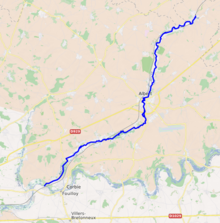
The Ancre (French pronunciation: [ɑ̃kʁ] ⓘ; Picard: Inke) is a river of Picardy, France. Rising at Miraumont, a hamlet near the town of Albert, it flows into the Somme at Corbie. It is 37.4 km (23.2 mi) long. [1] For most of its length it flows through the department of Somme. For a short stretch near Puisieux, it forms the border with Pas-de-Calais.
See also
- Battle of the Ancre Heights (October 1916)
- Battle of the Ancre (November 1916)
References
Wikimedia Commons has media related to
Ancre.