Alton, Texas | |
|---|---|
 Location of Alton, Texas | |
 | |
| Coordinates: 26°17′4″N 98°18′21″W / 26.28444°N 98.30583°W | |
| Country | |
| State | |
| County | Hidalgo |
| Incorporated | 1978 [1] |
| Area | |
| • Total | 7.31 sq mi (18.94 km2) |
| • Land | 7.31 sq mi (18.93 km2) |
| • Water | 0.00 sq mi (0.01 km2) |
| Elevation | 161 ft (49 m) |
| Population | |
| • Total | 18,198 |
| • Density | 2,489.8/sq mi (961.3/km2) |
| Time zone | UTC-6 ( Central (CST)) |
| • Summer ( DST) | UTC-5 (CDT) |
| ZIP code | 78573 |
| Area code | 956 |
| FIPS code | 48-02212 [4] |
| GNIS feature ID | 1329468 [5] |
| Website |
www |
Alton is a city in Hidalgo County, Texas, United States. The population was 18,198 at the 2020 census. [3]
History
Alton was founded in 1910 or 1911 by citizens and railroad officials of Alton, Illinois. [6]
On September 21, 1989, the Alton bus crash occurred; a Dr. Pepper truck hit a Mission Consolidated Independent School District school bus and caused it to fall into a caliche pit, killing 21 students. [7]
Geography
Alton is located at 26°17′4″N 98°18′21″W / 26.28444°N 98.30583°W (26.284307, −98.305940). [8] It is bordered to the south by Palmhurst and to the north and east by McAllen, although downtown McAllen is 10 miles (16 km) southeast of Alton. It is about 70 miles (110 km) north of Brownsville. [9]
According to the United States Census Bureau, Alton has a total area of 7.31 square miles (18.94 km2), of which 0.003 square miles (0.008 km2), or 0.04%, are water. [2]
Demographics
| Census | Pop. | Note | %± |
|---|---|---|---|
| 1980 | 2,732 | — | |
| 1990 | 3,069 | 12.3% | |
| 2000 | 4,384 | 42.8% | |
| 2010 | 12,341 | 181.5% | |
| 2020 | 18,198 | 47.5% | |
| U.S. Decennial Census [10] | |||
Alton is part of the McAllen–Edinburg–Mission and Reynosa–McAllen metropolitan areas.
2020 census
| Race | Number | Percentage |
|---|---|---|
| White (NH) | 439 | 2.41% |
| Black or African American (NH) | 47 | 0.26% |
| Native American or Alaska Native (NH) | 5 | 0.03% |
| Asian (NH) | 22 | 0.12% |
| Some Other Race (NH) | 27 | 0.15% |
| Mixed/Multi-Racial (NH) | 12 | 0.07% |
| Hispanic or Latino | 17,646 | 96.97% |
| Total | 18,198 |
As of the 2020 United States census, there were 18,198 people, 4,566 households, and 3,959 families residing in the city.
2000 census
As of the census [4] of 2000, there were 4,384 people, 1,059 households, and 988 families residing in the city. The population density was 2,075.5 inhabitants per square mile (801.4/km2). There were 1,175 housing units at an average density of 556.3 per square mile (214.8/km2). The racial makeup of the city was 79.33% White, 0.05% African American, 0.32% Native American, 19.02% from other races, and 1.28% from two or more races. Hispanic or Latino of any race were 97.90% of the population.
There were 1,059 households, out of which 58.0% had children under the age of 18 living with them, 70.7% were married couples living together, 17.8% had a female householder with no husband present, and 6.7% were non-families. 6.2% of all households were made up of individuals, and 3.8% had someone living alone who was 65 years of age or older. The average household size was 4.14 and the average family size was 4.29.
In the city, the population was spread out, with 37.9% under the age of 18, 12.1% from 18 to 24, 28.7% from 25 to 44, 14.7% from 45 to 64, and 6.6% who were 65 years of age or older. The median age was 25 years. For every 100 females, there were 94.8 males. For every 100 females age 18 and over, there were 88.0 males.
The median income for a household in the city was $22,097, and the median income for a family was $23,563. Males had a median income of $18,487 versus $15,341 for females. The per capita income for the city was $6,230. About 38.7% of families and 42.7% of the population were below the poverty line, including 51.9% of those under age 18 and 39.3% of those age 65 or over.
Education
Most of Alton is a part of the Mission Consolidated Independent School District. Small portions are within the Sharyland Independent School District and La Joya Independent School District. [13] [14]
Much of Alton was in the Alton Independent School District until January 27, 1975, when that district merged into Mission CISD. [15]
In 2018 city manager Jorge Arcaute stated that some families moved to Alton specifically to put their children in the Mission CISD and Sharyland ISD schools. [16]
All of Hidalgo County is in the service area of South Texas College. [17]
Schools
Mission CISD operates the following elementary schools that serve sections of Alton: [18] [19]
- Alton Elementary School – Alton
- Arturo Cantu Elementary School – Alton
- Named after Arturo Cantu, a Mission ISD teacher who in 1969 drowned in the Anzalduas Park after rescuing three of his students. [20]
- Raquel Cavazos Elementary School [21] – Alton
- Waitz Elementary School – Alton
- Hurla M. Midkiff Elementary School – Palmhurst
- Salinas Elementary School – annexed into the City of McAllen
Mission CISD operates Alton Memorial Junior High School, named in honor of the Mission CISD students who died in the 1989 bus crash, in Alton. [7] Students zoned to Cantu, Cavazos, and Waitz elementaries are zoned to Alton Memorial, while those zoned to Alton Elementary, Midkiff, and Salinas are zoned to Rafael A. Cantu Junior High School in Palmhurst. Sections of Alton are zoned to Mission High School and Veterans Memorial High School in Mission. [19]
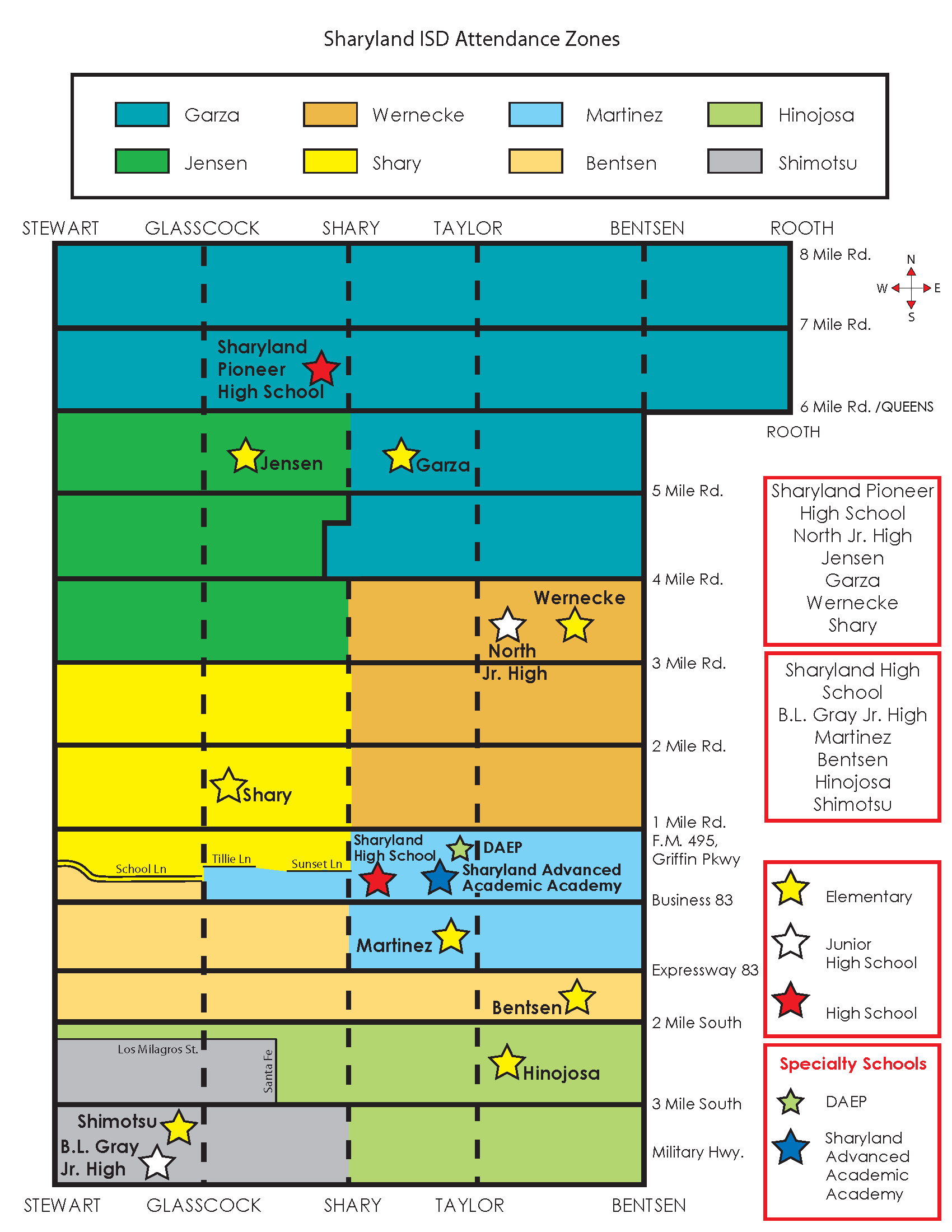
There is a Mission CISD alternative high school: Mission Collegiate High School, in Alton. [22] Sharyland ISD operates Jesse Jensen Elementary School in Alton. [14] Sharyland ISD sections of Alton are zoned to Jensen, North Junior High School in McAllen, and Sharyland Pioneer High School in unincorporated Hidalgo County. [23]
La Joya ISD operates Domingo Treviño Middle School in Alton. [14] [18] The sections of Alton in La Joya ISD are divided between:
- Diaz/Villareal Elementary School and Kika de la Garza Elementary School [24]
- Treviño Middle and Memorial Middle School [25]
- Juarez-Lincoln High School and Palmview High School [26]
In addition, South Texas Independent School District operates magnet schools that serve the community.
Parks and recreation
Josefa Garcia Park is in Alton. It previously had 5 acres (2.0 ha) of land. In 2018 Texas Parks and Wildlife Department (TPWD) gave a $500,000 grant to increase the park's size to 55 acres (22 ha). The park includes a memorial to the 1989 bus accident, with 21 crosses, one per deceased victim, and a statue of Jesus Christ. [27]
References
- ^ "Government – City of Alton".
- ^ a b "2020 U.S. Gazetteer Files". United States Census Bureau. Retrieved February 5, 2024.
- ^ a b "QuickFacts: Alton city, Texas". United States Census Bureau. Retrieved February 5, 2024.
- ^ a b "U.S. Census website". United States Census Bureau. Retrieved January 31, 2008.
- ^ "US Board on Geographic Names". United States Geological Survey. October 25, 2007. Retrieved January 31, 2008.
- ^ "History of Alton; City of Alton". Archived from the original on October 13, 2016. Retrieved July 2, 2016.
- ^ a b Fischler, Jacob (September 21, 2014). "Remembering the 21: Sunday is 25th anniversary of Alton bus tragedy". The Monitor. Retrieved August 2, 2018.
- ^ "US Gazetteer files: 2010, 2000, and 1990". United States Census Bureau. February 12, 2011. Retrieved April 23, 2011.
- ^ "Archive Photos: Alton Bus Wreck". CBS 4. September 21, 2009. Retrieved August 2, 2018.
- ^ "Census of Population and Housing". Census.gov. Retrieved June 4, 2015.
- ^ "Explore Census Data". data.census.gov. Retrieved May 21, 2022.
- ^ "About the Hispanic Population and its Origin". www.census.gov. Retrieved May 18, 2022.
- ^ " SCHOOL DISTRICT REFERENCE MAP (2010 CENSUS): Hidalgo County, TX." U.S. Census Bureau. Retrieved on August 2, 2018.
- ^ a b c " About Alton Archived January 7, 2019, at the Wayback Machine." Alton. Retrieved on August 2, 2018.
- ^ "Highway Accident Report – Collision between Mission Consolidated Independent School District School Bus and Valley Coca-Cola Bottling Company, Inc. Tractor-Semitrailer Intersection of Bryan Road and Texas Farm-to-Market Road 676 Alton, Texas September 21, 1989" (PDF). National Transportation Safety Board. p. 17 (PDF p. 24/95).
- ^ De Leon, Jose III (June 7, 2018). "Census Bureau: Alton is the fastest growing city in the county". Progress Times. Retrieved August 4, 2018.
- ^ Texas Education Code, Sec. 130.199. SOUTH TEXAS COMMUNITY COLLEGE DISTRICT SERVICE AREA..
- ^ a b " Proposed Zoning Map 2017 Archived August 2, 2018, at the Wayback Machine." City of Alton. Retrieved on August 2, 2018. This map shows the city boundaries and which schools are in the city limits.
- ^ a b " Mission CISD School Zones." Mission Consolidated Independent School District. Retrieved on August 2, 2018. See HTML version. Junior high boundaries are determined by the elementary school zoning, with some optional exceptions, while high school boundaries are described by text.
- ^ " School History." Arturo Cantu Elementary School. Retrieved on August 4, 2018.
- ^ Home. Raquel Cavazos Elementary School. Retrieved on August 2, 2018.
- ^ Home. Mission Collegiate High School. Retrieved on August 2, 2018.
- ^ Attendance boundary map. Sharyland Independent School District. Retrieved on August 2, 2018. See also simplified map which also has a chart stating which elementary schools feed into which secondary schools.
- ^ " Elementary School Zones 2017–2018 Archived 2018-09-16 at archive.today." La Joya Independent School District. Retrieved on September 16, 2018.
- ^ " Middle School Zones 2017–2018 Archived 2018-09-16 at archive.today." La Joya Independent School District. Retrieved on September 16, 2018.
- ^ " High School Zones 2017–2018 Archived 2018-09-16 at archive.today." La Joya Independent School District. Retrieved on September 16, 2018.
- ^ De Leon, Jose III (April 6, 2018). "Alton receives funding for $1.5M park expansion". Progress Times. Retrieved August 4, 2018.
External links
Municipalities and communities of
Hidalgo County, Texas, United States | ||
|---|---|---|
| Cities |  | |
| CDPs |
| |
|
Other community | ||