Algoa, Texas | |
|---|---|
 Location of Algoa, Texas | |
| Coordinates: 29°24′09″N 95°10′10″W / 29.40250°N 95.16944°W | |
| Country | United States |
| State | Texas |
| County | Galveston |
| Settled | 1880 |
| Elevation | 33 ft (10 m) |
| Population (
2000) | |
| • Total | 125 |
| Time zone | UTC-6 ( Central (CST)) |
| • Summer ( DST) | UTC-5 (CDT) |
| ZIP code | 77511 |
| Area codes | 281, 409 |
| GNIS feature ID | 1329358 [1] |
Algoa is an unincorporated community in Galveston County, Texas, United States. The population was 125 according to the 2000 census. [2] [3] The 2010 census did not record the population of Algoa.
History

The town was founded in 1880 on the Gulf, Colorado and Santa Fe Railway and originally named Hughes. In 1893 telephone service was installed in the area, and in 1897 a post office was opened under the name Algoa. [2]
Primarily an agricultural community, early crops consisted of mainly pears, satsumas, strawberries, and figs that were then sold in nearby Galveston. [4] Later, in the early 1900s, many farmers switched over to rice and dairy farming, as they were more profitable and stable commodities. [2]
Education
Algoa students are zoned to schools in the Santa Fe Independent School District.
Postal services
The Algoa post office closed in 1972. [4] Mail service is handled by the nearby Alvin and Santa Fe post offices. Algoa uses Alvin, Texas zip code, 77511.
References
- ^ "US Board on Geographic Names". United States Geological Survey. October 25, 2007. Retrieved January 31, 2008.
- ^ a b c Algoa, Texas from the Handbook of Texas Online
- ^ http://geonames.usgs.gov/pls/gnispublic/f?p=gnispq:3:::NO::P3_FID:1329358 GNIS Detail - Algoa, TX
- ^ a b "Algoa, Texas". Galveston County Historical Museum Website. Retrieved September 2, 2010.
External links
- Algoa, Texas from the Handbook of Texas Online
Municipalities and communities of
Galveston County, Texas, United States | ||
|---|---|---|
| Cities | 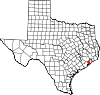 | |
| Village | ||
| CDPs | ||
|
Other communities | ||
| Footnotes | ‡This populated place also has portions in an adjacent county or counties | |
29°24′09″N 95°10′10″W / 29.40250°N 95.16944°W
| International | |
|---|---|
| National | |
| Other | |
 | This article about a location in Galveston County, Texas is a stub. You can help Wikipedia by expanding it. |