This article needs additional citations for
verification. (October 2022) |
Gaudêncio Machado Ramos Airport Aeroporto Gaudêncio Machado Ramos | |||||||||||
|---|---|---|---|---|---|---|---|---|---|---|---|
| Summary | |||||||||||
| Airport type | Public | ||||||||||
| Serves | Alegrete | ||||||||||
| Time zone | BRT ( UTC−03:00) | ||||||||||
| Elevation AMSL | 125 m / 410 ft | ||||||||||
| Coordinates | 29°48′45″S 055°53′36″W / 29.81250°S 55.89333°W | ||||||||||
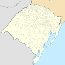
| Map | |||||||||||
| Runways | |||||||||||
| |||||||||||
Gaudêncio Machado Ramos Airport ( IATA: ALQ, ICAO: SSLT), informally known as Alegrete Novo Airport, is the airport serving Alegrete, Brazil.
History
The airport was built as a replacement to an older facility located closer to downtown which was then closed.
Airlines and destinations
| Airlines | Destinations |
|---|---|
| Azul Conecta | Porto Alegre |
Access
The airport is located 12 km (7 mi) from downtown Alegrete.
See also
References
- ^ "Aeródromos". ANAC (in Portuguese). 22 August 2019. Retrieved 7 July 2020.
- ^ "Gaudêncio Machado Ramos (SSLT)". DECEA (in Portuguese). Retrieved 19 September 2023.
External links
- Airport information for SSLT at Great Circle Mapper. Source: DAFIF (effective October 2006).
- Current weather for SSLT at NOAA/ NWS
- Accident history for ALQ at Aviation Safety Network

