| Albera Massif | |
|---|---|
 The northern side of the Albera Massif seen from
Sant Genís de Fontanes | |
| Highest point | |
| Elevation | 1,256 m (4,121 ft) |
| Coordinates | 42°28′55″N 2°56′49″E / 42.48194°N 2.94694°E |
| Geography | |
 Albera Massif Location in the Pre-Pyrenees area | |
| Location |
Pyrénées-Orientales Empordà, Catalonia |
| Parent range | Foothills of the Pyrenees |
| Climbing | |
| First ascent | Unknown |
| Easiest route | From La Jonquera or Sureda |
The Albera Massif ( Catalan: Serra de l'Albera; French: Massif des Albères) is a mountain range located in the south of Pyrénées-Orientales and the north of Catalonia, between France and Spain. It is the main easternmost prolongation of the Pyrenees. Its highest peak is the Puig Neulós, with an elevation of 1,256 metres. [1]
Most of the southern side of the range is part of the Paratge Natural d'Interès Nacional de l'Albera natural reserve. [2] There are some ancient megaliths in the range. [3] The Col du Perthus marks the western boundary of the massif.
The massif is at the eastern end of the "Axial Zone" of the Pyrenees mountain range. As in most of that zone, the geological formations in the massif are mostly of Paleozoic and earlier ages, with granite, gneiss, and schists (and other metasediments) being the predominant formations. [4] [5]
On the northern slopes of the massif, the Albères fault (which runs roughly west to east from near Le Boulou to near Argelès) marks a clear geological and topographical boundary between the Palaeozoic and older formations of the Albera massif and the Neogene deposits of the Roussillon basin. [6]


History
The Albera Range became the border between France and Spain following the Treaty of the Pyrenees, when Philip IV of Spain ceded a part of the Spanish kingdom to Louis XIV of France, dividing Northern Catalonia from Historical Catalonia.
Toponymy
L'étymologie du mot « Albères » est problématique, par manque de documents anciens (les premiers sont datés du ixe siècle) et par le fait que plusieurs racines très fréquentes semblent correspondre à ce nom.
Une première hypothèse est qu'il soit issu du Latin Albaria par adjonction du suffixe collectif -aria à l'adjectif albus, qui signifie « blanc », mais cette explication n'est pas satisfaisante, car le massif n'est pas de couleur blanche : rarement enneigé, il ne montrait sans doute pas, au Moyen Âge, de roches blanches, car il était couvert de forêts. Il pourrait aussi provenir de alba, l'aube, car il est le plus oriental des Pyrénées, ou encore de la racine pré-latine Alp qui se trouve dans de nombreux noms de montagnes en Europe occidentale.
Lluis Basseda penche pour la dernière hypothèse : la racine Alp suivie soit du collectif Latin -aria ou du suffixe ibéro-basque -erri. Le terme Albera désignerait une montagne escarpée, haute mais riche en pâturage, à opposer à Corbera, utilisé pour un relief arrondi, moins élevé et couvert de buissons qu'on retrouve dans la région dans des noms comme la commune Corbère-les-Cabanes ou le massif des Corbières. Cette hypothèse correspond à la disposition des lieux concernés.
Le nom apparaît pour la première fois, en Latin, en 844 dans un texte du futur empereur Charles le Chauve qui mentionne un lieu situé in monte Albario. Le terme se retrouve indifféremment au singulier ou au pluriel au cours du Moyen Âge. Il finite par être fixé au singulier en Catalan sous la forme Albera et au pluriel en français. Ainsi, en français, l'expression « les Albères » désigne le massif, alors que L'Albère est le nom d'une commune française située dans ce massif.
Geography
Topography
The Albères massif is bounded to the west by the Col du Perthus and the Rome river, which separate it from the Salines4 massif, to the east by the Mediterranean Sea between Argelès-sur-Mer in France and Port-Bou and Llançà in Spain. The Albères dominate the lower Tech valley and the Roussillon plain to the north and the Empordà plain to the south. The mountains on the right bank of the Tech, to the west, the boundary is uncertain and almost impossible to determine. To the south, the Cap de Creus massif is sometimes considered to be part of the Albères5. It culminates at 1,256 meters above sea level at Puig Neulós.
The summit ridge of the Albères helps demarcate the border between France and Spain. Thus, the massif is geographically part of the Pyrenees. Administratively, it is located in the department of Pyrénées-Orientales in France, and in the province of Girona in Catalonia (Spain).
Geology
The Albères massif is located at the eastern end of the axial zone of the Pyrenees mountain range. This area is mainly made up of Paleozoic and older formations (dating from around 550 Ma to around 300 Ma) which outcrop in a broad belt running from west to east, from the Hautes-Pyrénées to the Canigou massif and the Vermeille coast, passing through Andorra6.
In the Albères massif, the two main groups of formations are metamorphosed formations of sedimentary origin (notably schists), and formations of plutonic origin (mainly granites and gneisses)7.
On its northern slope, the Albères fault (which extends approximately from west to east from around Le Boulou to around Argelès) marks a clear geological and topographical limit between the Paleozoic and older formations of the Massif des Albères and the Neogene deposits of the Roussillon basin8.
Of mainly siliceous geological origin, this massif produces acidic soils; hence the presence of maquis and not scrubland (present on limestone soils).
Gallery
-
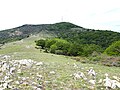
 Albera Massif
 -
 Albera Massif
 -
 Albera Massif
 -
 Albera Massif
 -
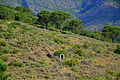
 Puig Neulós
 -
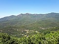
 Puig Sallfort seen from the Tour de Querroig.
 -
 Puig de Sant Cristau, towards the western end of the massif.
 -
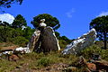
 Granite outcrop, above La Jonquera.
_-_4.jpg)
_-_2.jpg)
_-_3.jpg)
_-_1.jpg)


See also
References
- ^ Topographical map extract (in Géoportail).
- ^ Paratge Natural d'Interès Nacional de l'Albera. Col·lecció 1:25.000. Espais naturals protegits, Barcelona, Institut Cartogràfic de Catalunya, 1999
- ^ Monuments megalítics de l'Albera
- ^ Geological map extract (in Géoportail).
- ^ a b Notice explicative de la feuille Argelès-sur-Mer - Cerbère (1097) à 1/50 000, BRGM Éditions, Orléans, 2015.
- ^ Marc Calvet, Magali Delmas, Yanni Gunnell, Bernard Laumonier, Geology and Landscapes of the Eastern Pyrenees, Springer International Publishing, Kindle edition, 2022, pages 314-333.
External links
- Paratge Natural d'Interès Nacional de l'Albera
- Requesens - Puig Neulós hiking route
- Manel Figuera i Abadal, 50 ascensions fàcils pel Pirineu català, Valls, Cossetània, 2008
- Centre de reproducció de tortugues de l'Albera
| International | |
|---|---|
| National | |