40°18′59″N 44°15′13″E / 40.31639°N 44.25361°E
Aghdzk
Աղձք | |
|---|---|
 Aghtsk | |
 Aghdzk  Aghdzk | |
| Coordinates: 40°18′59″N 44°15′13″E / 40.31639°N 44.25361°E | |
| Country | Armenia |
| Province | Aragatsotn |
| Municipality | Ashtarak |
| Elevation | 1,260 m (4,130 ft) |
| Population (2008) | |
| • Total | 1,785 |
| Time zone | UTC+4 |
Aghdzk ( Armenian: Աղձք) is a village in the Ashtarak Municipality of the Aragatsotn Province of Armenia. It is home to the Arshakid Mausoleum, a large grave monument complex and basilica of the 4th to 5th centuries. King Shapur II of Persia exhumed the bones of the Armenian kings and took them to Persia symbolically taking Armenia's power. When Sparapet Vassak Mamikonian defeated the Persians and reclaimed the bones of the Arshakuni monarchs, he buried them at Aghdzk. Remains of the monuments and the basilica may still to be seen.
Aghdzk is the birthplace of Catholicos Komitas I of Armenia (6th century-628).
Gallery

-
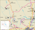 Road map of Aghdzk and region
 -
 Arshakid Mausoleum
 -
 Entrance
 -
 Church ruins (7c.)
 -
 Entrance stairs
 -
 Right niche
 -
 Left niche


_ruins,_Aghdzk,_Armenia2.jpg)


References
- Aghdzk at GEOnet Names Server
- World Gazetteer: Armenia[ dead link] – World-Gazetteer.com
- Report of the results of the 2001 Armenian Census
- Kiesling, Rediscovering Armenia, p. 16, available online at the US embassy to Armenia's website

|
| This article about a location in Aragatsotn Province, Armenia is a stub. You can help Wikipedia by expanding it. |