This article needs additional citations for
verification. (September 2009) |
Abony | |
|---|---|
 Aerial view | |
| Coordinates: 47°11′22″N 20°00′35″E / 47.18944°N 20.00969°E | |
| Country | Hungary |
| Region | Central Hungary |
| County | Pest |
| Subregion | Cegléd |
| Area | |
| • Total | 127.97 km2 (49.41 sq mi) |
| Highest elevation | 100 m (300 ft) |
| Lowest elevation | 90 m (300 ft) |
| Population (2008)
[2] | |
| • Total | 15,681 |
| • Density | 120/km2 (320/sq mi) |
| Time zone | UTC+1 ( CET) |
| • Summer ( DST) | UTC+2 ( CEST) |
| Postal code | 2740 |
| Area code | +36 53 |
| KSH code | 27872 [1] |
| Website | www.abony.hu |
Abony ( German: Wabing) is a town in Pest County, Hungary.
Geography
Abony is a town in the south-east of Pest County, between the Danube and Tisza rivers. It is 16 km (10 mi) from Cegléd and 85 km (53 mi) from Budapest, at an elevation of 90 to 100 m (300 to 330 ft). The area is on the River Tisza's wide floodplain which approximates 13,000 hectares (32,000 acres). Its rich black soil contains some sand.
Name
The name of the town developed from the diminutive form of the name Aba, which is of Turkic origin. It was attested as Abon in 1466. [3]
History
- There are some archaeological finds from the 7th and 8th centuries.
- The village was part of the shire county of Szolnok in the 13th century.
- The first known record of the village is in 1450 as Aban.
- In 1474, Balázs Magyar, his daughter Benigna Magyar and later her husband Pál Kinizsi owned the land.
- In 1515, István Werbőczy was given the village as a donation.
- In 1552, it came under Turkish rule, and during the next century it suffered almost complete destruction.
- At the beginning of the 18th century, the village's population was growing, and in 1748 became a small town.
- On 25 January 1849, Mór Perczel led the Hungarian troops to win near Abony as part of the Hungarian War of Independence.
The jewish community
Jews lived in the city from the 18th century. The synagogue was established in 1756, [4] and in 1788 the Jewish school was founded. In 1840, 912 Jews lived in the city. In May 1944, a ghetto was established by order of the German army, where the Jews of the city and the surrounding area were concentrated. In June, ghetto Jews were deported in two transports to the Auschwitz extermination camp. [5]
In literature
On 12 June 1847 Sándor Petőfi spent a night in the village pub on his way from Nagyszalonta (where he visited János Arany) to Budapest. It is mentioned it in his Journey letters.
Lajos Abonyi, a writer who lived in Abony, recorded a famous folk-song "In Nagyabony there are only two towers" from Zoltán Kodály's Braggadocio. In the song Nagyabony means this village. There is another Nagyabony in Slovakia, called in Slovak Veľké Blahovo. The song's tune is from Upper Hungary.
Economy
The local economy is mainly based on agriculture: most people are crop farmers, but some grow grapes and fruit.
Landmarks

- Lajos Abonyi Folk Museum and granary
- Harkányi Castle
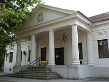
- Synagogue
- Roman Catholic church
- United Reformed Church[ clarification needed]
- Talián family mausoleum
- Family seats: Kostyán, Lavatka, Szapáry, Kisvigyázó (castle), Vigyázó, Ajtay, Sivó, Teszáry
Famous people
- János Varga, (1939 – 2022 ), Olympic champion wrestler.
- Gyula Háy (1900 – 1975), dramatist and poet.
- Artúr Balogh (1866 – 1951), Hungarian lawyer, university professor, politician, and member of the Hungarian Academy of Sciences.
- László Endre (1895 - 1946), politician and Nazi collaborator
- Zoltán Mucsi (b. 1957 - ), actor
- László Földi (b. 1952 – ), politician
- Norbert Kállai (b. 1984 – ), footballer
International relations
Twin towns — sister cities
Abony is twinned with:
References
- ^ a b Abony at the Hungarian Central Statistical Office (Hungarian).
- ^ Abony at the Hungarian Central Statistical Office (Hungarian). 1 January 2008;
- ^ Kiss, Lajos (1980). Földrajzi nevek etimológiai szótára. Budapest: Akadémiai Kiadó. ISBN 963-05-2277-2.
- ^ Abonys synagogue
- ^ The Jewish Community of Abony in The Muzeum of The Jewish People
External links
- Official website in Hungarian
- Street map (in Hungarian)
- Aerial photographs of Abony
- Lajos Abonyi folk museum
- Abony at szeporszag.hu
- Abony at lap.hu
- The jewish community in Abony On JewishGen website.


