7th arrondissement of Marseille | |
|---|---|
 Location within Marseille | |
| Coordinates: 43°16′58″N 5°21′42″E / 43.2828°N 5.3617°E | |
| Country | France |
| Region | Provence-Alpes-Côte d'Azur |
| Department | Bouches-du-Rhône |
| Commune | Marseille |
| Government | |
| • Mayor (2020–2026) | Sophie Camard ( FI) |
| Area | 5.691 km2 (2.197 sq mi) |
| Population (2021)
[1] | 34,633 |
| • Density | 6,086/km2 (15,760/sq mi) |
| INSEE code | 13207 |
The 7th arrondissement of Marseille is one of the 16 arrondissements of Marseille, France. It is governed locally together with the 1st arrondissement, with which it forms the 1st sector of Marseille.
Population
| Neighbourhood | Population, 1990 | Population, 1999 | Population, 2006 |
|---|---|---|---|
| Bompard | 4,300 | 4,188 | 4,153 |
| Endoume | 5,788 | 5,658 | 5,504 |
| Les Îles | 81 | 95 | 86 |
| Le Pharo | 6,373 | 5,929 | 5,914 |
| Le Roucas Blanc | 4,087 | 4,030 | 3,762 |
| Saint-Lambert | 9,120 | 9,400 | 9,173 |
| Saint-Victor | 6,914 | 6,673 | 6,854 |
| Total | 36,663 | 35,973 | 35,446 |
-
 Endoume
 -
 Les Îles
 -
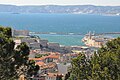 Le Pharo
 -
 Saint-Victor


,_entry_of_port,_with_Fort_Saint-Nicolas,_Fort_Saint-Jean_and_Palais_du_Pharo.JPG)

References
- ^ "Populations légales 2021". The National Institute of Statistics and Economic Studies. 28 December 2023.
External links
- Official website
- Dossier complet, INSEE
|
| This Bouches-du-Rhône geographical article is a stub. You can help Wikipedia by expanding it. |