| Local date | August 31, 1420 |
|---|---|
| Magnitude | 8.8–9.4 Mw |
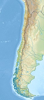
| Epicenter | 27°00′S 71°00′W / 27.0°S 71.0°W |
| Areas affected | Chile |
| Tsunami | yes |
The 1420 Caldera earthquake shook the southern portion of Atacama Desert in the early morning of August 31, 1420 and caused tsunamis in Chile as well as Hawaii and the towns of Japan. The earthquake is thought to have had a size of 8.8–9.4 Mw. [1] [2] Historical records of the tsunami exist for the Japanese harbours of Kawarago and Aiga where confused residents saw the water recede in the morning of September 1, [1] without any sign of an earthquake. [3] In Chile, rockfalls occurred along the coast as well, producing blocks of up to 40 tons that are now found inland. [1] This is also consistent with the identification of a possible tsunami deposit in Mejillones Bay that has been dated to the range 1409 to 1449. [4] [5] Deposits found by coring of recent sediments in a wetland near Tongoy Bay have also been linked to the 1420 tsunami. [6]
See also
References
- ^ a b c Guzmán, L. (February 14, 2019). "Encuentran registros de megaterremoto ocurrido hace seis siglos en el norte de Chile". El Mercurio (in Spanish). Santiago, Chile. Retrieved June 8, 2019.
- ^ Abad M.; Izquierdo T.; Cáceres M.; Bernárdez E.; Rodríguez-Vidal J. (2018). "Coastal boulder deposit as evidence of an ocean-wide prehistoric tsunami originated on the Atacama Desert coast (northern Chile)". Sedimentology. 67 (3): 1505–1528. doi: 10.1111/sed.12570. S2CID 135386871.
- ^ Tsuji Y. (2013). "Catalog of Distant Tsunamis Reaching Japan from Chile and Peru" (PDF). Report of Tsunami Engineering. 30: 62. Archived from the original (PDF) on March 20, 2020.
- ^ Vargas, G.; Ortlieb, L.; Chapron, E.; Valdes, J.; Marquardt, C. (2005). "Paleoseismic inferences from a high-resolution marine sedimentary record in northern Chile (23°S)". Tectonophysics. 399 (1–4): 381–398. Bibcode: 2005Tectp.399..381V. doi: 10.1016/j.tecto.2004.12.031.
- ^ Ruiz, S.; Madariaga, R. (2018). "Historical and recent large megathrust earthquakes in Chile". Tectonophysics. 733: 37–56. Bibcode: 2018Tectp.733...37R. doi: 10.1016/j.tecto.2018.01.015.
- ^ Araya, K.; Muñoz, P.; Dezileau, L.; Maldonado, A.; Campos-Caba, R.; Rebolledo, L.; Cardenas, P.; Salamanca, M. (2022). "Extreme Sea Surges, Tsunamis and Pluvial Flooding Events during the Last ~1000 Years in the Semi-Arid Wetland, Coquimbo Chile". Geosciences. 12 (3): 135. Bibcode: 2022Geosc..12..135A. doi: 10.3390/geosciences12030135.

