Wagner, South Dakota | |
|---|---|
| Motto(s): "A Going, Growing City" | |
 Location in
Charles Mix County and the state of
South Dakota | |
| Coordinates: 43°04′37″N 98°17′36″W / 43.07694°N 98.29333°W | |
| Country | United States |
| State | South Dakota |
| County | Charles Mix |
| Incorporated | 1907 [1] |
| Area | |
| • Total | 1.90 sq mi (4.92 km2) |
| • Land | 1.89 sq mi (4.90 km2) |
| • Water | 0.01 sq mi (0.02 km2) |
| Elevation | 1,447 ft (441 m) |
| Population | |
| • Total | 1,490 |
| • Density | 788.36/sq mi (304.37/km2) |
| Time zone | UTC−6 ( Central (CST)) |
| • Summer ( DST) | UTC−5 (CDT) |
| ZIP codes | 57380 |
| Area code | 605 |
| FIPS code | 46-68020 |
| GNIS feature ID | 1267620 [3] |
| Website |
www |
Wagner is a city in Charles Mix County, South Dakota, United States. The population was 1,490 at the 2020 census. [5] The city is served by Wagner Municipal Airport as well as YST Transit buses.
History
Wagner was founded in 1900. [6] The town was incorporated in 1907, [7] and was named for Walt Wagner, local postmaster. [8]
Geography
According to the United States Census Bureau, the city has a total area of 2.05 square miles (5.31 km2), of which 2.04 square miles (5.28 km2) is land and 0.01 square miles (0.03 km2) is water. [9]
Demographics
| Census | Pop. | Note | %± |
|---|---|---|---|
| 1910 | 964 | — | |
| 1920 | 1,236 | 28.2% | |
| 1930 | 1,420 | 14.9% | |
| 1940 | 1,319 | −7.1% | |
| 1950 | 1,528 | 15.8% | |
| 1960 | 1,586 | 3.8% | |
| 1970 | 1,655 | 4.4% | |
| 1980 | 1,453 | −12.2% | |
| 1990 | 1,462 | 0.6% | |
| 2000 | 1,675 | 14.6% | |
| 2010 | 1,566 | −6.5% | |
| 2020 | 1,490 | −4.9% | |
| U.S. Decennial Census
[10] 2018 Estimate [11] [4] | |||
2010 census
At the 2010 census, [12] there were 1,566 people, 639 households and 367 families living in the city. The population density was 767.6 inhabitants per square mile (296.4/km2). There were 726 housing units at an average density of 355.9 per square mile (137.4/km2). The racial makeup of the city was 54.7% White, 0.2% African American, 40.5% Native American, 0.2% Asian, 0.8% from other races, and 3.6% from two or more races. Hispanic or Latino of any race were 3.0% of the population.
There were 639 households, of which 29.6% had children under the age of 18 living with them, 38.2% were married couples living together, 13.6% had a female householder with no husband present, 5.6% had a male householder with no wife present, and 42.6% were non-families. 39.9% of all households were made up of individuals, and 21.1% had someone living alone who was 65 years of age or older. The average household size was 2.36 and the average family size was 3.20.
The median age was 42.8 years. 27.2% of residents were under the age of 18; 6.8% were between the ages of 18 and 24; 18.5% were from 25 to 44; 23.3% were from 45 to 64; and 24.1% were 65 years of age or older. The gender makeup of the city was 47.7% male and 52.3% female.
2000 census
At the 2000 census, there were 1,675 people, 678 households and 406 families living in the city. The population density was 619.4 inhabitants per square mile (239.2/km2). There were 747 housing units at an average density of 276.2 per square mile (106.6/km2). The racial makeup of the city was 63.40% White, 0.24% African American, 34.33% Native American, 0.06% Asian, 0.48% from other races, and 1.49% from two or more races. Hispanic or Latino of any race were 2.99% of the population.
There were 678 households, of which 28.0% had children under the age of 18 living with them, 40.4% were married couples living together, 14.6% had a female householder with no husband present, and 40.0% were non-families. 37.0% of all households were made up of individuals, and 21.5% had someone living alone who was 65 years of age or older. The average household size was 2.37 and the average family size was 3.11.
28.5% of the population were under the age of 18, 5.4% from 18 to 24, 22.9% from 25 to 44, 19.5% from 45 to 64, and 23.7% who were 65 years of age or older. The median age was 40 years. For every 100 females, there were 80.7 males. For every 100 females age 18 and over, there were 74.6 males.
The median household income was $21,863 and the median family income was $28,021. Males had a median income of $26,216 and females $17,333. The per capita income was $12,207. About 20.5% of families and 25.1% of the population were below the poverty line, including 30.6% of those under age 18 and 28.6% of those age 65 or over.
Climate
This climatic region is typified by large seasonal temperature differences, with warm to hot (and often humid) summers and cold (sometimes severely cold) winters. According to the Köppen Climate Classification system, Wagner has a humid continental climate, abbreviated "Dfa" on climate maps. [13]
| Climate data for Wagner, South Dakota | |||||||||||||
|---|---|---|---|---|---|---|---|---|---|---|---|---|---|
| Month | Jan | Feb | Mar | Apr | May | Jun | Jul | Aug | Sep | Oct | Nov | Dec | Year |
| Mean daily maximum °C (°F) | −1 (31) |
2 (36) |
9 (48) |
17 (63) |
23 (74) |
29 (84) |
33 (91) |
32 (89) |
26 (79) |
19 (66) |
8 (47) |
2 (35) |
17 (62) |
| Mean daily minimum °C (°F) | −13 (9) |
−10 (14) |
−4 (24) |
2 (36) |
8 (47) |
14 (58) |
17 (63) |
16 (61) |
11 (51) |
4 (39) |
−4 (25) |
−10 (14) |
3 (37) |
| Average precipitation mm (inches) | 18 (0.7) |
23 (0.9) |
41 (1.6) |
69 (2.7) |
89 (3.5) |
97 (3.8) |
71 (2.8) |
69 (2.7) |
64 (2.5) |
43 (1.7) |
25 (1) |
20 (0.8) |
630 (24.7) |
| Source: Weatherbase [14] | |||||||||||||
See also
References
- ^ "SD Towns" (PDF). South Dakota State Historical Society. Retrieved February 17, 2010.
- ^ "ArcGIS REST Services Directory". United States Census Bureau. Retrieved October 15, 2022.
- ^ a b U.S. Geological Survey Geographic Names Information System: Wagner, South Dakota
- ^ a b "Census Population API". United States Census Bureau. Retrieved October 15, 2022.
- ^ "U.S. Census Bureau: Wagner city, South Dakota". www.census.gov. United States Census Bureau. Retrieved February 5, 2022.
- ^ Federal Writers' Project (1940). South Dakota place-names, v.1-3. University of South Dakota. p. 66.
- ^ "Wagner, South Dakota". City-Data.com. Retrieved August 5, 2012.
- ^ "Profile for Wagner, South Dakota, SD". ePodunk. Retrieved August 5, 2012.
- ^ "US Gazetteer files 2010". United States Census Bureau. Retrieved June 21, 2012.
- ^ United States Census Bureau. "Census of Population and Housing". Retrieved July 15, 2014.
- ^ "Population and Housing Unit Estimates". United States Census Bureau. May 24, 2020. Retrieved May 27, 2020.
- ^ "U.S. Census website". United States Census Bureau. Retrieved June 21, 2012.
- ^ Climate Summary for Wagner, South Dakota
- ^ "Weatherbase.com". Weatherbase. 2013. Retrieved on October 10, 2013.
External links
Municipalities and communities of
Charles Mix County, South Dakota, United States | ||
|---|---|---|
| Cities | 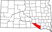 | |
| Towns | ||
| CDPs | ||
|
Other communities | ||
| Indian reservation | ||
| International | |
|---|---|
| National | |
| Other | |