This article lacks
inline citations besides
NRIS, a database which provides minimal and sometimes ambiguous information. (November 2013) |
Van Buren Place Historic District | |
 House in Van Buren Place Historic District | |
 | |
| Location | 2620--2657 Van Buren Place,
West Adams, Los Angeles |
|---|---|
| Coordinates | 34°1′55″N 118°17′45″W / 34.03194°N 118.29583°W |
| Architect | Clark, Percy H., Co., Inc. |
| Architectural style | Bungalow/Craftsman, Shingle Style |
| NRHP reference No. | 89001103 [1] |
| Added to NRHP | August 10, 1989 |
The Van Buren Place Historic District, located in the West Adams section of Los Angeles, California, is a Historic District listed in the National Register of Historic Places. The district is located in the 2600 block of Van Buren Place and consists of Craftsman, Shingle-Craftsman and Tudor-Craftsman style homes built between 1903 and 1916. The area was founded by Percy H. Clark who built six of the homes. The district is significant, for the purpose of the National Register Historic District designation, in the area of community planning and development and the area of architecture.
See also
References
-
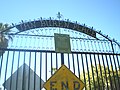 Gate to Van Buren Place
 -
 House in 2600 block of Van Buren Place
 -
 House in 2600 block of Van Buren Place


Further reading
- [1] Bob Pool, "This Old House: Former Drug Hub Draws Attention on Tour of Homes," Los Angeles Times, page 1
| Topics | |
|---|---|
| Lists by state |
|
| Lists by insular areas | |
| Lists by associated state | |
| Other areas | |
| Related | |
|
| This article about a property in Los Angeles County, California on the National Register of Historic Places is a stub. You can help Wikipedia by expanding it. |
|
| This Los Angeles–related article is a stub. You can help Wikipedia by expanding it. |
- Historic districts in Los Angeles
- National Register of Historic Places in Los Angeles
- West Adams, Los Angeles
- Shingle Style architecture in California
- Historic districts on the National Register of Historic Places in California
- Los Angeles County, California Registered Historic Place stubs
- Los Angeles geography stubs