Sedlec | |
|---|---|
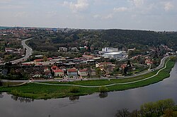
 Sedlec, view from
Bohnice | |
 Location of Sedlec within the City of Prague. | |
| Coordinates: 50°7′52″N 14°23′25″E / 50.13111°N 14.39028°E | |
| Country | Czech Republic |
| City | Prague |
| District | Prague 6 |
| Incorporated into Prague | 1922 |
| Area | |
| • Total | 21.46 km2 (8.29 sq mi) |
| Population (31 December 2015)
[1] | |
| • Total | 892 |
| • Density | 42/km2 (110/sq mi) |
| Time zone | UTC+1 ( CET) |
| • Summer ( DST) | UTC+2 ( CEST) |
Sedlec is a cadastral district of Prague, Czech Republic. In 2015 it had 892 inhabitants. The German name of Sedlec is Selz.
References
- ^ "Obyvatelstvo a rozloha katastrálních území Prahy 2001–2015". Český statistický úřad. Retrieved 2015-12-31.