Rennes Métropole | |
|---|---|
 | |
 Location within the Ille-et-Vilaine department | |
| Country | France |
| Region | Brittany |
| Department | Ille-et-Vilaine |
| No. of communes | 43 |
| Established | January 2015 |
| Seat | Rennes |
| Government | |
| • President (2020-2026) | Nathalie Appéré ( PS) |
| Area | 705.0 km2 (272.2 sq mi) |
| Population (2018) | 451,762 |
| • Density | 641/km2 (1,660/sq mi) |
| Website | Rennes-Metropole.fr |
Rennes Métropole is the métropole, an intercommunal structure, centred on the city of Rennes. It is located in the Ille-et-Vilaine department, in the Brittany region, western France. It was created in January 2015, replacing the previous Communauté d'agglomération de Rennes, [1] which had itself succeeded in 2000 to the previous district created in 1970 with less powers than the current métropole. Its area is 705.0 km2. Its population was 451,762 in 2018, of which 217,728 in Rennes proper. [2]
The goal of the Métropoles (intercommunal structure for the largest French cities like Lille, Lyon, Bordeaux or Strasbourg) is to build a better metropolitan area by synchronizing the transport system, environmental actions, urbanization, economic and social development, culture, university research, etc.
Participants
The métropole comprises the following 43 communes: [1] [3] [4]
- Acigné
- Bécherel
- Betton
- Bourgbarré
- Brécé
- Bruz
- Cesson-Sévigné
- Chantepie
- La Chapelle-Chaussée
- La Chapelle-des-Fougeretz
- La Chapelle-Thouarault
- Chartres-de-Bretagne
- Chavagne
- Chevaigné
- Cintré
- Clayes
- Corps-Nuds
- Gévezé
- L'Hermitage
- Laillé
- Langan
- Miniac-sous-Bécherel
- Montgermont
- Mordelles
- Nouvoitou
- Noyal-Châtillon-sur-Seiche
- Orgères, Ille-et-Vilaine
- Pacé
- Parthenay-de-Bretagne
- Pont-Péan
- Rennes (seat)
- Le Rheu
- Romillé
- Saint-Armel
- Saint-Erblon
- Saint-Gilles
- Saint-Grégoire
- Saint-Jacques-de-la-Lande
- Saint-Sulpice-la-Forêt
- Thorigné-Fouillard
- Le Verger
- Vern-sur-Seiche
- Vezin-le-Coquet
Metropolitan Rennes (450,000 inhabitants) encompasses only the central part of the metropolitan area of Rennes (750,000 inhabitants). Communes further away from the center of the metropolitan area have formed their own intercommunal structures, such as Châteaugiron, Noyal-sur-Vilaine, Liffré, Melesse, La Mézière, Montfort-sur-Meu or Guichen.
Gallery
-
 Rennes Metropole view
 -

-
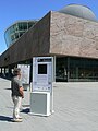 Metropolitan cultural center Les Champs Libres
 -
 Bus and Rennes Metro
 -
 Metropole president
 -

-

-
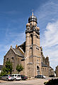 Saint-Maximilien church in Corps-Nuds


.jpg)

.jpg)


References
- ^ a b "Décret n° 2014-1602 du 23 décembre 2014 portant création de la métropole dénommée « Rennes Métropole » | Legifrance". Retrieved 2017-06-29.
- ^ Comparateur de territoire, INSEE. 4 April 2022.
- ^ Rennes Métropole (N° SIREN : 243500139), BANATIC. Accessed 4 April 2022.
- ^ INSEE
48°06′51″N 1°40′51″W / 48.1142°N 1.6808°W
|
| This Ille-et-Vilaine geographical article is a stub. You can help Wikipedia by expanding it. |