| Pywiack Dome | |
|---|---|
 | |
| Highest point | |
| Elevation | 8,819 [1] ft (2,688 m) NAVD 88 |
| Prominence | 251 ft (77 m) [2] |
| Coordinates | 37°50′47″N 119°26′35″W / 37.84639°N 119.44306°W [1] [2] |
| Geography | |
 Pywiack Dome Location of Pywiack Dome in
California  Pywiack Dome Pywiack Dome (the United States) | |
| Location | Yosemite National Park, Mariposa County, California, U.S. |
| Parent range | Sierra Nevada |
| Topo map | USGS Tenaya Lake |
Pywiack Dome is a prominent 600 foot granite dome in Yosemite National Park, located 0.7 miles (1.1 km) north-east of Tenaya Lake, 4 miles (6.4 km) west of Tuolumne Meadows and 200 feet (61.0 m) from the Tioga Road. [3] It is quite near Harlequin Dome, [4] and North and South Whizz Domes are north.
Josiah Whitney the head of California Geological Survey wrote in 1863 about Pywiack Dome in Geology:
At the head of Lake Tenaya is a very conspicuous conical knob of bare granite, about 800 feet high, the sides of which are everywhere finely polished and grooved by former glaciers. [5]
Climbing

The west face of the formation is popular with rock climbers and has several multi-pitch slab climbs easily visible from the Tioga Road. [6] Earliest was Dike Route a 6 pitch YDS 5.9R first climbed in August 1966 by Tom Gerughty, Roger Evje and Dave Meeks. [7] Other popular climbs include Zee Tree (a 5 pitch YDS 5.7) [8] and Aqua Knobby (a 4 pitch YDS 5.9) [9]
Etymology
"Py-we-ack" in the native language means "glistening rocks", and the native people applied it to both the Tenaya Creek and Tenaya Lake, due to the abundance of glacial polish in the upper Tenaya basin. In 1932 the name "Pywiack" has applied to Pywiack Cascade. Pywiack Dome was known early by various names, including Murphy's Dome, Teapot Dome, Matthes Dome, Ten-ieya Dome, and Turtle Rock. The name Pywiack Dome was recommended by David Brower in the early 1950s, and first appeared on the 1956 15-minute quadrangle map. [3] [5]
Views
-
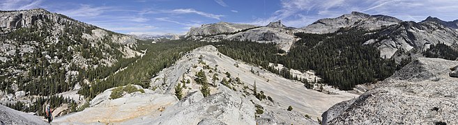
 South west panorama
 -
 North east panorama


References
- ^ a b "Pywiack Dome". Geographic Names Information System. United States Geological Survey, United States Department of the Interior. Retrieved 2015-12-31.
- ^ a b "Pywiack Dome, California". Peakbagger.com. Retrieved 2015-12-31.
- ^ a b "Pywiack Dome". SummitPost.org. Retrieved 2016-01-21.
- ^ Janes, Josh (September 21, 2006). "Phobos/Deimos Cliff Rock Climbing". Phobos/Deimos Cliff Rock Climbing. mountainproject.com. Retrieved 2 February 2019.
- ^ a b Browning, Peter (2005). Yosemite Place Names: The Historic Background of Geographic Names in Yosemite National Park. Lafayette, CA: Great West Books. p. 119. ISBN 0-944220-19-3.
- ^ "Tuolumne Meadows Rock Climbing". Mountain Project. Retrieved 31 December 2015.
- ^ Barnes, Greg; McNamara, Chris; Roper, Steve (2009). Tuolumne Free Climbs (2nd ed.). SuperTopo. ISBN 0976523574. Retrieved 31 December 2015.
- ^ "Zee Tree". the Crag. Retrieved 31 December 2015.
- ^ "Aqua Knobby". Gear Loop Topo. Retrieved 31 December 2015.
|
| This Yosemite-related article is a stub. You can help Wikipedia by expanding it. |
|
| This Mariposa County, California–related article is a stub. You can help Wikipedia by expanding it. |