Pontocola, Mississippi | |
|---|---|
 Pontocola  Pontocola | |
| Coordinates: 34°08′43″N 88°49′18″W / 34.14528°N 88.82167°W | |
| Country | United States |
| State | Mississippi |
| County | Lee |
| Elevation | 361 ft (110 m) |
| Time zone | UTC-6 ( Central (CST)) |
| • Summer ( DST) | UTC-5 (CDT) |
| GNIS feature ID | 684561 [1] |
Pontocola is a ghost town in Lee County, in the U.S. state of Mississippi.
History
Pontocola is a name derived from the Chickasaw language purported to mean "hanging grapes". [2] A post office operated under the name Pontocola from 1858 to 1904. [3]
References
- ^ "Pontocola". Geographic Names Information System. United States Geological Survey, United States Department of the Interior.
- ^ Baca, Keith A. (2007). Native American Place Names in Mississippi. University Press of Mississippi. p. 84. ISBN 978-1-60473-483-6.
- ^ "Lee County". Jim Forte Postal History. Retrieved April 24, 2020.
Municipalities and communities of
Lee County, Mississippi, United States | ||
|---|---|---|
| Cities | 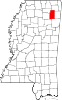 | |
| Towns | ||
| CDP | ||
|
Other communities | ||
| Ghost town | ||
| Footnotes | ‡This populated place also has portions in an adjacent county or counties | |
|
| This Lee County, Mississippi state location article is a stub. You can help Wikipedia by expanding it. |