Pleasant Grove, California | |
|---|---|
 Pleasant Grove | |
| Nickname: Gouge-Eye | |
 Pleasant Grove, California  Pleasant Grove, California | |
| Coordinates: 38°49′26″N 121°29′02″W / 38.82389°N 121.48389°W | |
| Country | United States |
| State | California |
| County | Sutter |
| Elevation | 49 ft (15 m) |
| Time zone | UTC-8 ( Pacific (PST)) |
| • Summer ( DST) | UTC-7 (PDT) |
| ZIP code | 95668 |
| Area code(s) | 916, 279 |
| GNIS feature ID | 230798 [1] |
Pleasant Grove is an unincorporated community in Sutter County, California, United States. Pleasant Grove is 7.5 miles (12.1 km) southeast of Nicolaus. Pleasant Grove has a post office with ZIP code 95668. [2]
History
The community originated as a wagon and freight stop, and was nicknamed "Gouge-Eye" after a saloon fight in which one man gouged out the eye of another. The post office opened as Pleasant Grove Creek in 1867, became Pleasant Grove in 1875, and moved 1.5 miles (2.4 km) east in 1940. [3]
References
- ^ U.S. Geological Survey Geographic Names Information System: Pleasant Grove, California
- ^ ZIP Code Lookup
- ^ Durham, David L. (1998). California's Geographic Names: A Gazetteer of Historic and Modern Names of the State. Quill Driver Books. p. 539. ISBN 1-884995-14-4.
Wikimedia Commons has media related to
Pleasant Grove, California.
Municipalities and communities of
Sutter County, California, United States | ||
|---|---|---|
| Cities | 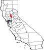 | |
| CDPs | ||
|
Unincorporated communities | ||
|
| This Sutter County, California-related article is a stub. You can help Wikipedia by expanding it. |