| Pit-3 Dam | |
|---|---|
 Satellite view | |
| Official name | Pit Number Three Dam |
| Country | United States |
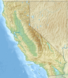
| Location | Shasta County, California |
| Coordinates | 41°01′18″N 121°40′33″W / 41.02167°N 121.67583°W |
| Owner(s) | Pacific Gas and Electric Company [1] |
| Dam and spillways | |
| Impounds | Pit River |
| Height | 130 ft (40 m) [2] |
| Length | 494 ft (151 m) [2] |
| Width (crest) | 30 ft (9.1 m) [1] |
| Width (base) | 110 ft (34 m) [1] |
| Reservoir | |
| Creates | Lake Britton |
| Total capacity | 41,877 acre⋅ft (51,655,000 m3) [2] |
| Catchment area | 4,700 square miles (12,000 km2) [1] |
| Surface area | 1,265 acres (5.12 km2) [3] |
| Power Station | |
| Type | Run-of-the-river |
| Hydraulic head | 600 feet (180 m) [2] |
| Installed capacity | 69.9 MW [2] |
| Annual generation | 333,606,000 KWh (2001–2012) [4] |
Pit-3 Dam (also known as Pit Number Three Dam and Dam Number Three) is a hydroelectric dam on the Pit River in northern California in the United States. It forms Lake Britton, and is owned by the Pacific Gas and Electric Company (PG&E).
Specifications
Pit 3 is a curved concrete gravity dam with a height of 130 ft (40 m) and length of 494 ft (151 m). The dam has a gated spillway with three steel gates and three inflatable rubber gates. [2]: 6 An intake structure at the dam diverts water into a 19-foot (5.8 m) diameter, 21,203-foot (6,463 m) long tunnel that connects to the Pit 3 hydroelectric plant. There are three 23.3 MW generators, for a total capacity of 69.9 MW. [2]: 6
Lake Britton, formerly known as Pit 3 Reservoir, has a maximum water level of 2,737.5 ft (834.4 m); however, the lake is usually kept below 2,736.5 ft (834.1 m) to avoid flooding parts of McArthur–Burney Falls Memorial State Park. [2]: 279 The gross storage capacity is 41,877 acre-feet (51,655,000 m3) and the usable (active) storage is 14,443 acre-feet (17,815,000 m3). [2]: 6
The lake level changes on a weekly basis with greater drawdowns during the weekdays for power generation, and refilling on the weekends. [2]: 9 In addition to generating power at the Pit 3 hydroelectric station, the reservoir also helps regulate water flowing through the Pit 4 and Pit 5 stations downstream.
The dam is the place where Pacific Crest Trail crosses the Pit River. [2]: 279
History
Construction was completed in 1925. [5]
See also
References
- ^ a b c d "Lake Britton, northwest California". FindLakes. Retrieved 2010-11-13.
- ^ a b c d e f g h i j k "Draft Environmental Impact Statement for Hydropower License: Pit 3, 4, 5 Hydroelectric Project". Federal Energy Regulatory Commission. Mar 2003. Retrieved 2018-04-28.
- ^ "Pit River Watershed". California Hydropower Reform Coalition. Retrieved 2010-11-13.
- ^ "California Hydroelectric Statistics & Data". California Energy Commission. Archived from the original on 2018-02-26. Retrieved 2018-04-27.
- ^ Rountree, Marilyn. "Hydroelectric Dams and Powerhouses". Shasta County History. Retrieved 2010-11-13.

