From Wikipedia, the free encyclopedia
This list includes properties and districts listed on the
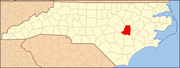
National Register of Historic Places in
Wayne County, North Carolina . Click the "Map of all coordinates" link to the right to view an online map of all properties and districts with latitude and longitude coordinates in the table below.
[1]
Current listings This
National Park Service list is complete through
NPS recent listings posted April 5, 2024.
[2]
[3]
Name on the Register
[4]
Image
Date listed
[5]
Location
City or town
Description
1
Charles B. Aycock Birthplace
Upload image February 26, 1970 (
#70000482 ) 6 miles from jct. of SR 1542 and U.S. 117
35°31′11″N 77°58′30″W / 35.519722°N 77.975°W / 35.519722; -77.975 (Charles B. Aycock Birthplace )
Fremont
2
Barnes-Hooks Farm
Upload image September 1, 1995 (
#95001072 ) 414 Stuckey Rd.
35°34′15″N 77°59′05″W / 35.570833°N 77.984722°W / 35.570833; -77.984722 (Barnes-Hooks Farm )
Fremont
3
Borden Manufacturing Company
Borden Manufacturing Company
February 2, 2005 (
#04001583 ) 800 and 801 N. William St.
35°23′32″N 77°59′20″W / 35.392222°N 77.988889°W / 35.392222; -77.988889 (Borden Manufacturing Company )
Goldsboro
4
Eureka United Methodist Church
Upload image August 26, 1982 (
#82003520 ) Church St.
35°32′40″N 77°52′47″W / 35.544444°N 77.879722°W / 35.544444; -77.879722 (Eureka United Methodist Church )
Eureka
5
First Presbyterian Church
First Presbyterian Church
May 29, 1979 (
#79003340 ) 111 W. Ash St.
35°23′10″N 77°59′50″W / 35.386111°N 77.997222°W / 35.386111; -77.997222 (First Presbyterian Church )
Goldsboro
6
Former U.S. Post Office
Upload image June 2, 1995 (
#95000670 ) 124 W. James St.
35°11′50″N 78°04′01″W / 35.197222°N 78.066944°W / 35.197222; -78.066944 (Former U.S. Post Office )
Mount Olive
7
L. D. Giddens and Son Jewelry Store
L. D. Giddens and Son Jewelry Store
March 19, 1979 (
#79001763 ) 135 S. Center St.
35°22′56″N 77°59′52″W / 35.382325°N 77.997733°W / 35.382325; -77.997733 (L. D. Giddens and Son Jewelry Store )
Goldsboro
8
Goldsboro Union Station
Goldsboro Union Station
April 13, 1977 (
#77001015 ) 101 North Carolina St.
35°23′05″N 78°00′15″W / 35.384722°N 78.004167°W / 35.384722; -78.004167 (Goldsboro Union Station )
Goldsboro
9
Goldsboro Woman's Club
Upload image December 7, 2022 (
#100008464 ) 116 North William St.
35°23′00″N 77°59′35″W / 35.3833°N 77.9930°W / 35.3833; -77.9930 (Goldsboro Woman's Club )
Goldsboro
10
Harry Fitzhugh Lee House
Upload image March 1, 1984 (
#84002542 ) 310 W. Walnut St.
35°23′03″N 78°00′11″W / 35.384167°N 78.003056°W / 35.384167; -78.003056 (Harry Fitzhugh Lee House )
Goldsboro
11
Mount Olive High School
Upload image October 22, 1998 (
#98001266 ) 100 Wooten St.
35°12′01″N 78°04′23″W / 35.200278°N 78.073056°W / 35.200278; -78.073056 (Mount Olive High School )
Mount Olive
12
Mount Olive Historic District
Upload image May 27, 1999 (
#99000639 ) Roughly bounded by Park Ave., Wooten, Nelson, and Johnson Sts.
35°11′42″N 78°04′09″W / 35.195°N 78.069167°W / 35.195; -78.069167 (Mount Olive Historic District )
Mount Olive
13
Odd Fellows Lodge
Odd Fellows Lodge
August 3, 1978 (
#78001984 ) 111-115 N. John St.
35°23′00″N 77°59′43″W / 35.383261°N 77.995386°W / 35.383261; -77.995386 (Odd Fellows Lodge )
Goldsboro
14
Perry-Cherry House
Upload image March 13, 1986 (
#86000392 ) 308 W. Main St.
35°11′50″N 78°04′14″W / 35.197222°N 78.070556°W / 35.197222; -78.070556 (Perry-Cherry House )
Mount Olive
15
Southerland-Burnette House
Upload image February 8, 1988 (
#88000057 ) 201 N. Chesnut St.
35°11′51″N 78°04′04″W / 35.1975°N 78.067778°W / 35.1975; -78.067778 (Southerland-Burnette House )
Mount Olive
16
Uzzell-Best Farm
Upload image September 7, 2023 (
#100009228 ) 1361 New Hope Rd.
35°22′12″N 77°52′38″W / 35.3701°N 77.8771°W / 35.3701; -77.8771 (Uzzell-Best Farm )
La Grange vicinity
17
Vernon
Upload image October 9, 1974 (
#74001387 ) Address Restricted
Mount Olive
Demolished
[6]
18
Solomon and Henry Weil Houses
Solomon and Henry Weil Houses
December 22, 1976 (
#76001350 ) 204 and 200 W. Chestnut St.
35°22′56″N 78°00′00″W / 35.382169°N 78.000067°W / 35.382169; -78.000067 (Solomon and Henry Weil Houses )
Goldsboro
19
Dred and Ellen Yelverton House
Upload image August 27, 2009 (
#09000662 ) 1979 NC 222 E.
35°33′36″N 78°00′28″W / 35.559897°N 78.0078°W / 35.559897; -78.0078 (Dred and Ellen Yelverton House )
Fremont
See also References
^ The latitude and longitude information provided in this table was derived originally from the National Register Information System, which has been found to be fairly accurate for about 99% of listings. Some locations in this table may have been corrected to current GPS standards.
^ National Park Service,
United States Department of the Interior ,
"National Register of Historic Places: Weekly List Actions" , retrieved April 5, 2024.
^ Numbers represent an alphabetical ordering by significant words. Various colorings, defined
here , differentiate
National Historic Landmarks and
historic districts from other NRHP buildings, structures, sites or objects.
^
"National Register Information System" .
National Register of Historic Places .
National Park Service . April 24, 2008.
^ The eight-digit number below each date is the number assigned to each location in the
National Register Information System database, which can be viewed by clicking the number.
^
"North Carolina Listings in the National Register of Historic Places by County" . North Carolina State Historic Preservation Office. 22 October 2008. Archived from
the original on 30 November 2012. Retrieved 6 July 2009 .
Topics Lists Other lists
Topics Lists by state Lists by insular areas Lists by associated state Other areas Related