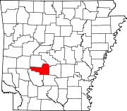
[3]
Name on the Register
[4]
Image
Date listed
[5]
Location
City or town
Description
1
Alderson-Coston House
Alderson-Coston House
May 26, 1995 (
#95000657 ) 204 Pine Bluff St.
34°21′43″N 92°48′33″W / 34.361944°N 92.809167°W / 34.361944; -92.809167 (Alderson-Coston House )
Malvern
2
Bank of Malvern
Bank of Malvern
March 13, 1987 (
#87000425 ) 212 S. Main St.
34°21′48″N 92°48′49″W / 34.363333°N 92.813611°W / 34.363333; -92.813611 (Bank of Malvern )
Malvern
3
Billings-Cole House
Billings-Cole House
May 27, 2015 (
#15000283 ) 725 E. Page Ave.
34°21′48″N 92°48′12″W / 34.3634°N 92.8032°W / 34.3634; -92.8032 (Billings-Cole House )
Malvern
4
Blakely House
Blakely House
May 3, 1976 (
#76002142 ) West of Social Hill on
Highway 84
34°20′06″N 93°01′32″W / 34.335°N 93.025556°W / 34.335; -93.025556 (Blakely House )
Social Hill
5
Cabin No. 1
Cabin No. 1
April 20, 1995 (
#95000455 ) Cabin area access road at
Lake Catherine State Park
34°26′15″N 92°54′46″W / 34.4375°N 92.912778°W / 34.4375; -92.912778 (Cabin No. 1 )
Shorewood Hills
6
Clark House
Clark House
December 22, 1982 (
#82000828 ) 1324 S. Main St.
34°21′24″N 92°48′30″W / 34.356667°N 92.808333°W / 34.356667; -92.808333 (Clark House )
Malvern
7
Couchwood
Couchwood
December 4, 1986 (
#86003582 ) On the grounds of the Couchwood estate, 601 Couchwood Rd.
[6]
34°26′47″N 92°54′50″W / 34.4465°N 92.914°W / 34.4465; -92.914 (Couchwood )
Shorewood Hills
Extends into
Garland County ; listing encompasses artwork of
Dionicio Rodriguez on the private estate of
Harvey C. Couch .
8
Couchwood Historic District
Couchwood Historic District
May 17, 2001 (
#01000487 ) 601 Couchwood Rd.
34°26′50″N 92°54′50″W / 34.447222°N 92.913889°W / 34.447222; -92.913889 (Couchwood Historic District )
Hot Springs
Extends into
Garland County ; listing encompasses buildings and structures of the private estate of
Harvey C. Couch .
9
Garrett's Grocery Store
Garrett's Grocery Store
January 19, 2023 (
#100008561 ) 2450
US 67
34°13′24″N 93°00′10″W / 34.2233°N 93.0029°W / 34.2233; -93.0029 (Garrett's Grocery Store )
Friendship
10
Gatewood House
Gatewood House
July 24, 1992 (
#92000928 ) 235 Pine Bluff St.
34°21′41″N 92°48′30″W / 34.361389°N 92.808333°W / 34.361389; -92.808333 (Gatewood House )
Malvern
11
Hodges House
Hodges House
June 2, 1995 (
#95000683 )
Highway 7
34°16′23″N 93°08′53″W / 34.273056°N 93.148056°W / 34.273056; -93.148056 (Hodges House )
Bismarck
12
Hot Spring County Courthouse
Hot Spring County Courthouse
November 7, 1996 (
#96001271 ) 210 Locust St.
34°21′46″N 92°48′53″W / 34.362778°N 92.814722°W / 34.362778; -92.814722 (Hot Spring County Courthouse )
Malvern
13
Hot Springs Railroad Roundhouse
Hot Springs Railroad Roundhouse
May 29, 2003 (
#03000462 ) 132 Front St.
34°21′53″N 92°48′59″W / 34.364722°N 92.816389°W / 34.364722; -92.816389 (Hot Springs Railroad Roundhouse )
Malvern
14
Jones Mill Site (3HS28)
Upload image September 12, 1988 (
#87001385 ) Address Restricted
Jones Mill
15
Lake Catherine Quarry
Upload image September 11, 1975 (
#75000388 ) Address Restricted
Malvern
16
Lake Catherine State Park-Bridge No. 2
Lake Catherine State Park-Bridge No. 2
May 28, 1992 (
#92000528 )
Highway 171 west of Slunger Creek in
Lake Catherine State Park
34°25′46″N 92°56′21″W / 34.429444°N 92.939167°W / 34.429444; -92.939167 (Lake Catherine State Park-Bridge No. 2 )
Shorewood Hills
17
Lake Catherine State Park-Cabin No. 2
Lake Catherine State Park-Cabin No. 2
May 28, 1992 (
#92000526 ) Cabin area access road in
Lake Catherine State Park
34°26′15″N 92°54′45″W / 34.4375°N 92.9125°W / 34.4375; -92.9125 (Lake Catherine State Park-Cabin No. 2 )
Shorewood Hills
18
Lake Catherine State Park-Cabin No. 3
Lake Catherine State Park-Cabin No. 3
May 28, 1992 (
#92000527 ) Cabin area access road in
Lake Catherine State Park
34°26′15″N 92°54′44″W / 34.4375°N 92.912222°W / 34.4375; -92.912222 (Lake Catherine State Park-Cabin No. 3 )
Shorewood Hills
19
Lake Catherine State Park-Nature Cabin
Lake Catherine State Park-Nature Cabin
May 28, 1992 (
#92000535 ) Camping area access road in
Lake Catherine State Park
34°26′15″N 92°55′03″W / 34.4375°N 92.9175°W / 34.4375; -92.9175 (Lake Catherine State Park-Nature Cabin )
Shorewood Hills
20
Lake Catherine State Park Prisoner of War Structures
Lake Catherine State Park Prisoner of War Structures
January 24, 2017 (
#100000553 ) Campground,
Lake Catherine State Park
34°26′15″N 92°55′05″W / 34.437631°N 92.918142°W / 34.437631; -92.918142 (Lake Catherine State Park Prisoner of War Structures )
Hot Springs vicinity
Stone retaining wall and outdoor oven built in part by CCC and in part by German POW labor
21
Lawyers' Row Historic District
Lawyers' Row Historic District
September 28, 2015 (
#15000625 ) 118, 120, 130, 132 W. 2nd St.
34°21′49″N 92°48′53″W / 34.3635°N 92.8146°W / 34.3635; -92.8146 (Lawyers' Row Historic District )
Malvern
22
Lono Gymnasium
Lono Gymnasium
January 21, 2020 (
#100004896 ) 11702
AR 222
34°12′30″N 92°42′30″W / 34.2082°N 92.7082°W / 34.2082; -92.7082 (Lono Gymnasium )
Lono
23
Malvern Commercial Historic District
Malvern Commercial Historic District
September 28, 2015 (
#15000626 ) Bounded by W. 1st., S. Main, W. 5th & Locust Sts.
34°21′46″N 92°48′50″W / 34.3629°N 92.8138°W / 34.3629; -92.8138 (Malvern Commercial Historic District )
Malvern
24
Malvern Rosenwald School
Malvern Rosenwald School
September 28, 2005 (
#05001075 ) 836 Acme St.
34°21′45″N 92°49′18″W / 34.3625°N 92.821667°W / 34.3625; -92.821667 (Malvern Rosenwald School )
Malvern
25
Missouri-Pacific Railroad Depot-Malvern
Missouri-Pacific Railroad Depot-Malvern
June 11, 1992 (
#92000615 ) 1st St.
34°21′56″N 92°48′49″W / 34.365556°N 92.813611°W / 34.365556; -92.813611 (Missouri-Pacific Railroad Depot-Malvern )
Malvern
26
Morrison Plantation Smokehouse
Upload image December 28, 1977 (
#77000254 ) Off
Interstate 30
34°16′12″N 92°56′50″W / 34.27°N 92.947222°W / 34.27; -92.947222 (Morrison Plantation Smokehouse )
Saginaw
27
Pine Bluff Street Historic District
Pine Bluff Street Historic District
February 16, 1999 (
#99000154 ) Pine Bluff St., roughly from Bois D'Arc to McNeal St.
34°21′42″N 92°48′17″W / 34.361667°N 92.804722°W / 34.361667; -92.804722 (Pine Bluff Street Historic District )
Malvern
28
Remmel Dam
Remmel Dam
September 4, 1992 (
#92001084 ) Remmel Dam Rd.
34°25′37″N 92°53′38″W / 34.426944°N 92.893889°W / 34.426944; -92.893889 (Remmel Dam )
Jones Mill
29
Rockport Cemetery
Rockport Cemetery
January 28, 2002 (
#01001527 )
U.S. Route 270
34°22′48″N 92°49′57″W / 34.38°N 92.8325°W / 34.38; -92.8325 (Rockport Cemetery )
Rockport
30
Strauss House
Strauss House
December 22, 1982 (
#82000830 ) 528 E. Page St.
34°21′50″N 92°48′26″W / 34.363889°N 92.807222°W / 34.363889; -92.807222 (Strauss House )
Malvern