From Wikipedia, the free encyclopedia
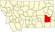
Location of Custer County in Montana
This is a list of the National Register of Historic Places listings in Custer County, Montana . It is intended to be a complete list of the properties and districts on the
National Register of Historic Places in
Custer County ,
Montana ,
United States . The locations of National Register properties and districts for which the latitude and longitude coordinates are included below, may be seen in a map.
[1]
There are 18 properties and districts listed on the National Register in the county.
This
National Park Service list is complete through
NPS recent listings posted April 12, 2024.
[2]
Current listings
[3]
Name on the Register
Image
Date listed
[4]
Location
City or town
Description
1
Carriage House Historic District
Carriage House Historic District
June 7, 1991 (
#91000720 ) Roughly bounded by Main, N. 9th, Palmer, N. 10th, Orr, and N. 13th Sts. and Montana Ave.
46°24′35″N 105°50′41″W / 46.409722°N 105.844722°W / 46.409722; -105.844722 (Carriage House Historic District )
Miles City
2
East Main Street Residential Historic District
East Main Street Residential Historic District
January 10, 1990 (
#89002171 ) 1600-2315 E. Main St.
46°24′31″N 105°50′07″W / 46.408611°N 105.835278°W / 46.408611; -105.835278 (East Main Street Residential Historic District )
Miles City
3
Fort Keogh
Fort Keogh
March 8, 1978 (
#78001680 ) 2.5 miles (4 km) southwest of Miles City
46°22′50″N 105°53′09″W / 46.380556°N 105.885833°W / 46.380556; -105.885833 (Fort Keogh )
Miles City
4
William Harmon House
William Harmon House
September 25, 1986 (
#86002747 ) 1005 Palmer
46°24′36″N 105°50′48″W / 46.41°N 105.846667°W / 46.41; -105.846667 (William Harmon House )
Miles City
5
Holy Rosary Hospital
Holy Rosary Hospital
January 15, 2009 (
#08001324 ) 310 N. Jordan and 2007 Clark St.
46°24′40″N 105°50′08″W / 46.411028°N 105.835539°W / 46.411028; -105.835539 (Holy Rosary Hospital )
Miles City
6
Ismay Jail
Ismay Jail
June 4, 1997 (
#97000501 ) Jailhouse Rd. west of its junction with East St.
46°29′53″N 104°47′34″W / 46.498056°N 104.792778°W / 46.498056; -104.792778 (Ismay Jail )
Ismay
7
Locate Creek Bridge
Upload image March 26, 2012 (
#12000170 ) Mile 3 N. Locate Rd.
46°28′30″N 105°18′17″W / 46.474887°N 105.304602°W / 46.474887; -105.304602 (Locate Creek Bridge )
Miles City vicinity
part of the Montana's Steel Stringer and Steel Girder Bridges MPS
8
Main Street Historic District
Main Street Historic District
July 21, 1989 (
#89000808 ) Roughly Main St. from Prairie Ave. to 4th St.
46°24′21″N 105°50′52″W / 46.405833°N 105.847778°W / 46.405833; -105.847778 (Main Street Historic District )
Miles City
9
Miles City Steam Laundry
Miles City Steam Laundry
July 5, 1979 (
#79001400 ) 800 Bridge St.
46°24′23″N 105°50′48″W / 46.406389°N 105.846667°W / 46.406389; -105.846667 (Miles City Steam Laundry )
Miles City
10
Miles City Waterworks Building and Pumping Plant Park
Miles City Waterworks Building and Pumping Plant Park
September 26, 1979 (
#79003723 ) West of Miles City on Pumping Plant Rd.
46°24′22″N 105°52′05″W / 46.406111°N 105.868056°W / 46.406111; -105.868056 (Miles City Waterworks Building and Pumping Plant Park )
Miles City
11
George M. Miles House
George M. Miles House
February 17, 1982 (
#82003161 ) 28 S. Lake St.
46°24′27″N 105°50′12″W / 46.4075°N 105.836667°W / 46.4075; -105.836667 (George M. Miles House )
Miles City
12
Mountain States Telephone and Telegraph Company
Mountain States Telephone and Telegraph Company
July 21, 1988 (
#88001118 ) 908 Main St.
46°24′26″N 105°50′44″W / 46.407222°N 105.845556°W / 46.407222; -105.845556 (Mountain States Telephone and Telegraph Company )
Miles City
13
Northern Pacific Railway Depot
Northern Pacific Railway Depot
April 1, 2010 (
#10000132 ) 500 Pacific Ave.
46°24′13″N 105°51′10″W / 46.403483°N 105.852772°W / 46.403483; -105.852772 (Northern Pacific Railway Depot )
Miles City
14
Olive Hotel
Olive Hotel
October 13, 1988 (
#88001117 ) 501 Main St.
46°24′21″N 105°51′03″W / 46.405833°N 105.850833°W / 46.405833; -105.850833 (Olive Hotel )
Miles City
15
Thomas and Beulah Shore House
Thomas and Beulah Shore House
December 18, 2003 (
#03001299 ) 602 S. Strevell Ave.
46°24′12″N 105°49′57″W / 46.403333°N 105.8325°W / 46.403333; -105.8325 (Thomas and Beulah Shore House )
Miles City
16
Walrond and Elizabeth Snell House
Walrond and Elizabeth Snell House
September 11, 2003 (
#03000923 ) 402 S. Lake St.
46°24′16″N 105°50′15″W / 46.404444°N 105.8375°W / 46.404444; -105.8375 (Walrond and Elizabeth Snell House )
Miles City
17
Ursuline Convent of the Sacred Heart
Ursuline Convent of the Sacred Heart
March 5, 1992 (
#92000115 ) 1411 Leighton Boulevard
46°24′44″N 105°50′32″W / 46.412222°N 105.842222°W / 46.412222; -105.842222 (Ursuline Convent of the Sacred Heart )
Miles City
18
US Post Office-Miles City Main
US Post Office-Miles City Main
March 14, 1986 (
#86000686 ) 106 N. 7th St.
46°24′28″N 105°50′58″W / 46.407778°N 105.849444°W / 46.407778; -105.849444 (US Post Office-Miles City Main )
Miles City
See also References
^ The latitude and longitude information provided in this table was derived originally from the National Register Information System, which has been found to be fairly accurate for about 99% of listings. Some locations in this table may have been corrected to current GPS standards.
^ National Park Service,
United States Department of the Interior ,
"National Register of Historic Places: Weekly List Actions" , retrieved April 12, 2024.
^ Numbers represent an alphabetical ordering by significant words. Various colorings, defined
here , differentiate
National Historic Landmarks and
historic districts from other NRHP buildings, structures, sites or objects.
^ The eight-digit number below each date is the number assigned to each location in the
National Register Information System database, which can be viewed by clicking the number.


_-_Custer_County,_Montana.png)

.jpg)