
This is a list of the National Register of Historic Places listings in Coal County, Oklahoma.
This is intended to be a complete list of the properties on the National Register of Historic Places in Coal County, Oklahoma, United States. The locations of National Register properties for which the latitude and longitude coordinates are included below, may be seen in a map. [1]
There are 5 properties listed on the National Register in the county.
This
National Park Service list is complete through
NPS recent listings posted April 12, 2024.
[2]
Current listings
| [3] | Name on the Register [4] | Image | Date listed [5] | Location | City or town | Description |
|---|---|---|---|---|---|---|
| 1 | Coalgate School Gymnasium-Auditorium | September 8, 1988 ( #88001382) |
Fox and Frey Sts. 34°32′01″N 96°13′13″W / 34.533611°N 96.220278°W | Coalgate | ||
| 2 | Keel Creek Bridge | April 4, 2007 ( #07000257) |
State Highway 31 over Keel Creek 34°36′34″N 96°08′42″W / 34.609444°N 96.145°W | Coalgate | Demolished in 2008 | |
| 3 | Merchants National Bank Building | December 6, 2006 ( #06001112) |
Southwestern corner of Main and Railway Sts. 34°27′50″N 96°13′29″W / 34.463889°N 96.224722°W | Lehigh | ||
| 4 | Benjamin Franklin Smallwood House | March 10, 1982 ( #82003676) |
West of Lehigh 34°27′44″N 96°16′33″W / 34.462222°N 96.275833°W | Lehigh | ||
| 5 | United States Post Office Coalgate |  |
April 17, 2009 ( #09000214) |
38 N. Main St. 34°32′19″N 96°13′06″W / 34.538611°N 96.218333°W | Coalgate |
See also
- List of National Historic Landmarks in Oklahoma
- National Register of Historic Places listings in Oklahoma
References
- ^ The latitude and longitude information provided in this table was derived originally from the National Register Information System, which has been found to be fairly accurate for about 99% of listings. Some locations in this table may have been corrected to current GPS standards.
- ^ National Park Service, United States Department of the Interior, "National Register of Historic Places: Weekly List Actions", retrieved April 12, 2024.
- ^ Numbers represent an alphabetical ordering by significant words. Various colorings, defined here, differentiate National Historic Landmarks and historic districts from other NRHP buildings, structures, sites or objects.
- ^ "National Register Information System". National Register of Historic Places. National Park Service. March 13, 2009.
- ^ The eight-digit number below each date is the number assigned to each location in the National Register Information System database, which can be viewed by clicking the number.
| Topics | |
|---|---|
| Lists by state |
|
| Lists by insular areas | |
| Lists by associated state | |
| Other areas | |
| Related | |
Municipalities and communities of
Coal County, Oklahoma, United States | ||
|---|---|---|
| Cities | 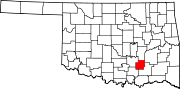 | |
| Towns | ||
| CDPs | ||
|
Other communities | ||
| Indian reservations | ||
| Footnotes | ‡This populated place also has portions in an adjacent county or counties | |