| Madison River | |
|---|---|
 Lower Madison River In
Bear Trap Canyon Below
Ennis, Montana | |
 Madison River watershed (
Interactive map) | |
| Location | |
| Country | United States |
| State | Wyoming and Montana |
| Physical characteristics | |
| Source | Madison Junction |
| • location | Yellowstone National Park, Wyoming |
| • coordinates | 44°38′32″N 110°51′56″W / 44.64222°N 110.86556°W [1] |
| Mouth | Missouri River |
• location | Three Forks, Montana |
• coordinates | 45°55′39″N 111°30′29″W / 45.92750°N 111.50806°W [1] |
| Length | 183 mi (295 km) |
| Discharge | |
| • location | near Three Forks |
| • average | 1,647 cu ft/s (46.6 m3/s) [2] |
| Basin features | |
| Tributaries | |
| • left | Firehole River |
| • right | Gibbon River |
The Madison River is a headwater tributary of the Missouri River, approximately 183 miles (295 km) long, in Wyoming and Montana. Its confluence with the Jefferson and Gallatin rivers near Three Forks, Montana forms the Missouri River.
The Madison rises in Teton County in northwestern Wyoming at the confluence of the Firehole and Gibbon rivers, a location in Yellowstone National Park called Madison Junction. It first flows west, then north through the mountains of southwestern Montana to join the Jefferson and the Gallatin rivers at Three Forks. The Missouri River Headwaters State Park is located on the Madison at Three Forks. [3] In its upper reaches in Gallatin County, Montana, the Hebgen Dam forms Hebgen Lake. In its middle reaches in Madison County, Montana, the Madison Dam forms Ennis Lake and provides hydroelectric power. In 1959, the 1959 Hebgen Lake earthquake formed Quake Lake just downstream from Hebgen Dam. Downstream from Ennis, the Madison flows through Bear Trap Canyon, known for its class IV-V whitewater. [4] The Bear Trap Canyon section is part of the Lee Metcalf Wilderness area.
The river was named in July 1805 by Meriwether Lewis at Three Forks. The central fork of the three, it was named for U.S. Secretary of State James Madison, who later succeeded Thomas Jefferson as President in 1809. The western fork, the largest, was named for President Jefferson and the east fork for Treasury Secretary Albert Gallatin.
The Madison is a class I river in Montana for the purposes of access for recreational use. [5]
Angling the Madison
The Madison River, from Madison Junction in Yellowstone to Three Forks, is a fly fishing mecca for serious anglers. It is classified as a blue ribbon fishery in Montana and is one of the most productive streams in Montana for brown trout, rainbow trout and mountain whitefish. [6]
See also
- Angling in Yellowstone National Park
- Fishes of Yellowstone National Park
- Montana Stream Access Law
- List of rivers of Montana
- List of Wyoming rivers
References
- ^ a b U.S. Geological Survey Geographic Names Information System: Madison River, USGS GNIS
- ^ "USGS Surface Water data for Montana". USGS Surface-Water Annual Statistics. United States Geological Survey. Retrieved 24 December 2022.
- ^ "Missouri Headwaters State Park on the Madison River". Montana Fish and Wildlife and Parks. Archived from the original on 21 May 2007. Retrieved 24 December 2022.
- ^ Fischer, Hank; Fischer, Carol (2008). Paddling Montana. Guildford, CT: The Globe Pequot Press. pp. 111–113. ISBN 978-0-7627-4352-0.
- ^ "Stream access in Montana". Montana Fish and Wildlife and Parks. Archived from the original on 10 March 2009. Retrieved 24 December 2022.
- ^ "Madison River data". Fishing guide. Montana Fish and Wildlife and Parks. Retrieved 19 January 2023.
Sources
- Back, Howard (1938). The Waters of the Yellowstone with Rod and Fly. New York, NY: Dodd & Mead.
- Parks, Richard (1998). Fishing Yellowstone National Park. Helena, MT: Falcon Press. ISBN 1-56044-625-0.
- Brooks, Charles E. (1979). The Living River: A fisherman's intimate profile of the Madison River watershed – its history, ecology, lore, and angling opportunities. Garden City, NJ: Nick Lyons Books. ISBN 0-385-15655-3.
- Mathews, Craig; Molinero, Clayton (1997). The Yellowstone Fly-Fishing Guide: A[n] authoritative guide to the waters of Yellowstone National Park. Guilford, CT: The Lyons Press. ISBN 1-55821-545-X.
- Brooks, Charles E. (1984). Fishing Yellowstone Waters. Clinton, NJ: New Win Publishing Inc. ISBN 0-8329-0353-1.
- Holt, John (1996). Montana Fly-Fishing Guide. Vol. East. Guilford, CT: The Lyons Press. ISBN 1-58574-529-4.
- Holt, John (1993). River Journal. Vol. Madison. Portland, OR: Frank Amato Publications. ISBN 1-878175-27-0.
- Staples, Bruce; Jacklin, Bob (2021). Fly Fishing West Yellowstone: A history and guide. Guilford, CT: Stackpole Books. ISBN 9780811738255.
External links
- . Collier's New Encyclopedia. 1921.
Yellowstone National Park - Norris and Madison | ||
|---|---|---|
Geothermal features, historic structures and other attractions in the
Norris and Madison Junction areas | ||
| Norris Geyser Basin | 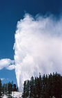 | |
| Gibbon Geyser Basin | ||
| Structures and history | ||
| Geography and geology | ||
| ||
| Authority control databases: National |
|---|