| Lilliput Glacier | |
|---|---|
| Type | Mountain glacier |
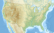
| Location | Mount Stewart, Sequoia National Park, Tulare County, California, U.S. |
| Coordinates | 36°34′53″N 118°33′07″W / 36.58139°N 118.55194°W [1] |
| Area | 0.05 km2 (0.019 sq mi) |
| Length | .16 km (0.099 mi) |
| Terminus | Talus |
| Status | Retreating |
Lilliput Glacier is the smallest named glacier in the Sierra Nevada of California. The glacier has an area of .05 km2 (0.019 sq mi), which is approximately 12.2 acres. In terms of area this is about the size of 48 typical suburb (1/4 acre or approx. 100' × 100') lots that single family homes are built on. This glacier lies on the shaded north-facing vertical cliff of Mount Stewart and is the southernmost named glacier in the United States. [2] [3]
See also
References
- ^ "Lilliput Glacier". Geographic Names Information System. United States Geological Survey, United States Department of the Interior. Retrieved September 23, 2012.
- ^ Triple Divide Peak, CA (Map). TopoQuest (United States Geological Survey Maps). Retrieved September 30, 2012.
- ^ Basagic, Hassan (August 2, 2006). "Glaciers of California". Portland State University. Archived from the original on January 1, 2011. Retrieved January 10, 2011.


