| Kenai Mountains | |
|---|---|
 | |
| Highest point | |
| Elevation | 1,517.9 m (4,980 ft) |
| Parent peak | Chugach Mountains |
| Coordinates | 59°41′32″N 150°36′56″W / 59.69222°N 150.61556°W |
The Kenai Mountains ( Dena'ina: Yaghanen Dghili) are a mountain range in the U.S. state of Alaska. They extend 192 km (120 mi) northeast from the southern end of the Kenai Peninsula to the Chugach Mountains, and have an average elevation of 3,000 to 5,000 feet. [1]
The Harding and Sargent Icefields, as well as the many glaciers that emanate from them, originate in the Kenai Mountains. [1] Several prime fish-producing rivers, including the Kenai River and the Russian River, also flow from the mountains.
The Dena'ina call the mountains Yaghanen Dghili, meaning "good land mountains". [2] The name "Kenai" was first published by Constantin Grewingk in 1849, who obtained his information from I. G. Wosnesenski's account of a voyage to the area in 1842.
Gallery
-
 Carpathian Peak seen from Turnagain Arm
 -
 Skilak Glacier in the Kenai Mountains
 -
 Mount Alice seen from Mount Marathon
 -
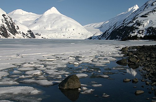 Looking across Portage Lake toward Bard Peak
 -
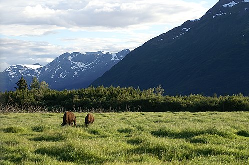 Wood Bison grazing near Kenai Mountains
 -
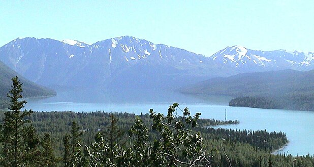 The Kenai Mountains and River


References
- Notes
- ^ a b "Alaskan mountains | mountains, United States". Encyclopedia Britannica. Retrieved 2017-04-10.
- ^ "Yaghanen Dghili, Kenai Mountains".
59°41′32″N 150°36′56″W / 59.69222°N 150.61556°W
|
| This article about a location in the Kenai Peninsula Borough, Alaska is a stub. You can help Wikipedia by expanding it. |