This article needs additional citations for
verification. (July 2012) |
Kanda-Sarugakuchō (神田猿楽町) is a district of Chiyoda, Tokyo, Japan, consisting of 1- chōme and 2-chōme. As of March 1, 2007, its population is 656. Note that the Shibuya ward also has a district with the same name.

Kanda-Sarugakuchō is located on the north part of Chiyoda. It borders Kanda-Surugadai to the north and east, Kanda-Ogawamachi to the south, Kanda-Misakichō, and Nishi-Kanda and Kanda-Jinbōchō to the west. The Kinka-dōri Ave forms its western boundary.
A commercial district, Kanda-Sarugakuchō is also home to several educational institutions.
The district has been renamed Kanda-Sarugakuchō, [1] which had been used before the enforcement of the addressing system modernization.
Education

Chiyoda Board of Education operates public elementary and junior high schools. Ochanomizu Elementary School ( お茶の水小学校) is the zoned elementary school for Kanda-Sarugakuchō 1-2 chōme. [2] Ochanomizu Elementary was created in 1993 as the merger of Kinka Elementary School (錦華小学校), Nishikanda Elementary School (西神田小学), and Ogawa Elementary School (小川小学校). The Kinka building became the Ochanomizu Elementary building. [3]
There is a freedom of choice system for junior high schools in Chiyoda Ward, and so there are no specific junior high school zones. [4]
Institutions within Kanda-Sarugakuchō include:
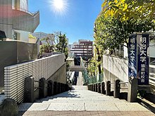
- Meiji University The 10th and 14th Buildings
- Meiji University Meiji High School & Junior High School[ citation needed]
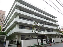
- Kanda Jogakuen Junior & Senior High School
References
- ^ 三崎町・猿楽町の町名変更 [Rename of Misakicho and Sarugakucho] (in Japanese). Japan: Chiyoda City. Retrieved 8 January 2018.
- ^ "区立小学校の通学区域". Chiyoda Board of Education. Retrieved 2022-10-08.
- ^ "沿革" (in Japanese). Ochanomizu Elementary School. Retrieved 2022-10-17.
-
^
"区立中学校の通学区域と学校選択". Chiyoda Board of Education. Retrieved 2022-10-08.
千代田区では、[...]
