.jpg) The intensifying extratropical cyclone responsible for the blizzard over the
Northeastern United States, at 2:15 a.m.
EST (07:15
UTC) on January 23, 2016 | |
| Type |
Extratropical cyclone Nor'easter Winter storm Ice storm Blizzard Tornado outbreak |
|---|---|
| Formed | January 19, 2016 |
| Dissipated | January 29, 2016 |
| Highest winds |
|
| Highest gust | 85 mph (135 km/h) |
| Lowest pressure | 983 mb (29.03 inHg) |
| Tornadoes confirmed | 6 on January 21 |
| Max. rating1 | EF2 tornado |
| Duration of tornado outbreak2 | 2 hours, 42 minutes |
| Largest hail | 2.75 in (7.0 cm) in diameter in Wilmer, Louisiana |
| Maximum snowfall or ice accretion | Snow – 42 in (110 cm) on
Glengary, West Virginia Ice – At least 0.75 in (19 mm) in western North Carolina |
| Fatalities | 55 |
| Damage | $500 million – $3 billion in economic losses |
| Power outages | 631,000+ people affected |
| Areas affected | Pacific Northwest, Great Plains, South Central United States, Eastern United States (especially the Mid-Atlantic states), Atlantic Canada, British Isles, Finland |
Part of the
2015–16 North American winter 1Most severe tornado damage; see Enhanced Fujita scale 2Time from first tornado to last tornado | |
The January 2016 United States blizzard produced up to 3 ft (91 cm) of snow in parts of the Mid-Atlantic and Northeastern United States during January 22–24, 2016. A weather system, evolving from a shortwave trough that formed in the Pacific Northwest on January 19, consolidated into a defined low-pressure area on January 21 over Texas. Meteorologists indicated that a resultant storm could produce more than 2 ft (61 cm) of snow across a wide swath of the Mid-Atlantic region and could "paralyze the eastern third of the nation", and regarded it as a "potentially historic blizzard". [1] [2] Winter weather expert Paul Kocin described the blizzard as "kind of a top-10 snowstorm". [3]
On January 20–22, the governors of eleven states and the mayor of Washington, D.C., declared a state of emergency in anticipation of significant snowfall and blizzard conditions. Approximately 103 million people were affected by the storm, with 33 million people placed under blizzard warnings. More than 13,000 flights were cancelled in relation to the storm, with effects rippling internationally. Thousands of National Guardsmen were placed on standby, and states deployed millions of gallons of brine and thousands of tons of road salt to lessen the storm's effect on roadways. A travel ban was instituted for New York City and Newark, New Jersey, for January 23–24. The storm was given various unofficial names, including Winter Storm Jonas, Blizzard of 2016, and Snowzilla.
Seven states observed snowfall in excess of 30 in (76 cm), with accumulations peaking at 42 in (110 cm) in Glengary, West Virginia. Ice- and snow-covered roads led to hundreds of incidents across the affected region, several of which resulted in deaths and injuries. At least 55 people were killed in storm-related incidents: Twelve in Virginia; nine in Pennsylvania; six each in New Jersey, New York, and North Carolina; four in South Carolina; three each in Maryland and Washington, D.C.; and one each in Arkansas, Delaware, Georgia, Kentucky, Massachusetts, and Ohio. Total economic losses are estimated between $500 million and $3 billion. The storm ranked as a Category 5 "extreme" event for the Northeast on the Regional Snowfall Index, and a Category 4 event for the Southeast. [4] [5] It is the most recent winter storm to rank as a Category 5 winter storm, and the first to do so since the 2011 Groundhog Day blizzard.
Preceding storm
A relatively minor storm ahead of the blizzard, similar to an Alberta clipper, [6] caught numerous drivers off-guard, producing a brief period of heavy snow during rush hour in the Mid-Atlantic region on January 20. [7] Although only 1 in (2.5 cm) of snow fell in Washington, D.C., roadways were not treated; any snow that melted on roads quickly froze into black ice, rendering them impassable. Some referred to the event as "Carmageddon 2.0". [6] Portions of Interstate 95 and Interstate 495 in Virginia and Maryland (especially on the Woodrow Wilson Bridge), as well as Interstate 270, were brought to a standstill through the early hours of January 21. [6] Virginia State Police responded to 767 accidents and 392 reports of disabled vehicles. [8] The Virginia Department of Transportation mobilized 115 salt trucks to clear roads. [6] A man was killed after being struck by a snow plow in Beltsville, Maryland. [8] Washington, D.C. Mayor Muriel Bowser issued an apology for inadequate preparations in the wake of the storm on January 22. [9] Vehicles in Maryland became stranded, with some residents abandoning their cars altogether. [10]
Georgia Governor Nathan Deal issued a state of emergency for northern counties on January 19, ensuring areas were better prepared than during a similar storm in 2014. [11] Icy conditions prompted road closures in northern Georgia, including portions of Interstate 75; several crashes resulted from the dangerous conditions. [12] Similar conditions affected Tennessee and Kentucky; schools closed on account of dangerous roads. [13] One person died and another was injured in an accident in Knox County after speeding on slippery roads. [8] [14] Two deaths resulted from snow-related car accidents in North Carolina. [7] Another person died, and two others were injured, when a car collided with a salt truck in Whitley County, Kentucky. [15]
Meteorological history

The development of the winter storm was anticipated by forecasters for at least a week. [16] It originated in a shortwave trough—a weather disturbance in the upper atmosphere—that came ashore at the Pacific Northwest on January 19. [17] The trough strengthened as it moved southeastward through the Great Plains, [18] and on January 21 it spawned a weak low-pressure area over central Texas. [19] The incipient storm system began to intensify as it tracked eastward through the Gulf Coast states, triggering a line of strong to severe thunderstorms and multiple tornado warnings. [20]
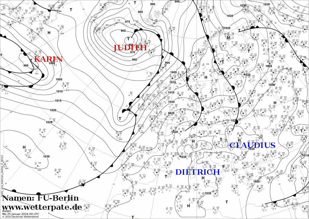
During the mid-afternoon hours of January 22, a new low-pressure area began to develop over the coast of the Carolinas, as the former storm tracked into central Georgia. Owing to uncertainty in short-range guidance but a high confidence of a sharp northern edge of precipitation, many forecasts were predicting 12" of snow or less until just hours before snowfall began, from Allentown, Pennsylvania, toward New York City and the southern coast of New England. As the storm moved further north and rapidly strengthened, it became apparent that snowfall would be much higher farther north, and forecasters quickly began upgrading their totals. [21] Early on January 24, as the storm was leaving New England, the system began to become elongated, as a secondary low developed to the southwest of the storm's central low. [22] On January 25, the blizzard left the East Coast of the United States; on the same day, the system was named Karin by the University of Berlin. [23]
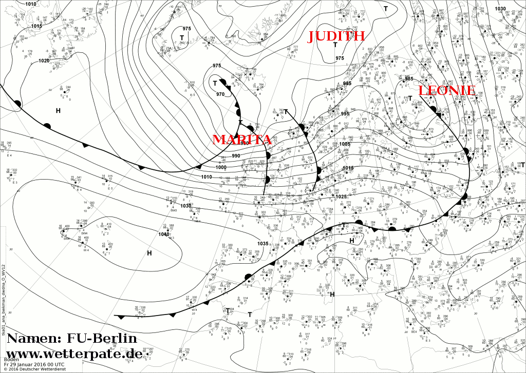
Accompanied by a strong jet stream in the Atlantic, the remnants of the storm crossed the British Isles on January 26. The wind and rain associated with the low was forecast to have the potential to cause disruption in the United Kingdom, [24] and indeed there were areas that saw severe weather. [25] During the next few days, the system accelerated towards the northeast. On January 29, the storm system was absorbed by Windstorm Leone, over Finland. [26]
Preparations

Multiple offices of the National Weather Service issued various watches and warnings across the storm's projected path. Blizzard warnings covered coastal Connecticut; most of Delaware; most of Maryland; Massachusetts, particularly Martha's Vineyard; most of New Jersey; New York, including New York City; Pennsylvania; Rhode Island, especially Block Island; Virginia; and Washington, D.C. [27] Winter storm warnings were issued from Arkansas to Massachusetts, including parts of Connecticut, northern Georgia, extreme southern Illinois, extreme southern Indiana, the entirety of Kentucky, extreme northeastern Louisiana, southeastern Massachusetts, northeastern Mississippi, extreme southeastern Missouri, extreme southern New York, most of North Carolina, southern Ohio, southern Rhode Island, northern South Carolina, most of Tennessee, most of Virginia, and all of West Virginia. [28] [29] Freezing rain advisories covered parts of North and South Carolina. [30] Further winter weather advisories covered additional portions of the country, including eastern Kansas, southeastern Missouri, and northern Alabama. [31] Offshore, storm warnings covered areas from Georgia to Maine. [32] [33]
On January 21–22, the governors of Delaware, [34] Georgia, [35] Kentucky, [36] Maryland, [37] New York, [38] New Jersey, [39] North Carolina, [40] Virginia, [37] Pennsylvania, [41] Tennessee, [42] West Virginia, [43] and the mayor of Washington, D.C., declared a state of emergency in anticipation of significant snowfall and blizzard conditions. [37]
Airlines cancelled more than 1,000 flights, with hundreds more preemptively grounded, by the afternoon of January 21 for January 22–24. Ripple effect cancellations spread across the entire East Coast. [44] By the afternoon of January 23, more than 10,100 flights were cancelled across the country, [45] affecting well over 100,000 travelers. [46] Nearly 2,000 more flights were delayed. [47] Most airports in the Mid-Atlantic region suspended service altogether, with Baltimore–Washington International, Philadelphia International Airport, Ronald Reagan Washington National, and Washington Dulles International closed through the evening of January 24. [45] [48] Flights to and from LaGuardia, John F. Kennedy International, and Newark Liberty International were largely cancelled as well. [45] American Airlines suspended all flights departing from Charlotte-Douglas International Airport, causing a ripple of flights being cancelled throughout the country. Effects rippled internationally, with more than 100 flights in Canada, Mexico, and the United Kingdom cancelled. [45] [49] [50] Altogether, 13,046 flights were cancelled between January 22 and 26. [51] Amtrak suspended service for many lines, including the Crescent service from New York City to New Orleans; the Cardinal to Chicago; and the Silver Meteor to Miami. [52]
Multiple sporting events, including those held by the Atlantic Coast Conference, National Basketball Association, and the National Hockey League, were postponed by the storm, while the National Football League's Arizona Cardinals vs. Carolina Panthers NFC Championship went on as planned for January 24 in Charlotte. [53] [54]
Mid-Atlantic
_in_McLean,_Fairfax_County,_Virginia-cropped.jpg)

A snow emergency was declared for Washington, D.C., meaning that residents would not be allowed to park on snow emergency routes after 9:30 p.m. local time on January 22. [37] Mayor Bowser urged people to remain home during the storm, "[u]nless you absolutely have to be out tomorrow afternoon [January 22], residents should get home as soon as possible". [9] Across Maryland, 2,700 pieces of snow equipment were mobilized and crews planned to distribute 365,000 tons of road salt. In Virginia, 500 vehicles were deployed to treat roads and 500 members of the Virginia National Guard were placed on standby. [37] Schools across the D.C. area were scheduled to end classes early on January 22, before the storm's arrival. [55] Stores across Maryland, Virginia, and Washington, D.C., reported a substantial uptick in sales, with groceries, heaters, shovels, and similar items sold out in numerous locations. [8] West Virginia Governor Earl Ray Tomblin mobilized the state's National Guard on January 21. [56]

The Washington Metropolitan Area Transit Authority (WMATA) announced on January 21 that it would shut down its entire mass transit system over the weekend of January 22 and 23, including the Washington Metro and Metrobus, making it the longest such shutdown in the agency's history. [57] [58] On January 25, the WMATA operated limited Metro bus service, as well as rail service only on the underground portions of the Red, Green, and Orange Lines; however, fares were not charged. [59] In Richmond, Virginia, all flights out of Richmond International Airport on January 23 were cancelled, [60] and the Greater Richmond Transit Company (GTRC) bus system took the rare step of suspending all routes on January 24. [61]

The Pennsylvania Department of Transportation had 2,200 vehicles and more than 733,000 tons of road salt on standby for use. Trucks deployed brine across major roads in and around Philadelphia, though residents were advised to avoid travel unless necessary. [62] A travel ban was declared for Lancaster, Lebanon, Newberry Township, and York on January 23. [63] [64] SEPTA issued a near complete shutdown of its services, shutting down all bus services and closing all rail except for the Broad Street Line and Market–Frankford Line subways. [65]


New York City mayor Bill de Blasio declared a hazardous travel advisory for the city, encouraging people not to travel; however, he did not ban traveling. [66] On January 22, he declared a "winter weather emergency" and told residents to "Get done what you have to get done today ... Do not bring your vehicle out tomorrow". [67] Taking place a year after a storm prompted the closure of the city's subway system in January 2015, only to largely bypass the city, Governor Andrew Cuomo stated that services would remain running. [62] Approximately 1,800 workers equipped with 800 heaters were to keep rails clear for use. [38] Thousands of sanitation workers, 1,700 plows, and 150,000 tons of road salt were on standby to clear city roads. [38] [62] He also put 600 members of the New York National Guard on standby. [67] More than 50 power workers from Vermont were dispatched to Long Island to help restore power outages. [68] Around noon on January 23, owing to a significant increase in expected snowfall, Cuomo issued a travel ban for all roads in New York City and Long Island. The New York City Transit Authority suspended bus service; rail service on the Long Island Rail Road, Metro-North, and Staten Island Railway; and elevated subway service (with underground subway lines remaining open until further notice). In the meantime, the Port Authority of New York and New Jersey closed bridges and tunnels in the region. [69] The New Jersey Transit was also shut down in preparation of the blizzard. [70]
A travel ban was instituted for Newark, New Jersey, on January 23 through the afternoon of January 24 in light of hundreds of snow-related accidents. [71]
Strong winds coupled with prolonged onshore flow resulted in a major coastal flood threat for Delaware and New Jersey. Near-shore waves were forecast to reach 15 to 20 ft (4.6 to 6.1 m) with a storm surge of 3 to 5 ft (0.91 to 1.52 m). [2] In New Jersey, a mandatory evacuation was ordered for residents in coastal Barnegat Township in anticipation of significant coastal flooding; several other towns were placed under voluntary evacuation orders. [67]
Delaware Governor Jack Markell declared a "level 1 driving warning", encouraging people not to travel and indicating drivers should be extra cautious. The Delaware Department of Transportation had 330 snow plows ready to clear roads, though many areas were expected to be impassible on January 23. Shelters were also opened for the homeless. [34] In New Castle County and Kent County in Delaware the Department of Transportation and Governor Jack Markell declared a Level 2 driving restriction (essential personnel on the roads only.) [72]
Southeast
Anticipating a damaging ice storm, approximately 4,500 linemen were placed on standby to repair downed power lines in North Carolina; 1,000 state transportation workers also prepared for heavy snowfall, with crews placed on 12-hour shifts to be deployed as needed. [40] Crews from across the country arrived to assist North Carolina power companies. [48] Two million gallons of brine were used to pre-treat roads statewide. [73] Across Tennessee, state offices closed for January 22, warming centers opened, and the Red Cross placed shelters on standby. [74] The Tennessee Highway Patrol asked for people to remain off the roads, saying, "We are desperately asking you please DON'T DRIVE". [48] [75]
British Isles
The storm was forecast to cross the Atlantic Ocean and affect the British Isles from January 26 to 28. The storm was expected to be less severe, with rain rather than snow; however, the possibility of strong winds and localized flooding was noted. [76] Particular concern was raised over areas that suffered from significant flooding during the preceding months. [77] [78] Wind gusts as high as 70 mph (110 km/h) were forecast for the Hebrides and 50 to 60 mph (80 to 97 km/h) for coastal Scotland. [79] The storm in the British Isles was far less severe than in the United States and Storm Gertrude a few days later may have been worse. [80]
Impact


The storm's widespread effects paralyzed travel across the eastern United States as it produced more than 20 in (51 cm) of snow across a large area along the Appalachian Mountains. [81] At least 55 fatalities have been attributed to the storm and its aftermath: 12 in Virginia, [82] 9 in Pennsylvania, [82] 6 in New Jersey, [83] [84] [85] 6 in New York, [86] [87] 6 in North Carolina, [82] 4 in South Carolina, [82] 3 in Maryland, [88] [89] 3 in Washington, D.C., [90] 1 in Arkansas, [91] 1 in Delaware, [82] 1 in Georgia, [51] 1 in Kentucky, [92] 1 in Massachusetts, [51] and 1 in Ohio. [93] Throughout the affected region, more than 631,000 people lost power: 270,000 in New Jersey, [94] 147,000 in North Carolina, [95] 66,000 in Georgia, [96] 55,000 in Virginia, [97] 47,000 collectively in Delaware and Maryland, [98] and nearly 30,000 in South Carolina. [99]
Economic losses—from lost sales revenue and wages—are estimated between $500 million and $3 billion. Moody's Analytics indicated the highest losses, stating $2.5–3 billion; however, the storm's occurrence on a weekend accounted for less losses than what would otherwise be expected. [100] Planalytics placed losses at $850 million and IHS Global Insight estimated losses between $500 million and $1 billion. Although an estimate was not provided, AON Benfield placed losses in the billions of dollars, noting similarities to the Blizzard of 1996 which inflicted $4.6 billion in economic losses. [101] Despite the expected major losses, the rush to buy supplies ahead of the storm's arrival may mitigate the overall impact. [102] The airline industry suffered approximately $200 million in lost revenue. [103]
Using the Regional Snowfall Index, the storm ranked as a Category 5, "extreme", storm for the Northeast and a Category 4, "crippling", for the Southeast. It was also ranked as a Category 3, "major", event in the Ohio Valley. Approximately 103 million people were in the storm's path, [104] including 33 million in the expected blizzard area. [105] About 21 million people in the Northeast experienced more than 20 in (51 cm) of snow. Half of the affected people were in the Northeast (which includes the Northeast megalopolis); the storm's RSI reached 20.138 in this region, the fourth-highest on record for the region. The primary factor driving its high classification was the affected population. The storm's RSI of 13.776 in the Southeast was the twelfth-highest on record. [104]
Severe weather on the Gulf Coast
During January 21 through the early hours of January 22, severe thunderstorms brought damaging winds and hail to portions of Louisiana, Mississippi, Alabama, and Florida. [106] Five tornadoes touched down across Mississippi: an EF0 near Crystal Springs, an EF0 near Homewood, an EF1 near Loyd Star, an EF1 near Pinola, and an EF2 near Sumrall. Numerous trees and power lines were downed, multiple structures were damaged, and a few were destroyed by the tornadoes. [107] Straight line winds near Improve, Lamar County, Mississippi, significantly damaged 10–12 homes. Hail reached 2.75 in (7.0 cm) in diameter in Wilmer, Louisiana. The most significant damage occurred overnight across the Florida Panhandle and neighboring Alabama. Winds gusting to 73 mph (117 km/h) downed numerous trees and power lines and damaged structures. [106]
Southeastern states

Snow fell across a large portion of Arkansas on January 21–22, [73] with a daily record of 7.2 in (18 cm) observed just outside Little Rock. [108] [109] Snowfall was confined to the eastern half of the state, with freezing rain amounting to 0.25 in (6.4 mm) observed in northeastern counties. [110] Strong winds in excess of 35 mph (56 km/h)—with a gust of 47 mph (76 km/h) measured in Jonesboro—left more than 16,000 people in the state without power. [73] One fatality near Hoxie was due to slippery roads. [91]
Early on January 22, heavy snow fell across parts of western Tennessee. Roads around Nashville quickly became impassable, including portions of Interstates 40 and 24, and local police reported more than 200 accidents. [62] In Lexington, Kentucky, one accident led to injury; 17 other accidents were reported. [73] Multiple accidents in Rockcastle County prompted the closure of 12 mi (19 km) of I-75 in Kentucky. [36] Along a 35-mile (56 km) stretch of Interstate 75 in Kentucky, hundreds of drivers became stranded for more than 16 hours on January 22–23. In a separate incident, an 11-mile (18 km) stretch of Interstate 77 in West Virginia was blocked by stuck tractor-trailers that were lying across the highway. [105] The National Guard was deployed to provide people with food, water, and fuel. [111] A transportation worker died when his truck skidded off icy roads. [92]
Treacherous road conditions in North Carolina resulted in at least 571 accidents and 800 "service calls" from police. [73] Five deaths were reported across the state. [112] One person died in a collision on Interstate 95. Numerous roads were shut down accordingly. [73] One person was killed and three others were injured in Forsyth County. An accident along Interstate 77 near Troutman resulted in the death of a 4-year-old boy. [113] Freezing rain resulted in widespread power outages, bringing down numerous trees and power lines in the state. Many roads closed because of debris, including portions of Interstate 40 in Johnston County. Approximately 147,000 people lost power in North Carolina, with Wake County accounting for 50,000 of the total. [95]
Four people died in South Carolina: two from carbon monoxide poisoning in Greenville, one in a car accident on an icy road in Greenville County, and another from an accident in Jonesville. [82] [114] Nearly 30,000 people lost power in the state. [99] Portions of Interstates 26 and 95 were temporarily shut down for icy conditions. [115] Flurries were observed as far south as the coastal regions of the state, including the ACE Basin as well as Charleston. [116]
Upwards of 8 in (20 cm) of snow fell across Georgia, with the highest totals confined to northern parts of the state. High winds downed trees and power lines, leaving approximately 66,000 people without power across the state. [96] A postal worker was killed when strong winds blew a large branch off a tree, crushing him in his car. [51] Snow fell as far south as Mobile, Alabama, [117] with additional flurries extending into Jacksonville and Gainesville along the Florida Panhandle late on January 22. Temperatures in Gainesville fell to 28 °F (−2 °C). [118] Further south in Florida, record rain of 4.79 in (122 mm) fell in West Palm Beach. [119]
Mid-Atlantic states

Maximum snow depth was measured at 42 in (110 cm) in Glengary, West Virginia, on January 24. [120] Baltimore, Maryland, recorded its largest snowfall on record. [121] Two people died from heart attacks while shoveling snow and a third from undetermined causes across Maryland. [88] [89] A large portion of the Ocean City fishing pier was destroyed by rough seas and high winds. [122] West Virginia's emergency management reported Interstate 77 to be "completely shut down" following an accident involving semi-trailers. The National Guard was called in to assist clearing the stranded vehicles. [105] Six people died from snow-related incidents in Virginia. [123] Virginia State Police responded to 989 accidents and 793 disabled vehicles through the evening of January 22. [105] A total of 12 people died in storm-related incidents across Virginia. [82] One person died when their car skid off a road in Chesapeake and collided with a tree. [112] Five people died from hypothermia: one each in Charles City, Gloucester County, Hampton, Henry County, and Wise County. [82] [124] A combination of snow and ice accumulation caused the roof of Donk's Theatre in Hudgins, Virginia, to collapse; the structure was deemed a total loss and will be demolished. [125] The roof of a 4,700 ft2 (437 m2) building collapsed in Charlottesville. [97] Seven people required hospitalization for carbon monoxide poisoning at an apartment complex in Herndon when vents became clogged with snow. [126] The snow completely destroyed two parking lots at Chincoteague National Wildlife Refuge. [127] Three people died while shoveling snow in Washington, D.C. [90]

Snow-related incidents resulted in nine deaths across Pennsylvania. [82] In Harrisburg, snowfall from the storm was reported as 30.2 in (77 cm), breaking the city's previous record snowfall of 25 in (64 cm) which was set in February 1983. [128] Near Bedford, approximately 500 vehicles became stuck along a westbound stretch of the Pennsylvania Turnpike for over 24 hours from January 22–23 near the eastern approach to the Allegheny Mountain Tunnel. Among the stranded vehicles were one bus carrying the Duquesne University men's basketball team and another carrying Temple University's women's gymnastics team. [129] Despite the scale of the incident, no major injuries were reported. [130] The band Guster, stranded in Pittsburgh by the blocking of the turnpike, held an impromptu concert in an alley. [131] Four people died while shoveling snow: two in both Lancaster and Montgomery counties. [132] [133] [134] One of the dead in Montgomery County was a woman who was 8-months pregnant; the baby was declared dead on-scene when paramedics arrived. [132] [135] Another man died from carbon monoxide poisoning in his car in Reading after a passing snow plow buried his car in snow. [136]

One person died in Magnolia, Delaware, after suffering a heart attack while shoveling. [82] A power outage at the Delaware City Refinery, thought to be related to the storm, forced the facility to shut down after chemicals were released. [137] A mother and her 1-year-old son died from carbon monoxide poisoning in Passaic, New Jersey, after snowfall blocked their vehicle's tailpipe; a 3-year-old girl was hospitalized, [138] [139] but later died on January 27. [85] Three other people died while attempting to walk home during the blizzard: one each in East Greenwich Township, Hackensack, and Mahwah. [83] [84]
Snowfall across New York City and Long Island was more intense than initially forecast, falling at rates of 3 in (7.6 cm) per hour at times. Before the travel ban was implemented, buses struggled to make their routes and long delays were common. [140] At Central Park, a storm-total accumulation of 27.5 in (69.8 cm) was observed, the highest total on record for the city since observations began in 1869. This surpassed the previous record of 26.9 in (68.3 cm) measured during the February 2006 blizzard. [141] [142] The snowstorm made January 2016 the 2nd snowiest January in New York City history, while tying it with February 1934 for the 6th snowiest month. [143] Accumulations reached an all-time record high of 30.5 in (77 cm) at John F. Kennedy International Airport. [120] [142] Police across New York City responded to more than 200 accidents and 300 disabled vehicles. [112] Emergency personnel responded to about 3,000 9-1-1 calls across the city. Five people died while shoveling snow: two in Queens, two in unknown parts of the city, and one in Staten Island. [86] [144] At least two deaths in Long Island were from shoveling snow. [145] One person was killed by a snow plow in Oyster Bay Cove on Long Island. [87]
Coastal flooding

Significant coastal flooding took place in Delaware and New Jersey. [146] The first, and most severe, round of flooding took place during the morning of January 23. A second round took place after the storm's passage on the morning of January 24, concurrent with high tide. [147] Record tides occurred in Lewes, Delaware. [148] Approximately 20 mi (32 km) of dunes along Delaware's 24 mi (39 km) oceanfront coast sustained significant damage, with many areas flattened. [149] Forty people required evacuation in Long Neck and Oak Orchard. [150] Delaware Route 1 was shut down between Bethany Beach and Dewey Beach for flooding. [151]
Tides at Cape May, New Jersey, reached a record 9.26 ft (2.82 m), surpassing the previous highest of 8.67 ft (2.64 m) set during Hurricane Sandy in 2012. [148] Fifty people required evacuation in Atlantic City, [105] and at least 150 homes were flooded. [152] Strong winds accompanying the flooding caused damage to many homes. [148] Streets in Ocean City and Stone Harbor were inundated with several feet of water; according to a resident in Stone Harbor, water reached 5 ft (1.5 m) in depth on some streets. Effects were most severe along the Delaware Bay. [153] Combined with snowfall and freezing temperatures, the flooded roads became a mix of ice and slush. [147] Long Beach Island, still recovering from the effects of Hurricane Sandy, sustained severe beach erosion. [154] The storm's tide and waves carved 15 ft (4.6 m) cliffs along coastal beaches. [152] A recently constructed dune in Belmar held back most of the water, with one minor breach along its 1.3 mi (2.1 km) expanse. [147]
New England
Southern New England experienced significant snow accumulations from Jan 23 to Jan 24. Around a foot of snow fell across Southern Connecticut, Rhode Island, and Southeastern Massachusetts. Blizzard conditions affected southeastern Massachusetts for several hours, with Nantucket and Martha's Vineyard reporting such conditions for four hours. Blizzard conditions were reported in Bridgeport for 4 hours lasting from 8 am to 12 pm. [155] Snow totals reached 16.0 in (40.6 cm) in Norwalk, Connecticut and 13.0 in (33.0 cm) on Block Island, Rhode Island. Wind gusts on Block Island reached 75 mph (121 km/h) while gusts in New Haven reached 52 mph (83 km/h). [156] One person died after being struck by a snow plow. [51]
Newfoundland and Nova Scotia
After leaving the Eastern United States, the storm complex brought light snowfall to coastal areas of Nova Scotia, Canada, on January 24. Environment Canada indicated accumulations up to 5 cm (2.0 in) alongside wind gusts of 30 to 70 km/h (19 to 43 mph). Residents, however, reported up to 30 cm (12 in) of snow in Shelburne County. [157] Street parking was banned in Halifax on select streets to enable easier clearing of roads. [158] On January 25, a Boeing 767 traveling from Miami, Florida, to Milan, Italy, encountered severe turbulence produced by the storm about 480 km (300 mi) off Newfoundland. Of the 203 people on board, including crew, seven were injured. The aircraft made an emergency landing at St. John's International Airport. [159]
Aftermath


Many cities struggled to cope with the snowfall, including Washington, D.C., where schools and government offices remained closed through January 26, three days after the storm. Schools in Baltimore, Maryland, and Philadelphia, Pennsylvania, also remained closed through January 26. [3] Side streets around the D.C. area were unplowed through January 26. [160] Through January 27, Washington, D.C. police issued $1,078,000 worth of parking tickets and $65,600 in fines for vehicles parked or abandoned on snow emergency routes. At least 656 vehicles were towed. [161]
The New York Post described Queens, New York, as "basically forgotten" on January 25 as roads remained covered with snow. [3] [162] Many residents complained that snowplows did not come through their area until at least a day after the storm passed. Crews expressed that certain areas, such as in the Bronx, were difficult to navigate with snow plows and there was no place to put the snow. A resident of Pelham Bay stated that 3-1-1 operators were not picking up calls. Mayor De Blasio toured areas of Staten Island on January 24 and urged people to be patient. [163] In contrast, both Governor Cuomo and Mayor De Blasio were praised for their handling of the storm prior to its arrival, and for being the first to issue a travel ban, which is credited for potentially saving lives. [164]
New Jersey Governor Chris Christie, who flew back to the state from New Hampshire during his presidential campaign, left to resume campaigning shortly after the storm passed. He was criticized for his quick departure and heated responses to questions about why he left the state. He stated that while there was some locally significant flood damage in Southern New Jersey, the overall effects across the state did not warrant his presence. He responded to one person by saying, "I don't know what you expect me to do. You want me to go down there with a mop?" [165] [166] A Stockton University graduate started up a fund to provide 1,000 mops to Christie in response to his comment. [167] On January 26, Christie apologized to North Wildwood Mayor Patrick Rosenello for calling him "crazy" during his response to criticism the day prior. Christie also requested that Rosenello apologize on his behalf to first responders, residents, and business owners. [168]
In March, President Barack Obama declared Delaware, [169] Maryland, [170] New Jersey, [171] Pennsylvania, [172] Virginia, [173] and Washington, D.C., major disaster areas. [174] The federal funding would only cover costs incurred by public infrastructure, debris removal, and emergency measures to ensure public safety. [175] [176] Preliminary estimates places the total cost of assistance at $168,334,023, [nb 1] with New Jersey accounting for $82,663,604. [177]
Snowfall measurement reviews

Following the storm, the National Weather Service conducted a review of eight snowfall observations following concerns over their quality. Measurements from Ronald Reagan Washington National Airport, Dulles International Airport, Baltimore/Washington International Airport, John F. Kennedy International Airport, LaGuardia Airport, and Philadelphia International Airport were verified as reliable. [141] The total at Ronald Reagan Washington National Airport was brought into question immediately following the blizzard as the snow observers lost their measuring board during the storm; [178] however, the assessment determined that proper procedure was continued even after the board was lost and the total was considered accurate. A review of measurements at Central Park, New York, revealed the 26.8 in (68 cm) observation was the result of a communication error and revised the storm-total to 27.5 in (70 cm)—an all-time record for New York City. Furthermore, the 28.1 in (71 cm) measurement at Newark International Airport, New Jersey, was invalidated due to measurements being taken every hour instead of every six hours thus inflating the total. [141] The State Climate Extremes Committee also conducted a review of a potential 24-hour state snowfall record at Mount Mitchell in North Carolina. Their results showed the 24-hour observation of 41 in (100 cm) to be in error, erroneously inflating the snowfall totals. Properly adjusting for liquid snow ratios, the total was revised to 21 in (53 cm). The storm-total accumulation was also revised from 66 in (170 cm) to 33 in (84 cm). [179]
Snowfall accumulations and records
|
|
Naming
The storm has received several nicknames from various media outlets. The name Winter Storm Jonas was created by The Weather Channel at the beginning of the winter storm season, and assigned to the storm system when it was forecast; it has also been used in international media, [185] and was used by New York City Mayor Bill de Blasio [186] and the United States Postal Service. [187] Reception of the naming of storms has been mixed; The New York Times refers to the name "Jonas" as a marketing ploy while The Weather Channel maintains that it helps others prepare in advance. [188] The Washington Post named the storm Snowzilla, referencing the 2014–16 El Niño event which has been named the " Godzilla El Niño". [189] [190] Connecticut-based WFSB named the system Anna, after former First Lady Anna Harrison. [191] Other sources have dubbed the storm simply Blizzard of 2016 or Blizzard 2016. [192]
See also
- Knickerbocker Storm
- North American blizzard of 1996 – Essentially an analog of the 2016 blizzard, with similar snow totals and areas affected.
- December 2009 North American blizzard
- February 5–6, 2010 North American blizzard
- February 9–10, 2010 North American blizzard
- January 31 – February 2, 2011 North American blizzard – Another powerful winter storm that had similar impacts
- February 2016 North American winter storm
- Early January 2017 North American winter storm
- Mid-January 2017 North American ice storm
- February 9–11, 2017 North American blizzard
- February 12–14, 2017 North American blizzard
- February 2021 nor'easter
Notes
- ^ An estimate of federal assistance for Pennsylvania is not available.
- ^ Preliminary reports indicated a storm-total snowfall of 66 in (170 cm) for Mount Mitchell, including 41 in (100 cm) in 24-hours. These values were later found to be inaccurate, potentially being inflated by snow drifts and inconsistent measurements, and considered invalid by the State Climate Extremes Committee. [179]
References
- ^ "Potentially historic blizzard looms over D.C., more than 2 feet of snow projected". Chicago Tribune. Chicago. January 21, 2016. Retrieved January 22, 2016.
- ^ a b Angela Fritz (January 22, 2016). "Eastern Seaboard braces for potentially historic winter storm". The Washington Post. Washington, D.C. Retrieved January 22, 2016.
- ^ a b c Sean Breslin (January 26, 2016). "Winter Storm Jonas: At Least 48 Dead; Roof Collapses Reported; D.C. Remains Shut Down". Atlanta, Georgia: The Weather Channel. Retrieved January 26, 2016.
- ^ "National Climate Report - January 2016 | January 2016 Blizzard | State of the Climate | National Centers for Environmental Information (NCEI)". www.ncdc.noaa.gov. Retrieved 2021-02-05.
- ^ "January 2016 snowstorm was a Category 5 event | NOAA Climate.gov". www.climate.gov. Retrieved 2021-02-05.
- ^ a b c d "Carmageddon 2.0: DC's ride home from hell in 1 inch of snow". WTTG. Washington, D.C.: 21st Century Fox. January 21, 2016. Archived from the original on January 23, 2016. Retrieved January 21, 2016.
- ^ a b "The Latest: Snow blamed for 2 North Carolina traffic deaths". WRAL-TV. Raleigh, North Carolina: CBS. January 21, 2016. Archived from the original on 2016-01-22. Retrieved January 21, 2016.
- ^ a b c d Greg Botelho and Ed Payne (January 21, 2016). "Snowstorm threatens East; Washington, Baltimore under blizzard warnings". CNN. Retrieved January 21, 2016.
- ^ a b "State of emergency declared in D.C., schools closed Friday". WJLA-TV. Washington, D.C.: Sinclair Broadcast Group. January 21, 2016. Retrieved January 21, 2016.
- ^ Tom Liddy (January 21, 2016). "Slick Roads Spark More Than 100 Accidents, Strand 'Hundreds' in DC Area". ABC News. Retrieved January 21, 2016.
- ^ "Officials say state is ready for winter weather". WSB-TV. Atlanta, Georgia: American Broadcasting Company. January 19, 2016. Archived from the original on 2016-01-22. Retrieved January 21, 2016.
- ^ "Icy conditions reported on Georgia roads". WSB-TV. Ringgold, Georgia: American Broadcasting Company. January 20, 2016. Archived from the original on 2016-01-22. Retrieved January 21, 2016.
- ^ "Middle TN, Southern KY Waking Up To Snow, Ice". WTVF. Nashville, Tennessee: E. W. Scripps Company. January 20, 2016. Archived from the original on 2016-01-22. Retrieved January 21, 2016.
- ^ "Knox County sheriff: 1 dead, 1 injured after speeding car slides off road". WATE-TV. Knoxville, Tennessee: Media General. January 20, 2016. Archived from the original on January 22, 2016. Retrieved January 21, 2016.
- ^ "At least 4 killed in snowstorm-related deaths in Ky., N.C., Tenn". WJLA-TV. Washington, D.C.: Sinclair Broadcast Group. Associated Press. January 21, 2016. Retrieved January 22, 2016.
- ^ Paul Kocin (January 21, 2016). "Probabilistic Heavy Snow and Icing Discussion: 429 PM EST Thu Jan 21 2016". Weather Prediction Center. Archived from the original on January 23, 2016. Retrieved January 21, 2016.
- ^ Frank Pereira (January 20, 2016). "Short Range Forecast Discussion: 310 AM EST Wed Jan 20 2016". Weather Prediction Center. Archived from the original on January 28, 2016. Retrieved January 21, 2016.
- ^ Brendon Rubin-Oster (January 21, 2016). "Short Range Forecast Discussion: 321 AM EST Thu Jan 21 2016". Weather Prediction Center. Archived from the original on December 19, 2015. Retrieved January 21, 2016.
- ^ Patrick Burke; Brian Hurley (January 21, 2016). "Quantitative Precipitation Forecast Discussion: 128 PM EST Thu Jan 21 2016: 321 AM EST Thu Jan 21 2016". Weather Prediction Center. Archived from the original on October 22, 2015. Retrieved January 21, 2016.
- ^ Steve Goss. "Day 1 Convective Outlook: 0150 PM CST Thu Jan 21 2016". Storm Prediction Center. Retrieved Jan 21, 2016.
- ^ Burke, Patrick; Orisson, Andrew (January 22, 2016). "Storm Summary Number 04 For Eastern U.S. Major Winter Storm". Weather Prediction Center. College Park, Maryland: National Oceanic and Atmospheric Administration. Retrieved January 22, 2016.
- ^ "WPC surface analysis valid for 01/24/2016 at 09 UTC". Weather Prediction Center. January 24, 2016. Retrieved April 5, 2021.
- ^ "Europe Weather Analysis on 2016-01-25". Free University of Berlin. January 25, 2016. Archived from the original on August 31, 2021. Retrieved April 5, 2021.
- ^ "Rain and strong winds this week". The Met Office. January 25, 2016. Retrieved January 26, 2016.
- ^ Nathan Rao; Nick Gutteridge; Zoie O'Brien; Kate Mansfield (January 27, 2016). "Worst Storm for a Century". Express. Retrieved January 29, 2016.
- ^ "Europe Weather Analysis on 2016-01-29". Free University of Berlin. January 29, 2016. Archived from the original on August 31, 2021. Retrieved April 5, 2021.
- ^ "Blizzard Warnings Across the United States on January 22, 2016". Various National Weather Service offices. National Oceanic and Atmospheric Administration. January 22, 2016. Archived from the original on January 26, 2016. Retrieved January 22, 2016.
- ^ "Winter Storm Warnings Across the United States on January 21, 2016". Various National Weather Service offices. National Oceanic and Atmospheric Administration. January 21, 2016. Archived from the original on January 26, 2016. Retrieved January 21, 2016.
- ^ "Winter Storm Warnings Across the United States on January 22, 2016". Various National Weather Service offices. National Oceanic and Atmospheric Administration. January 22, 2016. Archived from the original on January 26, 2016. Retrieved January 22, 2016.
- ^ "Winter Storm Warnings Across the United States on January 21, 2016". Various National Weather Service offices. National Oceanic and Atmospheric Administration. January 21, 2016. Archived from the original on February 1, 2016. Retrieved January 21, 2016.
- ^ "Winter Weather Advisories Across the United States on January 21, 2016". Various National Weather Service offices. National Oceanic and Atmospheric Administration. January 21, 2016. Archived from the original on January 25, 2016. Retrieved January 21, 2016.
- ^ "Storm Warnings Across the United States on January 21, 2016". Various National Weather Service offices. National Oceanic and Atmospheric Administration. January 21, 2016. Archived from the original on January 26, 2016. Retrieved January 21, 2016.
- ^ "Storm Warnings Across the United States on January 22, 2016". Various National Weather Service offices. National Oceanic and Atmospheric Administration. January 22, 2016. Archived from the original on January 26, 2016. Retrieved January 22, 2016.
- ^ a b "State of Emergency Issued for Delaware, Level 1 Driving Warning Starts at Midnight". WTXF-TV. Wilmington, Delaware: 21st Century Fox. January 22, 2016. Archived from the original on January 24, 2016. Retrieved January 22, 2016.
- ^ "State of emergency list in Georgia extended to 21 counties". WXIA-TV. Atlanta, Georgia: NBCUniversal. January 21, 2016. Archived from the original on February 23, 2016. Retrieved January 21, 2016.
- ^ a b Greg Kocher (January 22, 2016). "Bevin declares emergency as snow buries much of Kentucky". Lexington Herald-Leader. Lexington, Kentucky. Retrieved January 22, 2016.
- ^ a b c d e "Md., Va., D.C. declare states of emergency". WTOP-FM. Washington, D.C.: Hubbard Broadcasting. January 21, 2016. Retrieved January 21, 2016.
- ^ a b c "Governor Cuomo Declares State of Emergency for New York City, Long Island, and Lower Hudson Valley as Winter Storm Hits Region". Government of New York. January 23, 2016. Archived from the original on February 1, 2016. Retrieved January 23, 2016.
- ^ "New Jersey Gov. Chris Christie declares state of emergency ahead of blizzard, flooding". Bristol Herald Courier. Newark, New Jersey. Associated Press. January 22, 2016. Retrieved January 22, 2016.[ permanent dead link]
- ^ a b Joe Marusak; David Perlmutt (January 21, 2016). "Snow, wintry mix begins to fall in Charlotte area; CMS cancels school". The Charlotte Observer. Charlotte, North Carolina. Retrieved January 21, 2016.
- ^ "Gov. Wolf Declares State of Emergency for Pennsylvania Ahead of Snowstorm". WPVI-TV. Harrisburg, Pennsylvania: The Walt Disney Company. January 21, 2016. Retrieved January 21, 2016.
- ^ "Tennessee declares state of emergency ahead of 'blizzard-like conditions'". Chattanooga Times Free Press. Chattanooga, Tennessee. January 21, 2016. Retrieved January 21, 2016.
- ^ "W.Va. Governor issues State of Emergency". WSAZ-TV. Charleston, West Virginia: NBCUniversal. January 22, 2016. Retrieved January 22, 2016.
- ^ Ben Mutzabaugh; Harriet Baskas (January 21, 2016). "East Coast blizzard already a travel nightmare". USA Today. Retrieved January 21, 2016.
- ^ a b c d Ben Mutzabaugh (January 23, 2016). "Blizzard 2016: 10,000 flight cancellations and counting". USA Today. Washington, D.C. Retrieved January 23, 2016.
- ^ Carla Caldwell (January 22, 2016). "Close to 5,000 flights cancelled due to storm; Delta drops fee to reschedule (Update)". Atlanta Business Chronicle. Retrieved January 22, 2016.
- ^ Samantha Masunaga (January 22, 2016). "Thousands of flights canceled or delayed as East Coast snowstorm brews". Los Angeles Times. Los Angeles, California. Retrieved January 22, 2016.
- ^ a b c Greg Botelho; Ralph Ellis; Phil Gast (January 22, 2016). "Blizzard with 'life and death implications' hits D.C., Mid-Atlantic". CNN. Retrieved January 22, 2016.
- ^ "U.S. storm delays, cancels Saturday flights at Pearson". CBC News. January 23, 2016. Retrieved January 23, 2016.
- ^ "UK cancels dozens of flights after blizzard batters America's east coast". Irish Examiner. January 23, 2016. Retrieved January 23, 2016.
- ^ a b c d e Emily Knapp (January 25, 2016). "Snowstorm Deaths Reach 41 as East Coast Tries to Dig Out". ABC News. Retrieved January 25, 2016.
- ^ Alex Johnson; Jon Schuppe (January 22, 2016). "Blizzard 2016: Millions in the Path of Monster Snowstorm". NBC News. Retrieved January 22, 2016.
- ^ "US blizzard forces NBA, NHL postponements". Beirut: The Daily Star. January 22, 2016. Retrieved January 22, 2016.
- ^ "Winter Storm Jonas forces postponements across college basketball". CBS Sports. January 22, 2016. Retrieved January 22, 2016.
- ^ "Area Schools Cancel, Delay Classes Due to Snow". WRC-TV. NBCUniversal. January 21, 2016. Retrieved January 21, 2016.
- ^ "States of emergency declared as East Coast braces for winter storm". Fox News. Associated Press. January 21, 2016. Retrieved January 21, 2016.
- ^ Halsey III, Ashley; Duggan, Paul (January 21, 2016). "D.C. region braces for epic blizzard; Metro to shut down subway, bus lines". The Washington Post. Retrieved January 22, 2016.
- ^ "Metro to suspend service during blizzard" (Press release). Washington Metropolitan Area Transit Authority. January 21, 2016. Archived from the original on 2016-01-23. Retrieved January 22, 2016.
- ^ "Metro plans restoration of limited underground Metrorail, "lifeline" Metrobus service for Monday, January 25". Washington Metropolitan Area Transit Authority (WMATA). January 24, 2016. Archived from the original on 2016-01-27. Retrieved January 24, 2016.
- ^ Hylton, David; Bahorich, Susan (23 January 2016). "Flights, bus travel canceled out of Richmond". NBC 12 News. WWBT. Archived from the original on 1 February 2016. Retrieved 27 January 2016.
- ^ Oliver, Ned (24 January 2016). "11th biggest snowfall on record for Richmond; schools cancel classes". Richmond Times-Dispatch. Retrieved 27 January 2016.
- ^ a b c d Mark Berman (January 22, 2016). "Thousands of flights canceled, states of emergency declared as blizzard threatens East Coast". The Washington Post. Washington, D.C. Retrieved January 22, 2016.
- ^ "Lebanon declares state of emergency, travel ban". WGAL. Lebanon, Pennsylvania: Hearst Corporation. January 23, 2016. Retrieved January 23, 2016.
- ^ Megan Trimble (January 23, 2016). "Disaster Emergency: Travel bans issued in York County". PA Media Group. Advance Digital. Retrieved January 23, 2016.
- ^ "Transportation agencies brace for storm". philly.com. Philadelphia, Pennsylvania: Philadelphia Media Network, LLC. January 23, 2016. Retrieved January 23, 2016.
- ^ "New York City Prepared for Winter Storm De Blasio Says". WABC-TV. New York, New York: The Walt Disney Company. January 21, 2016. Retrieved January 21, 2016.
- ^ a b c "'Winter Weather Emergency' Declared in NYC Ahead of Nor'easter". WNBC. New York, New York: NBCUniversal. January 22, 2016. Retrieved January 22, 2016.
- ^ Dorothy Schnure (January 22, 2016). "GMP Sends Crews South to Help with Massive Snowstorn". vtdigger.com. Colchester, Vermont. Retrieved January 26, 2016.
- ^ "Travel ban in New York City". WNYW. 21st Century Fox. January 23, 2016. Archived from the original on January 24, 2016. Retrieved January 23, 2016.
- ^ NJ Transit shutting down service at 2 a.m. Saturday due to the blizzard, NJ.com, January 23, 2016
- ^ Myles Ma (January 24, 2016). "Newark mayor extends travel ban to 1 p.m." New Jersey On-Line. Newark, New Jersey: Advance Digital. Retrieved January 25, 2016.
- ^ "WDEL 101.7FM – 2016 Delaware Blizzard Storm Hub, Day 2 – Level 2 Driving Restrictions now in place". www.wdel.com. Archived from the original on 2016-01-27. Retrieved 2016-01-28.
- ^ a b c d e f Anna Norris (January 22, 2016). "Winter Storm Jonas Takes Fatal Turn in the South; Nashville Roads Gridlocked". Atlanta, Georgia: The Weather Channel. Retrieved January 22, 2016.
- ^ "Snow, freezing rain fall across much of Tennessee". Nashville, Tennessee: Chattanooga Times Free Press. Associated Press. January 22, 2016. Retrieved January 22, 2016.
- ^ Tennessee Highway Patrol [@TNHighwayPatrol] (January 22, 2016). "If you are thinking about going out for a Friday night on the town DON'T! We are desperately asking you please DON'T DRIVE. #STAYN" ( Tweet). Retrieved January 22, 2016 – via Twitter.
- ^ Alexandra Sims (January 23, 2016). "UK weather: Storm Jonas on way to Britain as low pressure system moves across Atlantic". The Independent. Retrieved January 26, 2016.
- ^ "UK on alert as snowstorm crosses Atlantic". Sky News. January 25, 2016. Archived from the original on January 26, 2016. Retrieved January 26, 2016.
- ^ "US snow storm to bring heavy rain and gales to UK". London, United Kingdom: BBC. January 25, 2016. Retrieved January 26, 2016.
- ^ "Weather alert as Northern Ireland faces heavy downpours". Belfast Telegraph. Belfast, Northern Ireland. January 26, 2016. Retrieved January 26, 2016.
- ^ BBC(London) 29/01/2016 Storm Gertrude: Gales cause chaos across parts of UK
- ^ Barbara Goldberg; Idrees Ali (January 23, 2016). "Blizzard intensifies as it slams New York, floods New Jersey". New York, New York: Reuters. Archived from the original on January 23, 2016. Retrieved January 23, 2016.
- ^ a b c d e f g h i j "Death toll from East Coast snow storm rises to at least 49". WXMI. Grand Rapids, Michigan: Tribune Media. Associated Press. January 27, 2016. Retrieved January 27, 2016.
- ^ a b Rebecca Forand (January 25, 2016). "Man walking home during blizzard is 4th storm-related death in NJ". New Jersey On-Line. East Greenwich Township, New Jersey: Advance Digital. Retrieved January 25, 2016.
- ^ a b Jeremy Tanner (January 25, 2016). "Woman found dead under snow in Mahwah, New Jersey". WPIX. Mahwah, New Jersey: Tribune Media. Retrieved January 25, 2016.
- ^ a b "New Jersey Girl, 3, Dies After Being Found in Snow-Covered Car". KNBC. Los Angeles, California: NBCUniversal. January 27, 2016. Retrieved January 28, 2016.
- ^ a b "5 snow shoveling deaths in New York". WNYW. New York, New York: 21st Century Fox. January 24, 2016. Archived from the original on January 24, 2016. Retrieved January 25, 2016.
- ^ a b "Snow Plow Strikes, Kills Man In Oyster Bay Cove". WCBS-TV. Oyster Bay Cove: CBS Corporation. January 25, 2016. Retrieved January 25, 2016.
- ^ a b "Man dies while shoveling snow in Maryland". WJLA-TV. Ft. Washington, Maryland: Sinclair Broadcast Group. January 23, 2016. Retrieved January 23, 2016.
- ^ a b David Anderson (January 23, 2016). "Two die in Harford during Saturday blizzard, snow expected to continue through the evening". The Baltimore Sun. Baltimore, Maryland. Retrieved January 23, 2016.
- ^ a b "3 Local Deaths Attributed to Shoveling Snow". WRC-TV. NBCUniversal. January 24, 2016. Retrieved January 25, 2016.
- ^ a b "1 fatality on Arkansas highways during storm". KTHV. Little Rock, Arkansas: Tegna, Inc. Associated Press. January 22, 2016. Archived from the original on 2016-01-23. Retrieved January 22, 2016.
- ^ a b "Blizzard Strikes US, Blankets Millions in Snow and Ice". KTRK-TV. Washington, D.C.: The Walt Disney Company. Associated Press. January 23, 2016. Archived from the original on 2016-01-24. Retrieved January 23, 2016.
- ^ Frank Lewis (January 23, 2016). "Sledding teen killed by truck". Portsmouth Daily Times. Retrieved January 23, 2016.
- ^ "New Jersey Event Report". National Centers for Environmental Information. National Weather Service Office in Mt. Holly, New Jersey. 2016. Retrieved April 20, 2016.
- ^ a b "More than 120,000 across N.C. without power". KSNT. Raleigh, North Carolina: NBCUniversal. Associated Press. January 23, 2016. Retrieved January 26, 2016.
- ^ a b "Northeast Georgia receives up to 8 inches of snow". The Augusta Chronicle. Atlanta, Georgia. Associated Press. January 23, 2016. Retrieved January 23, 2016.
- ^ a b "Charlottesville roof laden with snow collapses". WTOP-FM. Richmond, Virginia: Hubbard Broadcasting. Associated Press. January 25, 2016. Archived from the original on 2016-01-28. Retrieved January 26, 2016.
- ^ "Power restored across much of the Mid-Atlantic region". WTOP-FM. Baltimore, Maryland: Hubbard Broadcasting. Associated Press. January 24, 2016. Archived from the original on 2016-01-28. Retrieved January 26, 2016.
- ^ a b "Update: Power outages reported in the Upstate". The State. Columbia, South Carolina. January 22, 2016. Retrieved January 26, 2016.
- ^ "Blizzard will cost up to $3 billion". WTVR-TV. New York, New York: Tribune Media. CNN. January 25, 2016. Retrieved January 25, 2016.
- ^ Jonathan Berr (January 25, 2016). "This blizzard may land a $3 billion blow". CBS News. Retrieved January 26, 2016.
- ^ "Blizzard's hit on economy in hundreds of millions?". Washington, D.C.: CBS News. Associated Press. January 25, 2016. Retrieved January 26, 2016.
- ^ Benjamin Zhang (January 25, 2016). "Airlines could lose $200 million due to the blizzard – but they won't feel the pain". Business Insider. Retrieved January 25, 2016.
- ^ a b "Putting the January 22–24 Snowstorm in Historical Context". National Oceanic and Atmospheric Administration. February 18, 2016. Retrieved February 21, 2016.
- ^ a b c d e Greg Botelho; Jason Hanna; Joshua Berlinger (January 23, 2016). "Blizzard strikes East Coast; motorists stranded for hours in 3 states". CNN. Retrieved January 23, 2016.
- ^ a b "160121's Storm Reports (1200 UTC − 1159 UTC)". Storm Prediction Center. Norman, Oklahoma: National Oceanic and Atmospheric Administration. January 22, 2016. Retrieved January 22, 2016.
- ^ NWS Damage Survey for 01/21/16 Tornado Event. National Weather Service Office in Jackson, Mississippi (Report). National Oceanic and Atmospheric Administration. January 25, 2016. Archived from the original on January 26, 2016. Retrieved January 26, 2016.
- ^ a b 24-Hour Snowfall Totals for 01/21 to 01/22. National Weather Service Office in Little Rock, Arkansas (Report). National Oceanic and Atmospheric Administration. January 22, 2016. Archived from the original on January 31, 2016. Retrieved January 22, 2016.
- ^ Record Snowfall Set at North Little Rock. National Weather Service Office in Little Rock, Arkansas (Report). National Oceanic and Atmospheric Administration. January 22, 2016. Archived from the original on January 30, 2016. Retrieved January 22, 2016.
- ^ Winter Storm Summary: January 21–22, 2016 (PDF). National Weather Service Office in Little Rock, Arkansas (Report). National Oceanic and Atmospheric Administration. January 22, 2016. Archived from the original (PDF) on January 28, 2016. Retrieved January 22, 2016.
- ^ "Millions hunker down for snowstorm; cars stuck in Kentucky". WKRN-TV. Washington, D.C.: Media General. Associated Press. January 23, 2016. Archived from the original on January 24, 2016. Retrieved January 23, 2016.
- ^ a b c "Snowstorm socks East Coast: A look at the effects by state". The Morning Call. Allentown, Pennsylvania. Associated Press. January 23, 2016. Retrieved January 23, 2016.
- ^ "Update: At least 8 snowstorm-related deaths in Ken., Tenn., N.C." Richmond, Virginia: Richmond Times-Dispatch. Associated Press. January 22, 2016. Retrieved January 22, 2016.[ permanent dead link]
- ^ "At Least 30 Killed In Snowstorm-Related Deaths". WJZ-TV. Baltimore, Maryland: CBS Corporation. Associated Press. January 25, 2016. Retrieved January 25, 2016.
- ^ "Icy conditions, power outages tail off in SC after storm". WCIV. Columbia, South Carolina: Sinclair Broadcast Group. Associated Press. January 23, 2016. Retrieved January 26, 2016.
- ^ Alex Johnson; Jon Schuppe (January 24, 2016). "Blizzard 2016 Barrels Up East Coast With Deadly Force". NBC News. Retrieved June 21, 2021.
- ^ The Weather Channel [@weatherchannel] (January 23, 2016). "Snow has been reported as far south as #Mobile, Alabama. Snow showers are moving across the Florida panhandle: #flwx" ( Tweet). Retrieved January 22, 2016 – via Twitter.
- ^ Alex Harris (January 23, 2016). "Snow in the Sunshine State: North Florida sees a few flakes". Miami Herald. Miami, Florida. Retrieved January 23, 2016.
- ^ "Weekly wrap-up: Blizzard of 2016 ranks 4th among worst winter storms of past 100 years". AccuWeather. January 31, 2016. Retrieved December 2, 2022.
- ^ a b c d e f g h i j k l m n National Weather Service Eastern Region [@NWSEastern] (January 24, 2016). "Final snowfall map & totals from the January 22–23, 2016 blizzard. #bilzzard2016 #nywx #njwx #pawx #mdwx #vawx #wvwx" ( Tweet). Retrieved January 25, 2016 – via Twitter.
- ^ "Winter Storm Jonas Forecast". The Weather Channel. The Weather Channel. January 21, 2016. Retrieved January 21, 2016.
- ^ Christine Boynton (January 23, 2016). "Ocean City fishing pier torn apart by winter storm". WBFF. Ocean City, Maryland: Sinclair Broadcast Group. Retrieved January 23, 2016.
- ^ Scott Wise (January 25, 2016). "Snowstorm blamed for 6 Virginia deaths". WTVR-TV. Richmond, Virginia: Tribune Media. Retrieved January 25, 2016.
- ^ "At least 18 killed in snowstorm-related deaths". New Jersey Herald. Associated Press. January 23, 2016. Retrieved January 23, 2016.
- ^ Michael Martz (January 23, 2016). "Roof collapses on historic Donk's Theater, known as "Virginia's Lil Ole Opry"". Richmond Times-Dispatch. Richmond, Virginia. Retrieved January 23, 2016.
- ^ Victoria Jones (January 25, 2016). "Blocked Vents Cause Carbon Monoxide Poisoning at Virginia Apartments". WRC-TV. Washington, D.C.: NBCUniversal. Retrieved January 27, 2016.
- ^ Storm erases Chincoteague refuge lots, 13NewsNow, January 26, 2016
- ^ Coyle, Ryan (January 23, 2016). "Largest Snowfall in Recorded History for Some Parts of Central PA". ABC27.com. Archived from the original on January 22, 2016. Retrieved January 23, 2016.
- ^ "Effort to rescue occupants of 500 vehicles stranded on Pa. Turnpike continues". Pennlive.com. January 23, 2016. Retrieved January 23, 2016.
- ^ Cruz, Luis (January 24, 2016). "No major injuries reported in massive traffic backup on Pa. Turnpike". ABC27.com. Retrieved January 24, 2016.
- ^ "Alt rock Band Guster Performs Live in Pittsburgh Alleyway". Pittsburgh, Pennsylvania: Associated Press. January 25, 2016. Archived from the original on February 6, 2016. Retrieved January 26, 2016.
- ^ a b David Chang (January 24, 2016). "Pregnant Teen Dies After Shoveling Snow: Family". WCAU. NBCUniversal. Retrieved January 25, 2016.
- ^ David Chang (January 23, 2016). "Elderly Man Dies While Shoveling Snow in Lower Providence: Officials". WCAU. NBCUniversal. Retrieved January 25, 2016.
- ^ "2 Lancaster County men died while clearing snow, coroner reports". WGAL. Lancaster County, Pennsylvania: NBCUniversal. January 25, 2016. Retrieved January 25, 2016.
- ^ "Pregnant Pennsylvania Teen Among Winter Storm's 11 Snow Shoveling Deaths". KFSM-TV. Pottstown, Pennsylvania: Tribune Media. January 25, 2016. Retrieved January 25, 2016.
- ^ "Pennsylvania Man Dies After Plow Buries Car". KYW-TV. Reading, Pennsylvania: CBS Corporation. Associated Press. January 24, 2016. Retrieved January 25, 2016.
- ^ Xerxes Wilson (January 23, 2016). "Delaware City refinery power outage causes shutdown". The News Journal. Wilmington, Delaware. Retrieved January 27, 2016.
- ^ Checkey Beckford (January 24, 2016). "1-Year-Old, Mom Killed by Carbon Monoxide as Dad Clears Snow". WCAU. NBCUniversal. Retrieved January 25, 2016.
- ^ Lindsey Bever (January 25, 2016). "'Everybody cry': Mom, 1-year-old killed by carbon monoxide as dad clears snow". The Washington Post. Washington, D.C. Retrieved January 26, 2016.
- ^ James Barron; Rick Rojas (January 23, 2016). "Major Cities Grind to a Halt and Face Days of Digging Out". The New York Times. New York, New York. Retrieved January 23, 2016.
- ^ a b c d "Review of Jan. 2016 blizzard preliminary snow totals validates DC measurement". National Oceanic and Atmospheric Administration. April 28, 2016. Retrieved April 28, 2016.
- ^ a b c d e f g h i j k l m n o p q r s t u "Winter Storm Jonas: Where Does it Rank Historically?". Atlanta, Georgia: The Weather Channel. January 24, 2016. Retrieved January 25, 2016.
- ^ Winter weather: These are the 10 snowiest winter months in New York City history, Silive, January 23, 2023
- ^ "Officials: 3 New Yorkers died shoveling snow during blizzard". The Eagle. New York, New York. Associated Press. January 23, 2016. Archived from the original on February 18, 2016. Retrieved January 23, 2016.
- ^ Stack, Liam (January 23, 2016). "6 People Die While Shoveling Snow". The New York Times. Retrieved January 24, 2016.
- ^ Emily Shapiro (January 23, 2016). "Flooding Strikes Jersey Shore as Massive Snowstorm Wallops East Coast". ABC News. Retrieved January 23, 2016.
- ^ a b c Jon Hurdle; Benjamin Mueller (January 24, 2016). "With Morning Tides, More Flooding on Jersey Shore". The New York Times. New York, New York. Retrieved January 27, 2016.
- ^ a b c "Storm Causes Major Flooding in Several Jersey Shore Towns". WCAU. NBCUniversal. January 23, 2016. Retrieved January 23, 2016.
- ^ Molly Murray (January 25, 2016). "Dunes washed away; bayshore beaches flooded". The News Journal. Wilmington, Delaware. Retrieved January 27, 2016.
- ^ Cathy Carter (January 25, 2016). "Delaware National Guard came to the rescue over the weekend". Dover, Delaware: WDDE. Retrieved January 27, 2016.
- ^ Chris Flood (January 23, 2016). "Route 1 remains closed from Dewey to Bethany". Cape Gazette. Retrieved January 27, 2016.
- ^ a b Michael Miller (January 27, 2016). "Federal delegation tours flood-damaged South Jersey". Press of Atlantic City. Atlantic City, New Jersey. Retrieved January 27, 2016.
- ^ Jon Hurdle (January 27, 2016). "Jonas highlights New Jersey's unsolved back-bay flooding problem". NJ Spotlight. Archived from the original on January 31, 2016. Retrieved January 27, 2016.
- ^ MaryAnn Spoto (January 27, 2016). "N.J. wants feds to repair LBI beaches eroded by blizzard soon". New Jersey On-Line. Holgate, New Jersey: Advance Digital. Retrieved January 27, 2016.
- ^ US Department of Commerce, NOAA. "January 22-24, 2016 Blizzard". www.weather.gov. Retrieved 2021-08-01.
- ^ Danielle Vollmar (January 24, 2016). "5 Massachusetts locations saw blizzard conditions with storm". WCVB-TV. Boston, Massachusetts: Hearst Corporation. Retrieved January 25, 2016.
- ^ "Snow for some Nova Scotians, not a flake for others". The Chronicle Herald. January 24, 2016. Retrieved January 26, 2016.
- ^ "Halifax bans parking on 3 streets overnight to clear snow". Canadian Broadcasting Corporation. January 26, 2016. Retrieved January 26, 2016.
- ^ Hensley, Nicole (January 25, 2016). "Severe turbulence injures 7 on American Airlines flight to Milan; aircraft diverted to Newfoundland". Daily News. Retrieved January 26, 2016.
- ^ "Unplowed side-streets leave DC area residents furious". WTTG. Temple Hills, Maryland: 21st Century Fox. January 26, 2016. Archived from the original on January 28, 2016. Retrieved January 26, 2016.
- ^ "DC Issues $1 Million Worth of Parking Tickets After Blizzard". WRC-TV. Washington, D.C.: NBCUniversal. January 27, 2016. Retrieved January 27, 2016.
- ^ Megan McGibney; Michael Gartland; Bruce Golding (January 25, 2016). "Queens was basically forgotten during Winter Storm Jonas". New York Post. New York, New York. Retrieved January 26, 2016.
- ^ "Some Bronx, Queens, Staten Island Residents Say Plows Neglected Them". WCBS-TV. New York, New York: CBS Corporation. January 24, 2016. Retrieved January 26, 2016.
- ^ J. David Goodman; Jesse McKinley (January 25, 2016). "De Blasio and Cuomo Find Rare Harmony in Blizzard Response". The New York Times. New York, New York. Retrieved January 26, 2016.
- ^ David Chang (January 25, 2016). "'You Want Me to Go Down There With a Mop?' Christie Addresses Criticism Over His Response to Jersey Shore Flooding". WCAU. NBCUniversal. Retrieved January 26, 2016.
- ^ Jordyn Phelps (January 25, 2016). "'Want Me to Go Down There With a Mop?' Chris Christie Says About NJ Flooding Cleanup". ABC News. Retrieved January 26, 2016.
- ^ Diane D'Amico (January 26, 2016). "Stockton grad starts "Mops for Christie" campaign". The Press of Atlantic City. Retrieved January 26, 2016.
- ^ Matt Arco (January 26, 2016). "Christie apologizes to 'crazy mayor'". New Jersey On-Line. Manchester, New Hampshire: Advance Digital. Retrieved January 26, 2016.
- ^ "President Declares Disaster for Delaware". Washington, D.C.: Federal Emergency Management Agency. March 4, 2016. Retrieved April 20, 2016.
- ^ "President Declares Disaster for State of Maryland". Washington, D.C.: Federal Emergency Management Agency. March 4, 2016. Retrieved April 20, 2016.
- ^ "President Declares Disaster for State of New Jersey". Washington, D.C.: Federal Emergency Management Agency. March 15, 2016. Retrieved April 20, 2016.
- ^ "President Declares Disaster for Pennsylvania". Washington, D.C.: Federal Emergency Management Agency. March 23, 2016. Retrieved April 20, 2016.
- ^ "President Declares Disaster for the Commonwealth of Virginia". Washington, D.C.: Federal Emergency Management Agency. March 7, 2016. Retrieved April 20, 2016.
- ^ "President Declares Disaster for District of Columbia". Washington, D.C.: Federal Emergency Management Agency. March 4, 2016. Retrieved April 20, 2016.
- ^ "Federal Aid Programs for the District of Columbia Declaration". Washington, D.C.: Federal Emergency Management Agency. March 4, 2016. Retrieved April 20, 2016.
- ^ "Federal Aid Programs for the state of Maryland Declaration". Washington, D.C.: Federal Emergency Management Agency. March 4, 2016. Retrieved April 20, 2016.
-
^
"Delaware — Severe Winter Storm and Flooding: FEMA-4265-DR" (PDF). Washington, D.C.:
Federal Emergency Management Agency. March 16, 2016. Retrieved April 20, 2016.
- "New Jersey — Severe Winter Storm and Snowstorm: FEMA-4264-DR" (PDF). Washington, D.C.: Federal Emergency Management Agency. March 14, 2016. Retrieved April 20, 2016.
- "District of Columbia – Snowstorm: FEMA-4260-DR" (PDF). Washington, D.C.: Federal Emergency Management Agency. March 4, 2016. Retrieved April 20, 2016.
- "Maryland — Severe Winter Storm and Snowstorm: FEMA-4261-DR" (PDF). Washington, D.C.: Federal Emergency Management Agency. March 4, 2016. Retrieved April 20, 2016.
- "Virginia — Severe Winter Storm and Snowstorm: FEMA-4262-DR" (PDF). Washington, D.C.: Federal Emergency Management Agency. March 7, 2016. Retrieved April 20, 2016.
- ^ Angela Fritz; Shawn Boburg (January 24, 2016). "Lower-than-expected D.C. snowfall total raises questions about its measurement". The Washington Post. Retrieved April 28, 2016.
- ^ a b c Chris Stachelski (May 6, 2016). SCEC Decision: New 24 Hour Snowfall Record For North Carolina (PDF) (Report). National Centers for Environmental Information. Archived from the original (PDF) on August 24, 2017. Retrieved August 23, 2017.
- ^ 3 Day Event Totals Ending 7AM January 24th, 2016. National Weather Service Office in Greer, South Carolina (Report). Greer, South Carolina: National Oceanic and Atmospheric Administration. January 25, 2016. Archived from the original on February 3, 2016. Retrieved January 26, 2016.
- ^ a b Public Information Statement: Spotter Reports. National Weather Service Office in Sterling, Virginia (Report). Sterling, Virginia: National Oceanic and Atmospheric Administration. January 25, 2016. Archived from the original on February 3, 2016. Retrieved January 26, 2016.
- ^ "Glengary reacts to 42-inch snowfall". The Journal. January 26, 2016. Archived from the original on 2016-02-06. Retrieved January 28, 2016.
- ^ a b c d e f g h i j k l m n o p [National Record Event Reports for January 22–24, 2016]. Various National Weather Service Offices (Report). National Oceanic and Atmospheric Administration. January 24, 2016. Archived from the original on January 25, 2016. Retrieved January 25, 2016.
- ^ Record Daily Maximum Snowfall Set At Bowling Green. National Weather Service Office in Louisville, Kentucky (Report). National Oceanic and Atmospheric Administration. January 23, 2016. Archived from the original on February 2, 2016. Retrieved January 25, 2016.
-
^
"La côte est des Etats-Unis en alerte maximale avant l'arrivée de la tempête géante Jonas".
Le Monde (in French). Paris, France.
Agence France-Presse and
Reuters. January 22, 2016. Retrieved January 22, 2016.
- Alexandra Sims (January 22, 2016). "Winter Storm Jonas: 'Full-blown bread and milk freak out' erupts as blizzards threaten East Coast". The Independent. London, United Kingdom. Retrieved January 22, 2016.
- ^ @BilldeBlasio (January 23, 2016). "Jonas is here, NYC. Please be safe. Stay off the roads and look out for your neighbors" ( Tweet) – via Twitter.
- ^ Chiricello, Connie (January 22, 2016). "NY Postal Officials Preparing for Storm Jonas". United States Postal Service. Retrieved January 23, 2016.
- ^ Liam Stack (January 22, 2016). "Meet Jonas, Part Storm, Part Marketing Ploy". The New York Times. Retrieved January 22, 2016.
- ^ Angela Fritz (January 22, 2016). "We hereby name this winter storm 'Snowzilla'". The Washington Post. Washington, D.C. Retrieved January 22, 2016.
- ^ Patricia Kitchen (January 22, 2016). "'Snowzilla' is no 'Jonas,' but it just may make 'Make Winter Great Again' in Washington, D.C." Newsday. Retrieved January 22, 2016.
- ^ "Weekend Storm – the latest!". WFSB. Hartford, Connecticut: Meredith Corporation. January 21, 2016. Archived from the original on January 22, 2016. Retrieved January 22, 2016.
-
^ Mark Weiner (January 22, 2016).
"As Blizzard of 2016 roars up coast, Washington, D.C. begins massive shutdown".
The Post-Standard. Syracuse, New York. Retrieved January 22, 2016.
- Eileen Whelan (January 22, 2016). "The day is here! D.C. braces for Blizzard 2016". WJLA-TV. Washington, D.C.: Sinclair Broadcast Group. Retrieved January 22, 2016.
- Robinson Meyer (January 22, 2016). "What's the Name of the 2016 Blizzard?". The Atlantic. Boston, Massachusetts. Retrieved January 28, 2016.
External links
- 2015–16 North American winter
- Blizzards in the United States
- Blizzards in Canada
- 2016 meteorology
- 2016 natural disasters
- 2016 natural disasters in the United States
- 2016 disasters in Canada
- F2 tornadoes
- Nor'easters
- Natural disasters in Delaware
- Natural disasters in Georgia (U.S. state)
- Natural disasters in Kentucky
- Natural disasters in Maryland
- Natural disasters in New Jersey
- Natural disasters in New York (state)
- Natural disasters in North Carolina
- Natural disasters in South Carolina
- Natural disasters in Tennessee
- Natural disasters in Washington, D.C.
- Natural disasters in West Virginia
- Natural disasters in Pennsylvania
- Tornadoes in Mississippi
- 2016 in Texas
- 2016 in Louisiana
- 2016 in Delaware
- 2016 in Georgia (U.S. state)
- 2016 in Kentucky
- 2016 in Maryland
- 2016 in Mississippi
- 2016 in New Jersey
- 2016 in New York (state)
- 2016 in North Carolina
- 2016 in Pennsylvania
- 2016 in South Carolina
- 2016 in Tennessee
- 2016 in Washington, D.C.
- 2016 in West Virginia
- 2016 in Nova Scotia
- 2016 in Newfoundland and Labrador
- 2016 in the United Kingdom
- 2016 in Finland
- 2016 in Indiana
- January 2016 events in the United States
- 2016 disasters in Europe
- 2016 disasters in the United Kingdom