T10 Higashiyama Station 東山駅 | |||||||||||
|---|---|---|---|---|---|---|---|---|---|---|---|
 Entrance No.1 in 2020 | |||||||||||
| General information | |||||||||||
| Location | Ōidechō,
Higashiyama,
Kyoto,
Kyoto (京都市東山区大井手町) Japan | ||||||||||
| Coordinates | 35°0′33.91″N 135°46′46.95″E / 35.0094194°N 135.7797083°E | ||||||||||
| Operated by |
| ||||||||||
| Line(s) |
| ||||||||||
| Platforms | 1 island platform | ||||||||||
| Tracks | 2 | ||||||||||
| Connections | |||||||||||
| Construction | |||||||||||
| Structure type | Underground | ||||||||||
| Other information | |||||||||||
| Station code | T10 | ||||||||||
| History | |||||||||||
| Opened | 1997 | ||||||||||
| Passengers | |||||||||||
| FY2016 | 19,731 daily [1] | ||||||||||
| Services | |||||||||||
| |||||||||||
Higashiyama Station (東山駅, Higashiyama-eki, station Number: T10) is a train station on the Kyoto Municipal Subway Tōzai Line in Higashiyama-ku, city of Kyoto, Kyoto Prefecture, Japan.
Layout
The subway station has an island platform serving two tracks separated by platform screen doors.
| 1 | ■ Tōzai Line | for Kyōto Shiyakusho-mae, Karasuma Oike and Uzumasa Tenjingawa |
| 2 | ■ Tōzai Line | for Misasagi, Rokujizō and ( Keihan Railway Keishin Line) Hamaōtsu |
-
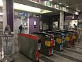 Ticket gates
 -
 Platform


Surroundings
- North of Sanjō-dōri
- Heian Shrine
- Okazaki Park
- The National Museum of Modern Art, Kyoto
- Kyoto Municipal Museum of Art
- Kyoto Prefectural Library
- Kyoto Kaikan
- Kyoto Industrial Promotion Center (Miyako messe)
- Hosomi Museum
- South of Sanjō-dōri
References
- ^ "京都市交通事業白書" (in Japanese). Kyoto Municipal Transportation Bureau.
Stations of the
Kyoto Municipal Subway
Tōzai Line | ||
|---|---|---|
|
| This Kyoto Prefecture railroad station-related article is a stub. You can help Wikipedia by expanding it. |