Glencoe | |
|---|---|
 Glencoe city hall and surroundings | |
 Location of Glencoe in Calhoun County and Etowah County, Alabama. | |
| Coordinates: 33°57′11″N 85°56′9″W / 33.95306°N 85.93583°W | |
| Country | United States |
| State | Alabama |
| Counties | Etowah, Calhoun |
| Government | |
| • Mayor | Chris Hare |
| Area | |
| • Total | 17.08 sq mi (44.24 km2) |
| • Land | 17.00 sq mi (44.03 km2) |
| • Water | 0.08 sq mi (0.21 km2) |
| Elevation | 577 ft (176 m) |
| Population (
2020) | |
| • Total | 5,372 |
| • Density | 316.02/sq mi (122.01/km2) |
| Time zone | UTC-6 ( Central (CST)) |
| • Summer ( DST) | UTC-5 (CDT) |
| ZIP code | 35905 |
| Area code | 256 |
| FIPS code | 01-29992 |
| GNIS feature ID | 2403701 [2] |
| Website |
www |
Glencoe (local pronunciation "Glin-ko") is a city in Calhoun and Etowah counties in the U.S. state of Alabama. It is part of the Gadsden Metropolitan Statistical Area. The city incorporated in 1939. [3] The population was 5,160 at the 2010 census. [4]
Geography
Glencoe is located at 33°57'11.333" North, 85°56'9.125" West (33.953148, -85.935868). [5]
According to the U.S. Census Bureau, the city has a total area of 17.0 square miles (44.1 km2), of which 16.9 square miles (43.9 km2) is land and 0.077 square miles (0.2 km2), or 0.49%, is water. [4]
Demographics
| Census | Pop. | Note | %± |
|---|---|---|---|
| 1940 | 669 | — | |
| 1950 | 1,466 | 119.1% | |
| 1960 | 2,592 | 76.8% | |
| 1970 | 2,901 | 11.9% | |
| 1980 | 4,648 | 60.2% | |
| 1990 | 4,670 | 0.5% | |
| 2000 | 5,152 | 10.3% | |
| 2010 | 5,160 | 0.2% | |
| 2020 | 5,372 | 4.1% | |
| U.S. Decennial Census
[6] 2013 Estimate [7] | |||
2000 census
As of the census [8] of 2000, there were 5,152 people, 2,000 households, and 1,526 families living in the city. The population density was 320.6 inhabitants per square mile (123.8/km2). There were 2,132 housing units at an average density of 132.7 per square mile (51.2/km2). The racial makeup of the city was 96.93% White, 1.73% Black or African American, 0.29% Native American, 0.17% Asian, 0.02% Pacific Islander, 0.10% from other races, and 0.76% from two or more races. 0.35% of the population were Hispanic or Latino of any race.
There were 2,000 households, out of which 32.2% had children under the age of 18 living with them, 63.7% were married couples living together, 9.1% had a female householder with no husband present, and 23.8% were non-families. 21.9% of all households were made up of individuals, and 10.1% had someone living alone who was 65 years of age or older. The average household size was 2.48 and the average family size was 2.89.
In the city, the age distribution of the population shows 22.2% under the age of 18, 7.3% from 18 to 24, 27.7% from 25 to 44, 25.3% from 45 to 64, and 17.5% who were 65 years of age or older. The median age was 41 years. For every 100 females, there were 92.2 males. For every 100 females age 18 and over, there were 89.3 males.
The median income for a household in the city was $38,385, and the median income for a family was $46,283. Males had a median income of $31,893 versus $26,652 for females. The per capita income for the city was $18,577. About 4.9% of families and 6.7% of the population were below the poverty line, including 8.0% of those under age 18 and 7.2% of those age 65 or over.
2010 census
As of the census [9] of 2010, there were 5,160 people, 2,129 households, and 1,488 families living in the city. The population density was 305 inhabitants per square mile (118/km2). There were 2,270 housing units at an average density of 133.5 per square mile (51/km2). The racial makeup of the city was 96.5% White, 1.3% Black or African American, 0.3% Native American, 0.5% Asian, 0.0% Pacific Islander, 0.2% from other races, and 1.1% from two or more races. 0.8% of the population were Hispanic or Latino of any race.
There were 2,129 households, out of which 25.3% had children under the age of 18 living with them, 55.5% were married couples living together, 10.1% had a female householder with no husband present, and 30.1% were non-families. 26.6% of all households were made up of individuals, and 12.8% had someone living alone who was 65 years of age or older. The average household size was 2.42 and the average family size was 2.92.
In the city, the age distribution of the population shows 21.2% under the age of 18, 8.4% from 18 to 24, 23.2% from 25 to 44, 30.1% from 45 to 64, and 17.2% who were 65 years of age or older. The median age was 42.7 years. For every 100 females, there were 96.0 males. For every 100 females age 18 and over, there were 101.0 males.
The median income for a household in the city was $53,279, and the median income for a family was $61,810. Males had a median income of $53,295 versus $31,481 for females. The per capita income for the city was $24,531. About 3.5% of families and 5.2% of the population were below the poverty line, including 6.7% of those under age 18 and 5.8% of those age 65 or over.
2020 census
| Race | Num. | Perc. |
|---|---|---|
| White (non-Hispanic) | 4,867 | 90.6% |
| Black or African American (non-Hispanic) | 154 | 2.87% |
| Native American | 21 | 0.39% |
| Asian | 55 | 1.02% |
| Pacific Islander | 1 | 0.02% |
| Other/Mixed | 188 | 3.5% |
| Hispanic or Latino | 86 | 1.6% |
As of the 2020 United States census, there were 5,372 people, 1,949 households, and 1,384 families residing in the city.
Notable people
- Shannon Camper, Miss Alabama 2004
- Mickey Gibbs, racing driver
- Jana Sanderson, Miss Alabama 2000
References
- ^ "2020 U.S. Gazetteer Files". United States Census Bureau. Retrieved October 29, 2021.
- ^ a b U.S. Geological Survey Geographic Names Information System: Glencoe, Alabama
- ^ "Glencoe | Encyclopedia of Alabama". Archived from the original on January 29, 2016. Retrieved January 23, 2016.
- ^ a b "Geographic Identifiers: 2010 Demographic Profile Data (G001): Glencoe city, Alabama". U.S. Census Bureau, American Factfinder. Archived from the original on February 12, 2020. Retrieved June 2, 2014.
- ^ "US Gazetteer files: 2010, 2000, and 1990". United States Census Bureau. February 12, 2011. Retrieved April 23, 2011.
- ^ "U.S. Decennial Census". Census.gov. Retrieved June 6, 2013.
- ^ "Annual Estimates of the Resident Population: April 1, 2010 to July 1, 2013". Archived from the original on May 22, 2014. Retrieved June 3, 2014.
- ^ "U.S. Census website". United States Census Bureau. Retrieved January 31, 2008.
- ^ "U.S. Census website". United States Census Bureau. Retrieved July 23, 2015.
- ^ "Explore Census Data". data.census.gov. Retrieved December 11, 2021.
External links
33°57′11″N 85°56′09″W / 33.953148°N 85.935868°W
Municipalities and communities of
Calhoun County, Alabama, United States | ||
|---|---|---|
| Cities | 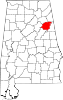 | |
| Towns | ||
| CDPs | ||
|
Unincorporated communities | ||
| Ghost town | ||
| Footnotes | ‡This populated place also has portions in an adjacent county or counties | |
Municipalities and communities of
Etowah County, Alabama, United States | ||
|---|---|---|
| Cities |  | |
| Towns | ||
| CDPs | ||
|
Unincorporated communities | ||
| Former City | ||
| Footnotes | ‡This populated place also has portions in an adjacent county or counties | |