Garrattsville, New York | |
|---|---|
Hamlet and CDP | |
| Coordinates: 42°38′50″N 75°10′19″W / 42.6472968°N 75.1718306°W [1] | |
| Country | United States |
| State | New York |
| County | Otsego |
| Town | New Lisbon |
| Elevation | 1,302 ft (397 m) |
| Time zone | UTC-5 ( Eastern (EST)) |
| • Summer ( DST) | UTC-4 (EDT) |
| ZIP code | 13342
[2] |
| Area code | 607 |
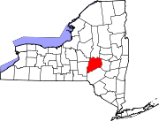
Garrattsville is a hamlet (and census-designated place) [3] in Otsego County, New York, United States. It is located in the town of New Lisbon at the intersection of Otsego County Route 16 and New York State Route 51. Butternut Creek flows southwest through the hamlet.
References
- ^ "Garrattsville". Geographic Names Information System. United States Geological Survey, United States Department of the Interior. Retrieved 2018-09-09.
-
^
"Garrattsville". tools.usps.com. usps. 2004. Retrieved 10 September 2018.
data
- ^ "State of New York Census Designated Places - Current/BAS20 - Data as of January 1, 2019". tigerweb.geo.census.gov. Retrieved 2020-02-24.

