Noisy–Champs Champy–Nesles | |||||||||||||||
|---|---|---|---|---|---|---|---|---|---|---|---|---|---|---|---|
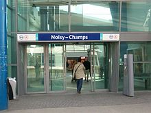
 North entrance of the station, Descartes side | |||||||||||||||
| General information | |||||||||||||||
| Location | France | ||||||||||||||
| Coordinates | 48°50′34″N 2°34′48″E / 48.8429°N 2.58°E | ||||||||||||||
| Operated by | RATP Group | ||||||||||||||
| Platforms | 2 side platforms | ||||||||||||||
| Tracks | 2 | ||||||||||||||
| Connections | |||||||||||||||
| Construction | |||||||||||||||
| Structure type | Below-grade | ||||||||||||||
| Parking | 318 spaces [1] | ||||||||||||||
| Accessible | Yes, by request to staff [2] | ||||||||||||||
| Other information | |||||||||||||||
| Station code | 87758342 | ||||||||||||||
| Fare zone | 4 | ||||||||||||||
| History | |||||||||||||||
| Opened | 19 December 1980 | ||||||||||||||
| Passengers | |||||||||||||||
| 2019 | 5,614,935 | ||||||||||||||
| Services | |||||||||||||||
| |||||||||||||||
| Future services | |||||||||||||||
| |||||||||||||||
Noisy–Champs station is a railway station on the RER train network at the border between Champs-sur-Marne, Seine-et-Marne and Noisy-le-Grand, Seine-Saint-Denis, France.
Description
The station opened on 19 December 1980, when RER Line A was extended to Torcy. [3] It serves the Descartes campus of the University of Paris-Est Marne-la-Vallée. Bus stations are on both ends of platforms: Champy is on Noisy-le-Grand side, Descartes on the Champs-sur-Marne side.
As of 2019 [update], the estimated annual attendance by the RATP Group was 5,614,935 passengers. [4]
Transport
Train
The average frequency is one train every 10 minutes to Paris and to Marne-la-Vallée–Chessy station (however, some trains terminate at Torcy station towards the east-side of the line).
Bus connections
The station is served at both ends by several buses: [5]
- On the west side at the stop called Noisy–Champs RER – Champy:
-
 RATP Bus:
- 310 (to Les Yvris–Noisy-le-Grand)
- 320 (circular line serving several districts in Noisy-le-Grand)
-
- On the east side at the stop called Noisy–Champs RER – Descartes:
-
RATP Bus:
-
Transdev Lys (by Setra):
-
 Noctilien:
- N130 (between Paris (Gare de Lyon) and Marne-la-Vallée–Chessy - Disneyland) [6]
-
Transport project
Paris Métro Line 11 is expected to be extended to Noisy–Champs in 2030.
This station should also be the terminus of the future lines 15 in 2025 and 16 in 2030. [7] [8]
Gallery
-
 East side (Descartes) entrance
 -
 Sign indicating the name of the station
(with a bus of line 213 in the background) -
 A train ( MI2N) arriving at the station
(towards Paris) -
 General view to the east (with the construction site of the Grand Paris Express on the right)
 -
 General view to the west (towards Paris)
 -
 General view during a winter night


References
- ^ "Plan Parc Relais labellisés" [Map with park-and-rides labeled] (PDF). Île-de-France Mobilités. October 2020. Retrieved 27 December 2023.
- ^ "Plan pour les voyageurs en fauteuil roulant" [Map for travelers in wheelchairs] (PDF). Île-de-France Mobilités. 2023. Retrieved 27 December 2023.
- ^ "A propos du RER A". Le blog du RER A (in French). Retrieved 17 December 2015.
- ^ "Trafic annuel entrant par station du réseau ferré 2019". Open Data RATP (Data.Ratp.fr) (in French). RATP Group. Retrieved 8 August 2021.
- ^ "Plan du réseau de bus à Marne-la-Vallée (Secteur n°11)" [Map of the RATP bus network in Marne-la-Vallée (Sector n° 11).] (PDF). Ratp.fr (Color map showing the names of bus stops and main streets.) (in French). RATP Group. May 2020. Retrieved 19 August 2020.
- ^ "Plan du réseau Noctilien (2017) - (Secteur : Paris & Sud-Est)" [Map of the night bus (Noctilien) network (2017) - (Sector: Paris and its south-eastern suburbs).] (PDF). Ratp.fr (Color map showing the names of the bus stops and the cities served.) (in French). RATP Group. April 2017. Retrieved 19 August 2020.
- ^ "Le Nouveau Grand Paris – Noisy Le Grand – Tourisme – Marne La Vallée".
- ^ "Station Noisy-Champs | Métro Ligne 11 Est".
External links
![]() Media related to
Gare de Noisy - Champs at Wikimedia Commons
Media related to
Gare de Noisy - Champs at Wikimedia Commons