
Size of this preview:
800 × 495 pixels. Other resolutions:
320 × 198 pixels |
640 × 396 pixels |
1,181 × 731 pixels.
Original file (1,181 × 731 pixels, file size: 1.56 MB, MIME type: image/png)
| This is a file from the
Wikimedia Commons. Information from its
description page there is shown below. Commons is a freely licensed media file repository. You can help. |
Summary
| Description |
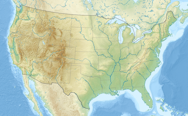
English: Relief location map of the
USA (without Hawaii and Alaska).
EquiDistantConicProjection : Central parallel : * N: 37.0° N Central meridian : * E: 96.0° W Standard parallels: * 1: 32.0° N * 2: 42.0° N Made with Natural Earth. Free vector and raster map data @ naturalearthdata.com. Formulas for x and y: x = 50.0 + 124.03149777329222 * ((1.9694462586094064-({{{2}}}* pi / 180))
* sin(0.6010514667026994 * ({{{3}}} + 96) * pi / 180))
y = 50.0 + 1.6155950752393982 * 124.03149777329222 * 0.02613325650382181
- 1.6155950752393982 * 124.03149777329222 *
(1.3236744353715044 - (1.9694462586094064-({{{2}}}* pi / 180))
* cos(0.6010514667026994 * ({{{3}}} + 96) * pi / 180))
|
| Date | |
| Source | Own work |
| Author | Uwe Dedering |
| Other versions |
|

Licensing
I, the copyright holder of this work, hereby publish it under the following licenses:
This file is licensed under the
Creative Commons
Attribution-Share Alike 3.0 Unported license.
- You are free:
- to share – to copy, distribute and transmit the work
- to remix – to adapt the work
- Under the following conditions:
- attribution – You must give appropriate credit, provide a link to the license, and indicate if changes were made. You may do so in any reasonable manner, but not in any way that suggests the licensor endorses you or your use.
- share alike – If you remix, transform, or build upon the material, you must distribute your contributions under the same or compatible license as the original.

|
Permission is granted to copy, distribute and/or modify this document under the terms of the GNU Free Documentation License, Version 1.2 or any later version published by the Free Software Foundation; with no Invariant Sections, no Front-Cover Texts, and no Back-Cover Texts. A copy of the license is included in the section entitled GNU Free Documentation License. |
You may select the license of your choice.
File history
Click on a date/time to view the file as it appeared at that time.
| Date/Time | Thumbnail | Dimensions | User | Comment | |
|---|---|---|---|---|---|
| current | 20:50, 2 April 2024 |
| 1,181 × 731 (1.56 MB) | Spesh531 | correction to Rhode Island border. Little Compton and Tiverton was previously shown to be in Massachusetts |
| 16:32, 23 December 2016 |
 | 1,181 × 731 (1.47 MB) | Jeanjung212 | Lossless Compressed/optimized png decreasing file size by 193731 bytes | |
| 10:37, 24 August 2010 |
 | 1,181 × 731 (1.66 MB) | Uwe Dedering | {{Information |Description={{en|1=Relief location map of the USA (without Hawaii and Alaska). EquiDistantConicProjection : Central parallel : * N: 37.0° N Central meridian : * E: 96.0° W Standard parallels: * 1: 32.0° N * 2: 42.0° N Made with Nat |
File usage
More than 100 pages use this file. The following list shows the first 100 pages that use this file only. A full list is available.
- Albany, New York
- Albuquerque, New Mexico
- Alexandria, Louisiana
- Ames, Iowa
- Ann Arbor, Michigan
- Augusta, Maine
- Austin, Texas
- Battle of Bennington
- Berkeley, California
- Boca Raton, Florida
- Boise, Idaho
- Bryce Canyon National Park
- Buffalo, New York
- Cambridge, Massachusetts
- Cape Canaveral
- Carson City, Nevada
- Cayuga Lake
- Cedar Falls, Iowa
- Chicago
- Cleveland
- Colorado Springs, Colorado
- Columbia, Maryland
- Columbia, Missouri
- Columbus, Indiana
- Columbus, Ohio
- Concord, New Hampshire
- Corvallis, Oregon
- Dallas
- Davenport, Iowa
- Dayton, Ohio
- Death Valley National Park
- Denver
- Des Moines, Iowa
- Detroit
- Detroit River
- Fort Collins, Colorado
- Fort Wayne, Indiana
- Fort Worth, Texas
- Frederick, Maryland
- Gaithersburg, Maryland
- Gary, Indiana
- Gettysburg, Pennsylvania
- Grand Canyon National Park
- Grand Teton National Park
- Great Salt Lake
- Harlingen, Texas
- Houston
- Isle Royale National Park
- Ithaca, New York
- Jackson, Mississippi
- Kalamazoo, Michigan
- Kansas City, Missouri
- Kitt Peak National Observatory
- Lake Kickapoo
- Lansing, Michigan
- Las Vegas
- Lewiston, Idaho
- Lexington, Kentucky
- Lincoln, Nebraska
- Los Angeles
- Memphis, Tennessee
- Miami
- Milwaukee
- Mobile, Alabama
- Monterey, California
- Nashville, Tennessee
- North Cascades National Park
- Oakland, California
- Omaha, Nebraska
- Palo Alto, California
- Philadelphia
- Phoenix, Arizona
- Pittsburgh
- Portland, Maine
- Portland, Oregon
- Provincetown, Massachusetts
- Pueblo, Colorado
- Puget Sound
- Richmond, Virginia
- Rock Creek Park
- Rockville, Maryland
- Roswell, New Mexico
- Salem, Oregon
- Salt Lake City
- San Antonio
- San Diego
- San Francisco
- Schenectady, New York
- Seneca Lake (New York)
- Shea Stadium
- Silver Spring, Maryland
- Spindletop
- Springfield, Illinois
- St. Louis
- Syracuse, New York
- Tallahassee, Florida
- Toledo, Ohio
- Tucson, Arizona
- Warren, Michigan
- Waterloo, Iowa
View more links to this file.
Global file usage
The following other wikis use this file:
- Usage on ab.wikipedia.org
- Usage on ace.wikipedia.org
- Usage on als.wikipedia.org
- Usage on ang.wikipedia.org
- Usage on ar.wikipedia.org
- قالب:خريطة مواقع
- قالب:خريطة مواقع/شرح
- قالب:خريطة مواقع الولايات المتحدة
- قالب:خريطة مواقع الولايات المتحدة2
- قالب:خريطة مواقع/ملعب
- وحدة:Location map/data/USA
- وحدة:Location map/data/United States
- وحدة:Location map/data/USA/شرح
- وحدة:Location map/data/United States of America
- كلية مونماوث
- وحدة:Location map/data/United States/شرح
- وحدة:Location map/data/United States of America/شرح
- بوينغ فيلد
- جامعات أمريكية حسب عدد الملتحقين بالمرحلة الجامعية
- جامعات الولايات المتحدة حسب عدد المسجلين
- فورتشن 1000
- تكوين هيل كريك
- انفجار صاروخ تيتان في داماسكيوس 1980
- تحطم طائرة بوينغ بي-52 في قاعدة فيرتشايلد الجوية
- Usage on arz.wikipedia.org
- Usage on ast.wikipedia.org
- Usage on as.wikipedia.org
- Usage on av.wikipedia.org
- Usage on azb.wikipedia.org
View more global usage of this file.