Size of this preview:
800 × 534 pixels. Other resolutions:
320 × 214 pixels |
640 × 427 pixels |
1,024 × 683 pixels |
1,500 × 1,001 pixels.
Original file (1,500 × 1,001 pixels, file size: 542 KB, MIME type: image/jpeg)
| This is a file from the
Wikimedia Commons. Information from its
description page there is shown below. Commons is a freely licensed media file repository. You can help. |
| Description |
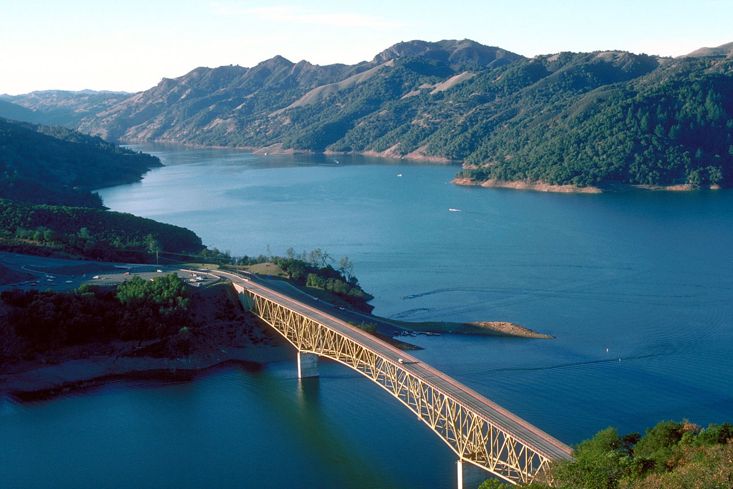
English: Aerial view of Lake Sonoma on Dry Creek in Sonoma County, California, USA. The lake is impounded by Warm Springs Dam, constructed in 1983 by the U.S. Army Corps of Engineers for flood control and water supply. The dam is just off to the right and is not visible in this picture. View is to the northwest.
Coordinates:
38°43′8.04″N 123°0′47.62″W / 38.7189°N 123.0132278°W |
|||
| Location | Sonoma County, California, USA | |||
| Date | not specified or unknown | |||
| Source |
U.S. Army Corps of Engineers Digital Visual Library Image page Image description page Digital Visual Library home page |
|||
| Author | U.S. Army Corps of Engineers, photographer not specified or unknown | |||
| Permission ( Reusing this file) |
|
|||
| Other versions |
|

File history
Click on a date/time to view the file as it appeared at that time.
| Date/Time | Thumbnail | Dimensions | User | Comment | |
|---|---|---|---|---|---|
| current | 03:32, 4 May 2007 |
| 1,500 × 1,001 (542 KB) | DanMS | {{Information | Description = {{en|Aerial view of Lake Sonoma on Dry Creek in Sonoma County, California, USA. The lake is impounded by Warm Springs Dam, constructed in 1983 by the U.S. Army Corps of Engineers for flood control and water supply. The dam |
File usage
The following pages on the English Wikipedia use this file (pages on other projects are not listed):
Global file usage
The following other wikis use this file:
- Usage on de.wikipedia.org
- Usage on es.wikipedia.org
- Usage on et.wikipedia.org
- Usage on fr.wikipedia.org
- Usage on sk.wikipedia.org
- Usage on www.wikidata.org