
Size of this preview:
800 × 533 pixels. Other resolutions:
320 × 213 pixels |
640 × 427 pixels |
1,024 × 683 pixels |
1,280 × 853 pixels |
2,560 × 1,707 pixels |
4,443 × 2,962 pixels.
Original file (4,443 × 2,962 pixels, file size: 3.94 MB, MIME type: image/jpeg)
| This is a file from the
Wikimedia Commons. Information from its
description page there is shown below. Commons is a freely licensed media file repository. You can help. |
|
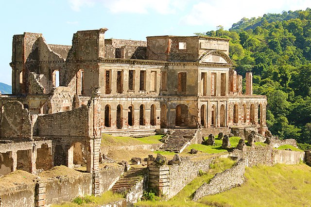
This place is a UNESCO
World Heritage Site, listed as
National History Park – Citadel, Sans Souci, Ramiers.
|
Summary
| Description |
English:
Sans-Souci Palace, National History Park, Haiti
Kreyòl ayisyen : Palè Sansousi, Pak Nasyonal Istorik, Ayiti
Français :
Le Palais Sans-Souci, Parc National Historique, Haïti |
| Date | |
| Source | Own work |
| Author | Didier Moïse |
| Permission ( Reusing this file) |
License: CC BY-SA 4.0 Attribution: "Photo by Didier Moïse" |
| Object location |
| View this and other nearby images on: OpenStreetMap |
|
|---|
Licensing
Didier Moïse, the copyright holder of this work, hereby publishes it under the following license:
This file is licensed under the
Creative Commons
Attribution-Share Alike 4.0 International license.
Attribution:
Didier Moïse
- You are free:
- to share – to copy, distribute and transmit the work
- to remix – to adapt the work
- Under the following conditions:
- attribution – You must give appropriate credit, provide a link to the license, and indicate if changes were made. You may do so in any reasonable manner, but not in any way that suggests the licensor endorses you or your use.
- share alike – If you remix, transform, or build upon the material, you must distribute your contributions under the same or compatible license as the original.
File history
Click on a date/time to view the file as it appeared at that time.
| Date/Time | Thumbnail | Dimensions | User | Comment | |
|---|---|---|---|---|---|
| current | 03:23, 17 May 2016 |
| 4,443 × 2,962 (3.94 MB) | DidierMoise | User created page with UploadWizard |
File usage
The following pages on the English Wikipedia use this file (pages on other projects are not listed):
Global file usage
The following other wikis use this file:
- Usage on ar.wikipedia.org
- Usage on eo.wikipedia.org
- Usage on eu.wikipedia.org
- Usage on fr.wikipedia.org
- Usage on ht.wikipedia.org
- Usage on hy.wikipedia.org
- Usage on id.wikipedia.org
- Usage on lt.wikipedia.org
- Usage on mad.wikipedia.org
- Usage on my.wikipedia.org
- Usage on pt.wikipedia.org
- Usage on ru.wikipedia.org
- Usage on sr.wikipedia.org
- Usage on te.wikipedia.org
- Usage on zh.wikipedia.org