No higher resolution available.
Raunkiaer.jpg (600 × 406 pixels, file size: 21 KB, MIME type: image/jpeg)
| This is a file from the
Wikimedia Commons. Information from its
description page there is shown below. Commons is a freely licensed media file repository. You can help. |
Yyggb
Summary
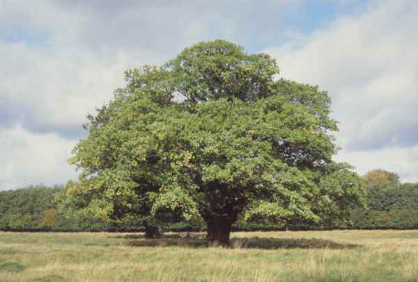
| Description | Raunkiærseg ( Quercus robur), Jægersborg dyrehave |
| Date | 24 November 2005 (original upload date) |
| Source | No machine-readable source provided. Own work assumed (based on copyright claims). |
| Author | No machine-readable author provided. Haabet assumed (based on copyright claims). |
| Object location |
| View this and other nearby images on: OpenStreetMap |
|
|---|
Licensing
| I, the copyright holder of this work, release this work into the
public domain. This applies worldwide. In some countries this may not be legally possible; if so: I grant anyone the right to use this work for any purpose, without any conditions, unless such conditions are required by law. |
derivative works
Derivative works of this file: Copa de árbol.png
File history
Click on a date/time to view the file as it appeared at that time.
| Date/Time | Thumbnail | Dimensions | User | Comment | |
|---|---|---|---|---|---|
| current | 08:21, 24 November 2005 |
| 600 × 406 (21 KB) | Haabet | Raunkiærseg Jægersborg dyrehave Category:Quercus Category:Danmark Category:Oaks |
File usage
The following pages on the English Wikipedia use this file (pages on other projects are not listed):
- Barnstokkr
- List of U.S. state and territory trees
- List of national trees
- Primary production
- Trysting tree
- Talk:Anti-gravity/Archive 1
- User:7h3 3L173
- User:AnkitaS
- User:BamBen2715
- User:Be Done
- User:C2CFAN
- User:Erynne Lasgalen
- User:Exacerbation/Sandbox
- User:Exacerbation/userboxes
- User:Jitterro
- User:Jorcoga/Userbox Gallery
- User:Jorcoga/Userboxes/Funny Tree
- User:Letthegoodtimesroll
- User:Migelot/Userboxes
- User:Mjkubba
- User:Mogthetormentor
- User:One2one
- User:Phyco1991
- User:Quincybuddha
- User:ReluctantPhilosopher
- User:Roastytoast
- User:SalmonCat
- User:ThevikasIN
- User:Whitesurf
Global file usage
The following other wikis use this file:
- Usage on an.wikipedia.org
- Usage on ar.wikipedia.org
- Usage on azb.wikipedia.org
- Usage on bg.wikipedia.org
- Usage on bg.wiktionary.org
- Usage on bn.wikipedia.org
- Usage on ca.wikipedia.org
- Usage on cy.wikipedia.org
- Usage on da.wikipedia.org
- Usage on da.wiktionary.org
- Usage on de.wikipedia.org
- Usage on diq.wikipedia.org
- Usage on eml.wikipedia.org
- Usage on en.wiktionary.org
- Usage on eo.wikipedia.org
- Usage on eo.wiktionary.org
- Usage on es.wikipedia.org
- Usage on es.wikibooks.org
- Usage on eu.wikipedia.org
- Usage on ext.wikipedia.org
- Usage on fa.wikipedia.org
- Usage on fr.wikipedia.org
- Usage on fy.wikipedia.org
- Usage on ga.wikipedia.org
- Usage on he.wikipedia.org
- Usage on he.wiktionary.org
- Usage on ht.wikipedia.org
- Usage on id.wikipedia.org
- Usage on incubator.wikimedia.org
- Usage on it.wikipedia.org
- Usage on it.wikivoyage.org
- Usage on ja.wikipedia.org
View more global usage of this file.