
Size of this preview:
800 × 533 pixels. Other resolutions:
320 × 213 pixels |
640 × 427 pixels |
1,024 × 683 pixels |
1,280 × 853 pixels |
2,560 × 1,707 pixels |
5,184 × 3,456 pixels.
Original file (5,184 × 3,456 pixels, file size: 5.48 MB, MIME type: image/jpeg)
| This is a file from the
Wikimedia Commons. Information from its
description page there is shown below. Commons is a freely licensed media file repository. You can help. |
Summary
| Description |
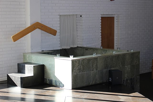
Svenska: Pingstkyrkan i Västerås. |
| Date | |
| Source | Ulf Klingström |
| Author | Ulkl |
| Object location |
| View this and other nearby images on: OpenStreetMap |
|
|---|
Licensing
| I, the copyright holder of this work, release this work into the
public domain. This applies worldwide. In some countries this may not be legally possible; if so: I grant anyone the right to use this work for any purpose, without any conditions, unless such conditions are required by law. |
File history
Click on a date/time to view the file as it appeared at that time.
| Date/Time | Thumbnail | Dimensions | User | Comment | |
|---|---|---|---|---|---|
| current | 15:07, 22 February 2020 |
| 5,184 × 3,456 (5.48 MB) | Ulkl | == {{int:filedesc}} == {{Information |Description = {{sv|1=Pingstkyrkan i Västerås.}} |Source = Ulf Klingström |Author = Ulkl |Date = 2018-09-15 |Permission = |other_versions = }} {{object location|59|36|19.1|N|16|31|51|E|region:SE_type:church}} == {{int:license-header}} == {{PD-self}} Category:Pingstkyrkan, Västerås Category:Churches in Västmanland County photographed in 2018 Category:2018 in Västerås [[Category:September 2018 in V... |
File usage
The following pages on the English Wikipedia use this file (pages on other projects are not listed):
Global file usage
The following other wikis use this file:
- Usage on ca.wikipedia.org
- Usage on es.wikipedia.org
- Usage on fr.wikipedia.org
- Usage on pt.wikipedia.org
- Usage on zh.wikipedia.org