
Size of this preview:
581 × 600 pixels. Other resolutions:
232 × 240 pixels |
465 × 480 pixels |
744 × 768 pixels |
992 × 1,024 pixels |
2,191 × 2,262 pixels.
Original file (2,191 × 2,262 pixels, file size: 3.48 MB, MIME type: image/png)
| This is a file from the
Wikimedia Commons. Information from its
description page there is shown below. Commons is a freely licensed media file repository. You can help. |
Summary
| Description |
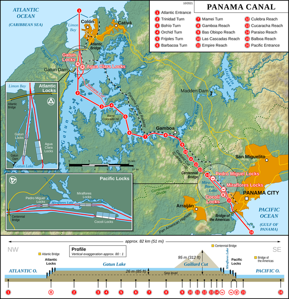
English: Map of the
Panama Canal (English version)
Deutsch: Karte des
Panamakanals (Englische Version) |
| Date | |
| Source |
Own work Map created using: |
| Author | Thoroe |
| Permission ( Reusing this file) |
Map data (c) OpenStreetMap (and) contributors, CC-BY-SA |
| Other versions |
|


|
This map has been made or improved in the German
Kartenwerkstatt (Map Lab). You can
propose maps to improve as well.
|

|
File:Panama Canal Map EN.svg is a vector version of this file. It should be used in place of this PNG file when not inferior.
File:Panama Canal Map EN.png →
File:Panama Canal Map EN.svg
For more information, see
Help:SVG. |
 |
Licensing
This file is licensed under the
Creative Commons
Attribution-Share Alike 2.0 Generic license.
Attribution: Thomas Römer/OpenStreetMap data
- You are free:
- to share – to copy, distribute and transmit the work
- to remix – to adapt the work
- Under the following conditions:
- attribution – You must give appropriate credit, provide a link to the license, and indicate if changes were made. You may do so in any reasonable manner, but not in any way that suggests the licensor endorses you or your use.
- share alike – If you remix, transform, or build upon the material, you must distribute your contributions under the same or compatible license as the original.
File history
Click on a date/time to view the file as it appeared at that time.
| Date/Time | Thumbnail | Dimensions | User | Comment | |
|---|---|---|---|---|---|
| current | 15:49, 3 October 2021 |
| 2,191 × 2,262 (3.48 MB) | Thoroe | + Atlantic Bridge |
| 23:03, 15 February 2017 |
 | 2,191 × 2,262 (3.59 MB) | Thoroe | Update | |
| 10:39, 29 December 2016 |
 | 1,292 × 1,336 (1.96 MB) | Foghe | New locks (2). | |
| 16:12, 27 December 2016 |
 | 1,292 × 1,336 (1.91 MB) | Foghe | New locks. | |
| 11:14, 22 December 2014 |
 | 1,294 × 1,336 (1.65 MB) | IceKarma | Fix "PAZIFIC O." in bottom section and losslessly squeeze with optipng. | |
| 11:22, 1 June 2012 |
 | 1,294 × 1,336 (1.84 MB) | Thoroe | Minor fixes and improvements | |
| 11:51, 31 May 2012 |
 | 1,294 × 1,336 (1.83 MB) | Thoroe | {{Information |Description ={{en|1=Map of the Panama Canal (English version)}} {{de|1=Karte des Panamakanals (Englische Version)}} |Source ={{own}} Map created using: *[http://gmt.soest.hawaii.edu Ge... |
File usage
The following pages on the English Wikipedia use this file (pages on other projects are not listed):
Global file usage
The following other wikis use this file:
- Usage on af.wikipedia.org
- Usage on am.wikipedia.org
- Usage on ar.wikipedia.org
- Usage on as.wikipedia.org
- Usage on azb.wikipedia.org
- Usage on bcl.wikipedia.org
- Usage on bg.wikipedia.org
- Usage on bh.wikipedia.org
- Usage on bn.wikipedia.org
- Usage on ca.wikipedia.org
- Usage on cs.wikipedia.org
- Usage on de.wikipedia.org
- Usage on el.wikipedia.org
- Usage on en.wikisource.org
- Usage on eo.wikipedia.org
- Usage on fa.wikipedia.org
- Usage on fi.wikipedia.org
- Usage on fo.wikipedia.org
- Usage on hak.wikipedia.org
- Usage on hi.wikipedia.org
- Usage on hr.wikipedia.org
- Usage on id.wikipedia.org
- Usage on ilo.wikipedia.org
- Kanal Panama
- Wikipedia:Napili nga artikulo ita nga aldaw/Marso 19
- Wikipedia:Napili nga artikulo ita nga aldaw/Mayo 3
- Wikipedia:Napili nga artikulo ita nga aldaw/Hunio 17
- Wikipedia:Napili nga artikulo ita nga aldaw/Agosto 1
- Wikipedia:Napili nga artikulo ita nga aldaw/Septiembre 15
- Wikipedia:Napili nga artikulo ita nga aldaw/Oktubre 30
- Wikipedia:Napili nga artikulo ita nga aldaw/Disiembre 14
- Wikipedia:Napili nga artikulo ita nga aldaw/Enero 28
- Usage on io.wikipedia.org
- Usage on it.wikipedia.org
- Usage on it.wikiquote.org
- Usage on ja.wikipedia.org
- Usage on ko.wikipedia.org
View more global usage of this file.