
Size of this preview:
769 × 600 pixels. Other resolutions:
308 × 240 pixels |
616 × 480 pixels |
985 × 768 pixels |
1,280 × 998 pixels |
2,560 × 1,996 pixels |
4,609 × 3,594 pixels.
Original file (4,609 × 3,594 pixels, file size: 2.27 MB, MIME type: image/jpeg)
| This is a file from the
Wikimedia Commons. Information from its
description page there is shown below. Commons is a freely licensed media file repository. You can help. |
Summary
| Camera location |
| View this and other nearby images on: OpenStreetMap |
|
|---|
| Description |
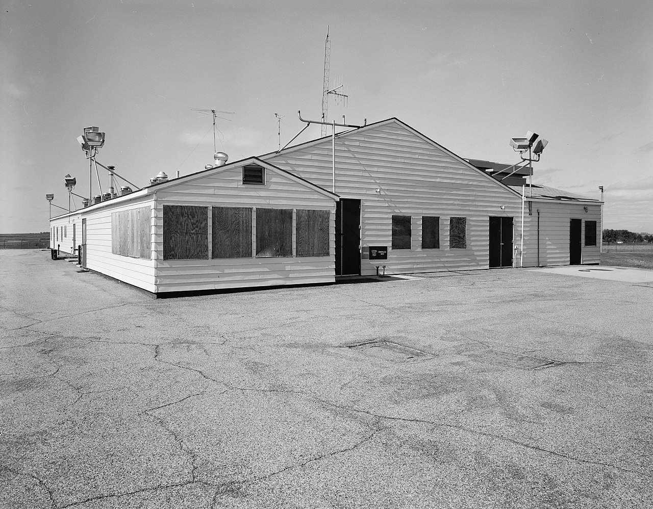
English: Front of the launch control support building at the
Oscar-Zero Missile Alert Facility, a
United States Air Force facility located along
North Dakota Highway 45 4.5 miles north of
Cooperstown in
Griggs County,
North Dakota, United States. Operated by the
Minuteman III-equipped 321st Missile Wing, the facility is listed on the
National Register of Historic Places.
|
||
| Date | after 1968 | ||
| Source |
|
||
| Author | Fraser, Clayton B |


|
Attribution information, such as the author's name, e-mail, website, or signature, that was once visible in the image itself has been moved into the image metadata and/or image description page. This makes the image easier to reuse and more language-neutral, and makes the text easier to process and search for. Commons
discourages placing visible author information in images.
|
Licensing
| This image or media file contains material based on a work of a National Park Service employee, created as part of that person's official duties. As a work of the U.S. federal government, such work is in the public domain in the United States. See the NPS website and NPS copyright policy for more information. |
|
File history
Click on a date/time to view the file as it appeared at that time.
| Date/Time | Thumbnail | Dimensions | User | Comment | |
|---|---|---|---|---|---|
| current | 17:47, 25 May 2009 |
| 4,609 × 3,594 (2.27 MB) | Cropbot | upload cropped version, operated by User:Finavon. Summary: border cropped |
| 03:26, 25 May 2009 |
 | 5,072 × 4,121 (2.5 MB) | Nyttend | {{Location|47|30|26.8|N|98|7|54.76|W}} {{Information |Description={{en|Front of the launch control support building at the {{w|Oscar-Zero Missile Alert Facility}}, a {{w|United States Air Force}} facility located along {{w|North Dakota Highway 45}} 4.5 mi |
File usage
The following pages on the English Wikipedia use this file (pages on other projects are not listed):
Global file usage
The following other wikis use this file:
- Usage on es.wikipedia.org