No higher resolution available.
NYC_Hudson_Bridge_C_rock.jpg (600 × 450 pixels, file size: 36 KB, MIME type: image/jpeg)
| This is a file from the
Wikimedia Commons. Information from its
description page there is shown below. Commons is a freely licensed media file repository. You can help. |
Summary
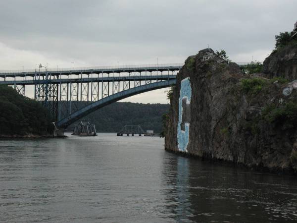
| Description | A view westward along the Harlem River, through Spuyten Duyvil and under the Henry Hudson Bridge. The Columbia "C" rock is seen to the right side. |
| Date | |
| Source | English Wikipedia |
| Author | CUlwt |
| Permission ( Reusing this file) |
This file has been released into the public domain by the copyright holder, its copyright has expired, or it is ineligible for copyright. This applies worldwide. |
| Other versions | Same picture on English Wikipedia [1] |
![[1]](/info/en/?search=Image:NYC_Hudson_Bridge_C_rock.jpg)
| Camera location | | View this and other nearby images on: OpenStreetMap |
|
|---|
Licensing
| |
This work has been released into the
public domain by its author,
CUlwt, at the
English Wikipedia project. This applies worldwide. In case this is not legally possible: |
File history
Click on a date/time to view the file as it appeared at that time.
| Date/Time | Thumbnail | Dimensions | User | Comment | |
|---|---|---|---|---|---|
| current | 17:20, 23 March 2007 |
| 600 × 450 (36 KB) | Jonathan71 | {{Information |Description=A view westward along the Harlem River, through Spuyten Duyvil and under the Henry Hudson Bridge. The Columbia "C" rock is seen to the right side. |Source=English Wikipedia |Date=31 August 2005 |Author=CUlwt |Permission=This fi |
File usage
The following pages on the English Wikipedia use this file (pages on other projects are not listed):
Global file usage
The following other wikis use this file:
- Usage on ca.wikipedia.org
- Usage on fa.wikipedia.org
- Usage on fr.wikipedia.org
- Usage on he.wikipedia.org
- Usage on ja.wikipedia.org
- Usage on ru.wikipedia.org