
Size of this preview:
778 × 600 pixels. Other resolutions:
312 × 240 pixels |
623 × 480 pixels |
997 × 768 pixels |
1,280 × 986 pixels |
2,560 × 1,973 pixels |
4,360 × 3,360 pixels.
Original file (4,360 × 3,360 pixels, file size: 7.88 MB, MIME type: image/jpeg)
| This is a file from the
Wikimedia Commons. Information from its
description page there is shown below. Commons is a freely licensed media file repository. You can help. |
Summary
| Description |
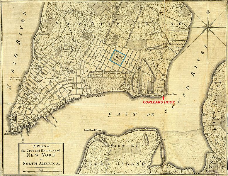
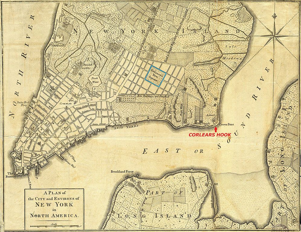
English: A 1776 map of
New York City. Map has had border cropped and color adjusted from original. This version had Corlears Hook labelled and New Delancey Square marked. |
| Date | Unknown date |
| Source | The Boston Public Library Digital Map Collection: http://maps.bpl.org/details_14193/ |
| Author | Unknown author; labelled by Beyond My Ken ( talk) |
| Other versions |

 |
Licensing
This work is in the
public domain in the
United States because it was
published (or registered with the
U.S. Copyright Office) before January 1, 1929.
Public domain works must be out of copyright in both the United States and in the source country of the work in order to be hosted on the Commons. If the work is not a U.S. work, the file must have an additional
copyright tag indicating the copyright status in the source country.
Note: This tag should not be used for sound recordings. |
File history
Click on a date/time to view the file as it appeared at that time.
| Date/Time | Thumbnail | Dimensions | User | Comment | |
|---|---|---|---|---|---|
| current | 00:55, 7 March 2017 |
| 4,360 × 3,360 (7.88 MB) | Beyond My Ken | == {{int:filedesc}} == {{Information |Description={{en|A 1776 map of New York City. Map has had border cropped and color adjusted from original. This version had Corlears Hook labelled and New Delancey Square marked.}} |Source=The B... |
File usage
The following pages on the English Wikipedia use this file (pages on other projects are not listed):
Global file usage
The following other wikis use this file:
- Usage on es.wikipedia.org
- Usage on ru.wikipedia.org