
Size of this PNG preview of this SVG file:
776 × 600 pixels. Other resolutions:
311 × 240 pixels |
621 × 480 pixels |
994 × 768 pixels |
1,280 × 989 pixels |
2,560 × 1,978 pixels |
990 × 765 pixels.
Original file (SVG file, nominally 990 × 765 pixels, file size: 16.22 MB)
| This is a file from the
Wikimedia Commons. Information from its
description page there is shown below. Commons is a freely licensed media file repository. You can help. |
Summary
| Description |
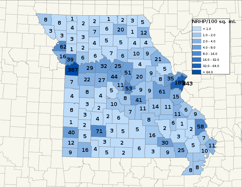
English: Map of Missouri NRHP/100 sq. mi., by county. As of 12/18/09
|
||
| Date | 12/24/09 | ||
| Source | Own work | ||
| Author | 25or6to4 |
Licensing
I, the copyright holder of this work, hereby publish it under the following licenses:
This file is licensed under the
Creative Commons
Attribution-Share Alike 3.0 Unported license.
- You are free:
- to share – to copy, distribute and transmit the work
- to remix – to adapt the work
- Under the following conditions:
- attribution – You must give appropriate credit, provide a link to the license, and indicate if changes were made. You may do so in any reasonable manner, but not in any way that suggests the licensor endorses you or your use.
- share alike – If you remix, transform, or build upon the material, you must distribute your contributions under the same or compatible license as the original.

|
Permission is granted to copy, distribute and/or modify this document under the terms of the GNU Free Documentation License, Version 1.2 or any later version published by the Free Software Foundation; with no Invariant Sections, no Front-Cover Texts, and no Back-Cover Texts. A copy of the license is included in the section entitled GNU Free Documentation License. |
You may select the license of your choice.
File history
Click on a date/time to view the file as it appeared at that time.
| Date/Time | Thumbnail | Dimensions | User | Comment | |
|---|---|---|---|---|---|
| current | 08:17, 11 April 2022 |
| 990 × 765 (16.22 MB) | 25or6to4 | Updated through March 2022 |
| 11:00, 23 March 2019 |
 | 990 × 765 (5.42 MB) | 25or6to4 | Updated through March 1, 2019. | |
| 17:44, 3 April 2016 |
 | 792 × 612 (1.75 MB) | 25or6to4 | Updated through January 1, 2016 | |
| 17:59, 15 September 2014 |
 | 792 × 612 (1.67 MB) | 25or6to4 | Updated through September 2014 | |
| 23:20, 7 September 2013 |
 | 792 × 612 (577 KB) | 25or6to4 | Updated through 08-29-2013. New color scheme. | |
| 07:21, 16 September 2012 |
 | 792 × 612 (499 KB) | 25or6to4 | updated through August 2012 | |
| 23:51, 24 December 2009 |
 | 612 × 792 (411 KB) | 25or6to4 | {{Information |Description={{en|1=Map of Missouri NRHP/100 sq. mi., by county. As of 12/18/09}} |Source={{own}} |Author= 25or6to4 |Date=12/24/09 |Permission= |other_versions= }} Category:Maps of Missouri [[Category:National Register |
File usage
The following pages on the English Wikipedia use this file (pages on other projects are not listed):
Global file usage
The following other wikis use this file:
- Usage on de.wikipedia.org
- Usage on pt.wikipedia.org
- Usage on ro.wikipedia.org
- William Clark (explorator)
- Missouri
- Categorie:Statul Missouri, SUA
- Format:Missouri stat SUA
- Saint Louis
- Jefferson City, Missouri
- Categorie:Formate Missouri
- Nevada, Missouri
- Categorie:Liste Missouri
- Categorie:Comitate din statul Missouri, SUA
- Hannibal, Missouri
- Comitatul Phelps, Missouri
- Categorie:Comitatul Phelps, Missouri
- Listă de oameni din statul Missouri
- Categorie:Guvernul statului Missouri
- Listă de comitate din statul Missouri
- Categorie:Sedii de comitate din Missouri
- Butler, Missouri
- Categorie:Comitatul Washington, Missouri
- Listă de orașe din statul Kentucky
- Listă de orașe din statul Missouri
- Categorie:Comitatul Wayne, Missouri
- Categorie:Zone metropolitane din Missouri
- Categorie:Zone micropolitane din Missouri
- Categorie:Comitatul Clark, Missouri
- Categorie:Comitatul Benton, Missouri
- Categorie:Comitatul Adair, Missouri
- Categorie:Comitatul Pike, Missouri
- Categorie:Comitatul Webster, Missouri
- Categorie:Comitatul Warren, Missouri
- Categorie:Comitatul Cass, Missouri
- Categorie:Comitatul Lafayette, Missouri
- Categorie:Comitatul Saint Clair, Missouri
- Categorie:Comitatul Lincoln, Missouri
- Categorie:Comitatul Douglas, Missouri
- Categorie:Comitatul Wright, Missouri
- Categorie:Comitatul Worth, Missouri
- Categorie:Comitatul Vernon, Missouri
- Categorie:Comitatul Texas, Missouri
- Categorie:Comitatul Taney, Missouri
- Categorie:Localități din Missouri
- Categorie:Comitatul Shelby, Missouri
- Categorie:Comitatul Scott, Missouri
- Categorie:Comitatul Madison, Missouri
- Categorie:Comitatul Howell, Missouri
- Categorie:Comitatul Andrew, Missouri
- Categorie:Comitatul Audrain, Missouri
- Categorie:Comitatul Barry, Missouri
View more global usage of this file.