
Size of this PNG preview of this SVG file:
677 × 599 pixels. Other resolutions:
271 × 240 pixels |
542 × 480 pixels |
868 × 768 pixels |
1,157 × 1,024 pixels |
2,314 × 2,048 pixels |
810 × 717 pixels.
Original file (SVG file, nominally 810 × 717 pixels, file size: 50 KB)
| This is a file from the
Wikimedia Commons. Information from its
description page there is shown below. Commons is a freely licensed media file repository. You can help. |
Summary
| Description |
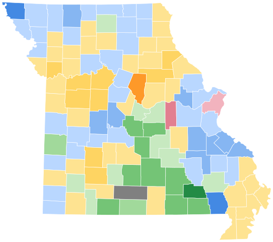
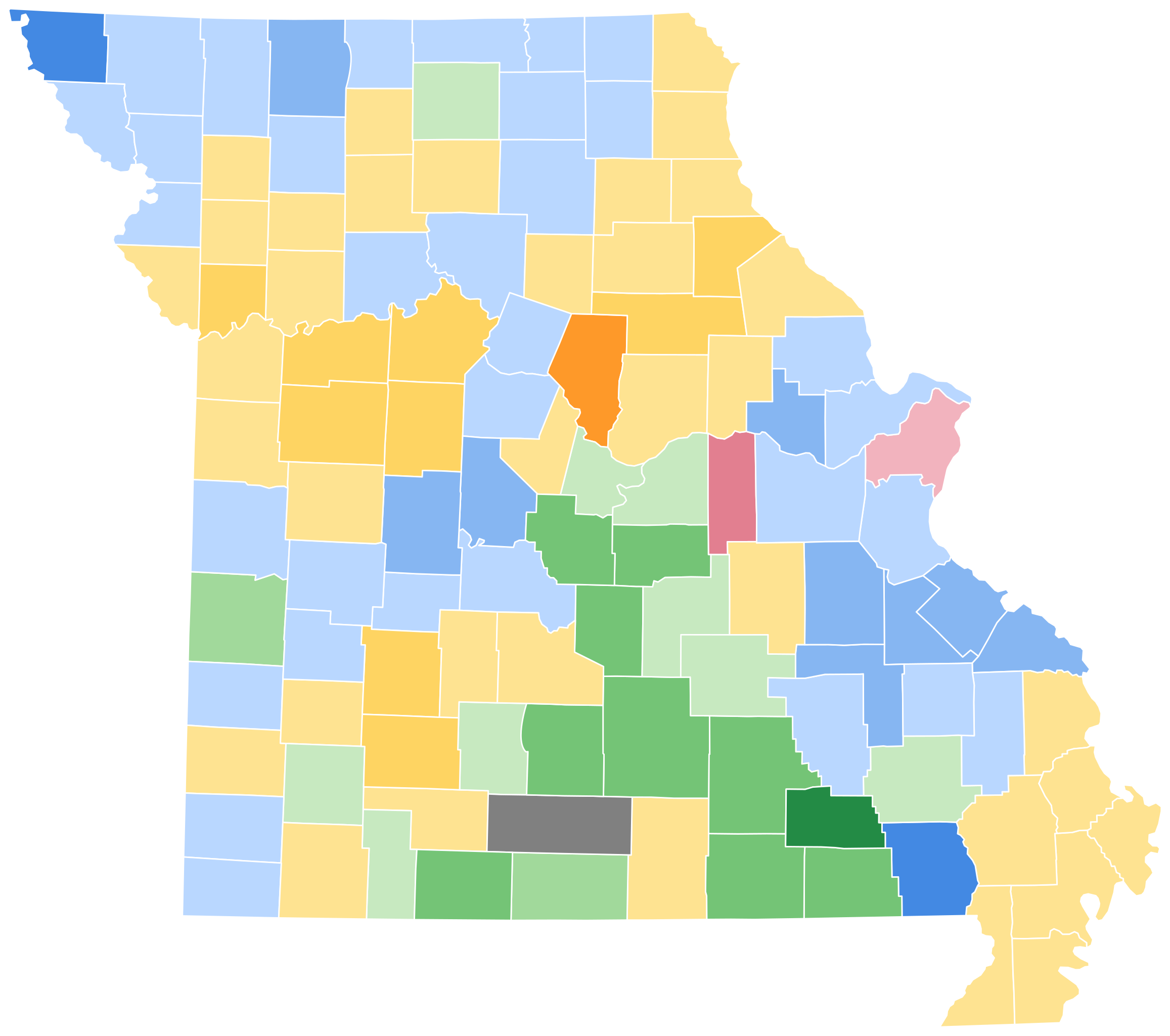
English: Missouri Presidential Election Results 1860 - Note that this map includes the anachronistic modern day county lines, and needs to be fixed to accurately display the correct borders as shown in
File:PresidentialCounty1860Colorbrewer.gif. |
| Date | |
| Source | Own work |
| Author | Politicsfan4 |
Licensing
I, the copyright holder of this work, hereby publish it under the following license:
This file is licensed under the
Creative Commons
Attribution-Share Alike 4.0 International license.
- You are free:
- to share – to copy, distribute and transmit the work
- to remix – to adapt the work
- Under the following conditions:
- attribution – You must give appropriate credit, provide a link to the license, and indicate if changes were made. You may do so in any reasonable manner, but not in any way that suggests the licensor endorses you or your use.
- share alike – If you remix, transform, or build upon the material, you must distribute your contributions under the same or compatible license as the original.
File history
Click on a date/time to view the file as it appeared at that time.
| Date/Time | Thumbnail | Dimensions | User | Comment | |
|---|---|---|---|---|---|
| current | 18:48, 27 March 2024 |
| 810 × 717 (50 KB) | ZackCarns | Map shapes |
| 01:57, 2 February 2021 |
 | 285 × 252 (25 KB) | Politicsfan4 | Uploaded own work with UploadWizard |
File usage
The following pages on the English Wikipedia use this file (pages on other projects are not listed):