
Size of this preview:
800 × 549 pixels. Other resolutions:
320 × 220 pixels |
640 × 439 pixels |
1,000 × 686 pixels.
Original file (1,000 × 686 pixels, file size: 173 KB, MIME type: image/jpeg)
| This is a file from the
Wikimedia Commons. Information from its
description page there is shown below. Commons is a freely licensed media file repository. You can help. |
|
This is an image of a place or building that is listed on the
National Register of Historic Places in the
United States of America. Its reference number is
76000530. |
Summary
| Camera location |
| View this and other nearby images on: OpenStreetMap |
|
|---|
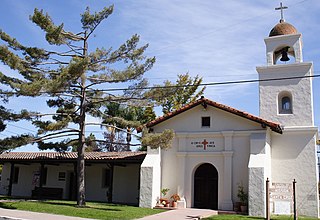
Teil der historischen Missionsanlage in Santa Cruz / Benutzeraufnahme.
Uploaded to German Wikipedia on 9. Oct 2005 by Tule
Licensing
| I, the copyright holder of this work, release this work into the
public domain. This applies worldwide. In some countries this may not be legally possible; if so: I grant anyone the right to use this work for any purpose, without any conditions, unless such conditions are required by law. |
File history
Click on a date/time to view the file as it appeared at that time.
| Date/Time | Thumbnail | Dimensions | User | Comment | |
|---|---|---|---|---|---|
| current | 15:33, 20 January 2006 |
| 1,000 × 686 (173 KB) | Matt314 | == Beschreibung und Quelle == Teil der historischen Missionsanlage in Santa Cruz / Benutzeraufnahme. ==Image History== Uploaded to German Wikipedia [ 08:13, 9. Okt 2005 . . Tule ( Diskussion) . |
File usage
The following pages on the English Wikipedia use this file (pages on other projects are not listed):
- Awaswas
- Awaswas language
- California Historical Landmarks in Santa Cruz County
- List of Spanish missions in California
- List of churches in the Roman Catholic Diocese of Monterey
- List of museums in the California Central Coast
- Mission Santa Cruz
- Santa Cruz, California
- Spanish missions in California
- User:Lionelt/List of Spanish missions of California
Global file usage
The following other wikis use this file:
- Usage on ca.wikipedia.org
- Usage on cs.wikipedia.org
- Usage on de.wikipedia.org
- Usage on eo.wikipedia.org
- Usage on es.wikipedia.org
- Usage on hr.wikipedia.org
- Usage on sh.wikipedia.org