Size of this preview:
672 × 599 pixels. Other resolutions:
269 × 240 pixels |
538 × 480 pixels |
861 × 768 pixels |
1,148 × 1,024 pixels |
2,237 × 1,995 pixels.
Original file (2,237 × 1,995 pixels, file size: 3.01 MB, MIME type: image/jpeg)
| This is a file from the
Wikimedia Commons. Information from its
description page there is shown below. Commons is a freely licensed media file repository. You can help. |
Summary
| Description |
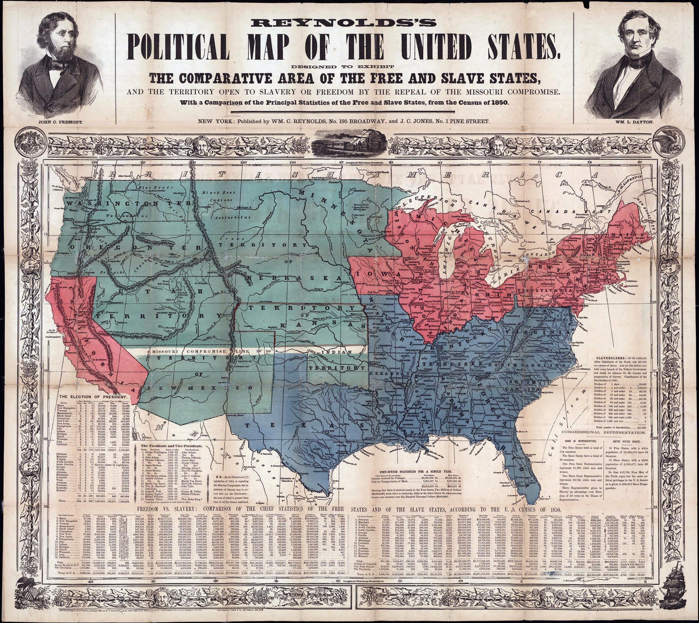
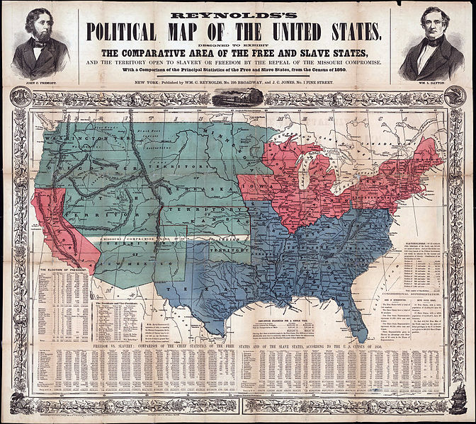
English: Printed on map: "Designed to exhibit the comparative area of the free and slave states and the territory open to slavery or freedom by the repeal of the Missouri compromise. With a comparison of the principal statistics of the free and slave states, from the census of 1850." Portraits of John C. Fremont and W.L. Dayton are on map borders. |
| Date | |
| Source | http://digital.lib.uh.edu/cdm4/item_viewer.php?CISOROOT=/p15195coll35&CISOPTR=28&DMSCALE=25&DMWIDTH=600&DMHEIGHT=600&DMX=0&DMY=0&DMMODE=viewer&DMTEXT=&REC=3&DMTHUMB=1&DMROTATE=0 |
| Author | Unknown author |
Licensing
| This file is made available under the Creative Commons CC0 1.0 Universal Public Domain Dedication. | |
| The person who associated a work with this deed has dedicated the work to the
public domain by waiving all of their rights to the work worldwide under copyright law, including all related and neighboring rights, to the extent allowed by law. You can copy, modify, distribute and perform the work, even for commercial purposes, all without asking permission.
|
File history
Click on a date/time to view the file as it appeared at that time.
| Date/Time | Thumbnail | Dimensions | User | Comment | |
|---|---|---|---|---|---|
| current | 04:04, 25 March 2012 |
| 2,237 × 1,995 (3.01 MB) | Aavindraa | bigger |
| 16:16, 9 November 2011 |
 | 559 × 498 (137 KB) | TejasDiscipulus2 |
File usage
The following pages on the English Wikipedia use this file (pages on other projects are not listed):
Global file usage
The following other wikis use this file:
- Usage on fa.wikipedia.org
- Usage on no.wikipedia.org