Size of this preview:
800 × 447 pixels. Other resolutions:
320 × 179 pixels |
640 × 357 pixels |
1,024 × 572 pixels |
1,280 × 715 pixels |
2,000 × 1,117 pixels.
Original file (2,000 × 1,117 pixels, file size: 328 KB, MIME type: image/png)
| This is a file from the
Wikimedia Commons. Information from its
description page there is shown below. Commons is a freely licensed media file repository. You can help. |
Summary
| Description |
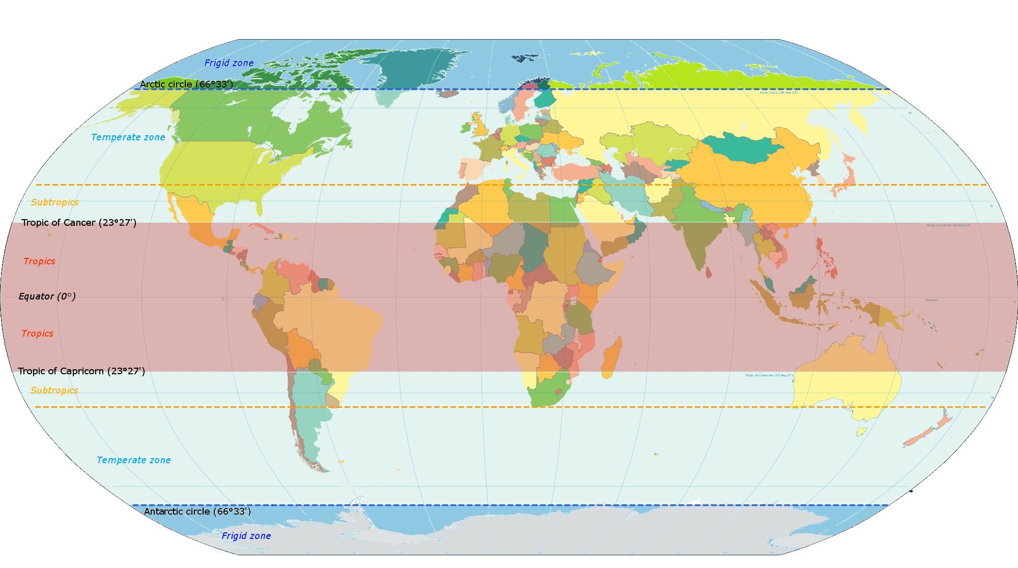
Español: Zonas latitudinales de la Tierra English: Latitude zones |
| Date | |
| Source | Own work, according File:World map torrid.svg & File:World map indicating tropics and subtropics.png |
| Author | Maulucioni |
Licensing
I, the copyright holder of this work, hereby publish it under the following license:
This file is licensed under the
Creative Commons
Attribution-Share Alike 4.0 International license.
- You are free:
- to share – to copy, distribute and transmit the work
- to remix – to adapt the work
- Under the following conditions:
- attribution – You must give appropriate credit, provide a link to the license, and indicate if changes were made. You may do so in any reasonable manner, but not in any way that suggests the licensor endorses you or your use.
- share alike – If you remix, transform, or build upon the material, you must distribute your contributions under the same or compatible license as the original.
File history
Click on a date/time to view the file as it appeared at that time.
| Date/Time | Thumbnail | Dimensions | User | Comment | |
|---|---|---|---|---|---|
| current | 13:06, 6 January 2015 |
| 2,000 × 1,117 (328 KB) | Maulucioni | Agrandando |
| 19:38, 18 December 2014 |
 | 800 × 447 (136 KB) | Maulucioni | ajustando colores | |
| 17:31, 16 December 2014 |
 | 800 × 447 (136 KB) | Maulucioni | User created page with UploadWizard |
File usage
The following pages on the English Wikipedia use this file (pages on other projects are not listed):
Global file usage
The following other wikis use this file:
- Usage on es.wikipedia.org
- Usage on eu.wikipedia.org
- Usage on hr.wikipedia.org
- Usage on ig.wikipedia.org
- Usage on sr.wikipedia.org