Size of this preview:
511 × 599 pixels. Other resolutions:
205 × 240 pixels |
409 × 480 pixels |
655 × 768 pixels |
873 × 1,024 pixels |
1,747 × 2,048 pixels |
4,000 × 4,690 pixels.
Original file (4,000 × 4,690 pixels, file size: 2.2 MB, MIME type: image/png)
| This is a file from the
Wikimedia Commons. Information from its
description page there is shown below. Commons is a freely licensed media file repository. You can help. |
Summary
| Description |
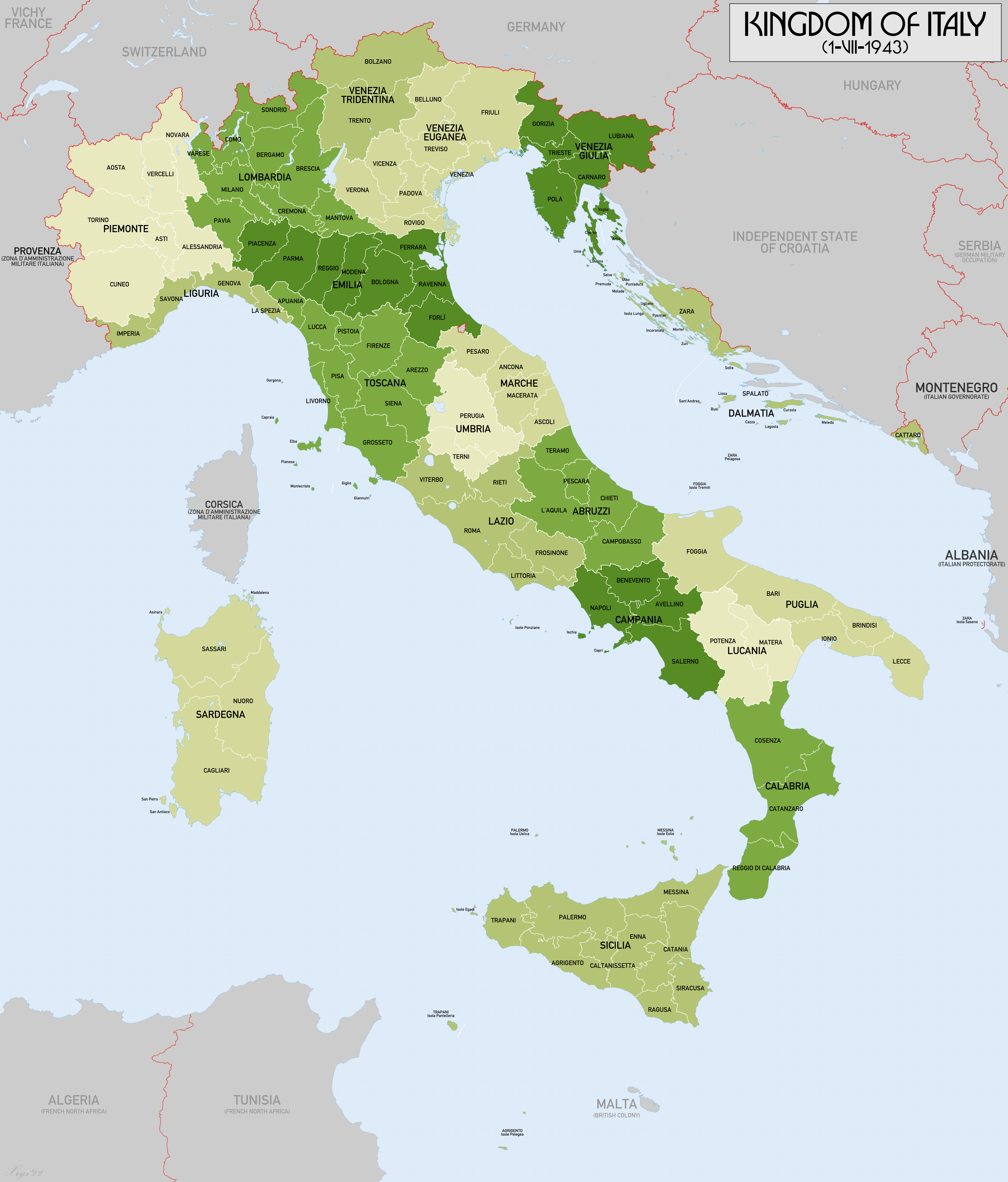
English: Administrative map of the Kingdom of Italy on 1-VII-1943. showing regions and provinces. Source data: Italy 250k (AMS 508), Italy 100k (GSGS 4164), Italien 100k (Deutsche Heereskarte) courtesy of www.mapywig.org |
| Date | |
| Source | Own work |
| Author | XrysD |
Licensing
I, the copyright holder of this work, hereby publish it under the following license:
This file is licensed under the
Creative Commons
Attribution-Share Alike 4.0 International license.
- You are free:
- to share – to copy, distribute and transmit the work
- to remix – to adapt the work
- Under the following conditions:
- attribution – You must give appropriate credit, provide a link to the license, and indicate if changes were made. You may do so in any reasonable manner, but not in any way that suggests the licensor endorses you or your use.
- share alike – If you remix, transform, or build upon the material, you must distribute your contributions under the same or compatible license as the original.
File history
Click on a date/time to view the file as it appeared at that time.
| Date/Time | Thumbnail | Dimensions | User | Comment | |
|---|---|---|---|---|---|
| current | 12:07, 29 August 2022 |
| 4,000 × 4,690 (2.2 MB) | XrysD | Added missing Tunisia. Re-labelled Algeria and Tunisia as being part of French North Africa. |
| 19:18, 12 October 2017 |
 | 4,000 × 4,695 (2.25 MB) | XrysD | Two typos (Mantona->Mantova, Forli->Forlì) | |
| 12:17, 7 October 2017 |
 | 4,000 × 4,695 (2.25 MB) | XrysD | User created page with UploadWizard |
File usage
The following pages on the English Wikipedia use this file (pages on other projects are not listed):
Global file usage
The following other wikis use this file:
- Usage on azb.wikipedia.org
- Usage on ca.wikipedia.org
- Usage on de.wikipedia.org
- Usage on hy.wikipedia.org
- Usage on it.wikipedia.org
- Usage on mk.wikipedia.org
- Usage on pl.wikipedia.org
- Usage on pt.wikipedia.org
- Usage on th.wikipedia.org